Main Information
LCI: HRV1609131026
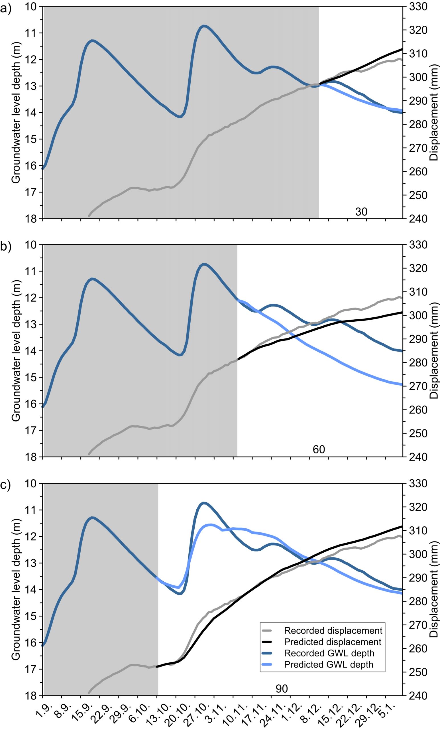
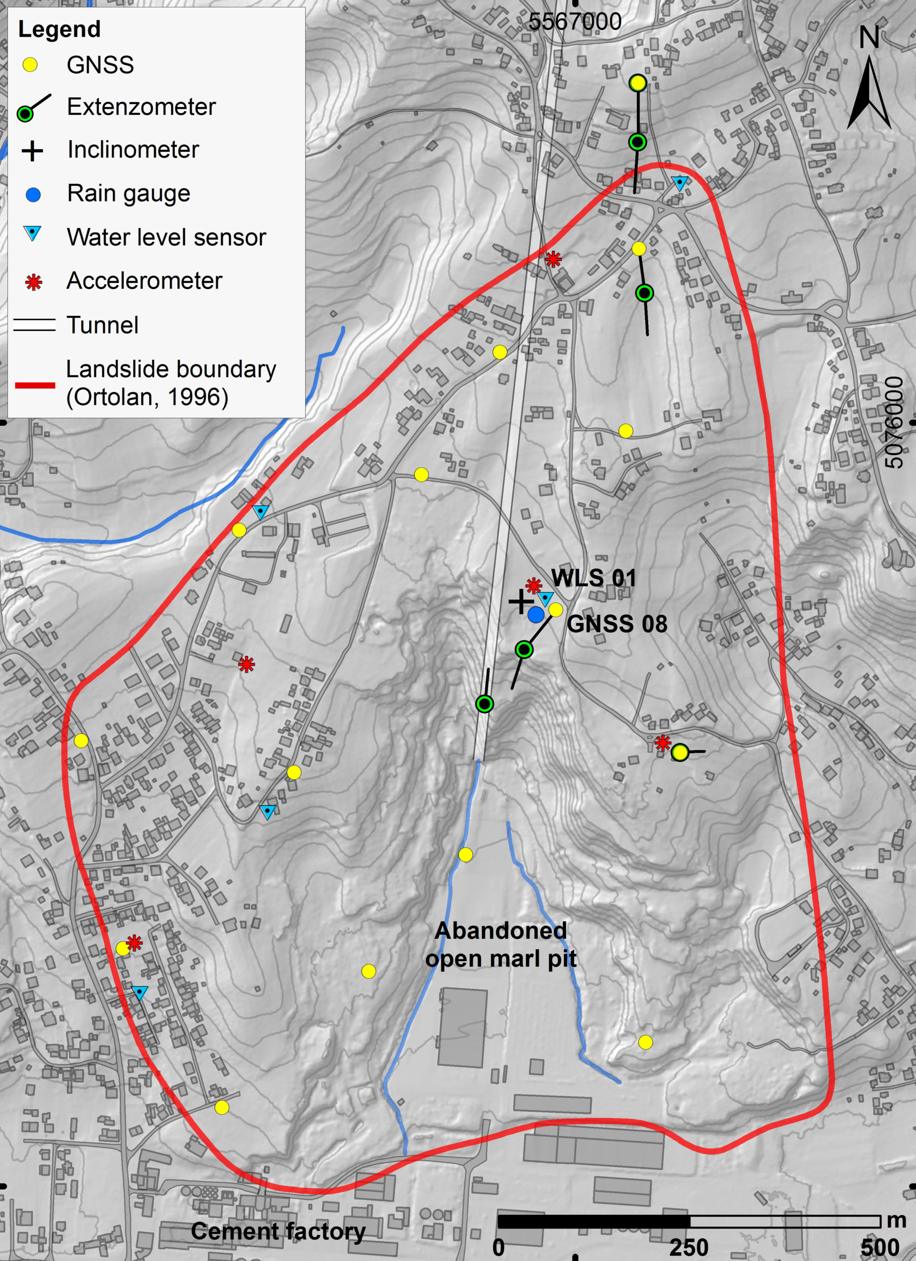
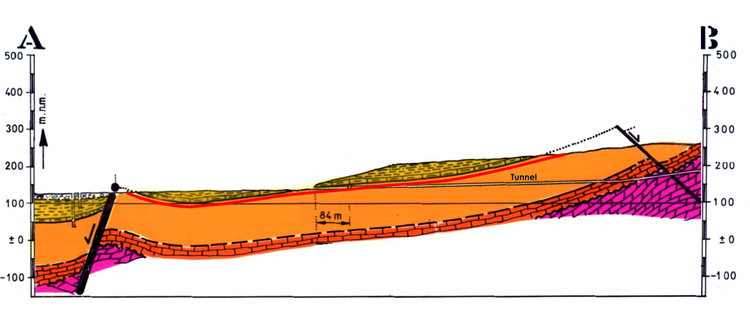
The Kostanjek landslide is the largest landslide in the Republic of Croatia. It is located in the western part of the City of Zagreb, in residential area at the base of the southwestern slope of Mt. Medvednica. The landslide was mainly caused by anthropogenic factors, including mining and excavation in a marl quarry for cement production at the toe part of the landslide and blasting in a limestone quarry placed on the north of the upper part of the landslide. It is a deep-seated large translational landslide formed in soft rock-hard soil, i.e., Pannonian and Sarmatian marls. The landslide extends over an area of approximately 1.2 km2 with a total volume of displaced mass of 32.6 x 10⁶ m3. The maximal depth of the sliding surface is 90 m. Since its activation in 1963, this landslide has caused substantial damage to buildings and infrastructure in the residential zone as well as to factories and commercial buildings. On Kostanjek landslide during the 2011-2013, within the frame of Japanese-Croatian SATREPS FY2008 project ‘Risk Identification and Land-Use Planning for Disaster Mitigation of Landslides and Floods in Croatia’, a monitoring system was established for the purpose of early warning system. The installed monitoring system consists of multiple sensor networks for the measurement of (1) external triggers (a rain gauge, a meteorological station and 7 accelerometers), (2) displacement/deformation/activity (15 GNSS sensors, 7 extensometers, 4 borehole extensometers and an inclinometer), and (3) hydrological properties (3 pore pressure gauges and 5 water level sensors in boreholes and domestic wells, and 2 water level sensors at outflow weirs).
Location
City / District: Zagreb
Province: City of Zagreb
Country: Croatia (Hrvatska)
Latitude: 45:49:20 N
Longitude: 15:51:24 E
Reporter
Reporter 1: Martin Krkac
Reporter 2: Snjezana Mihalic Arbanas
Landslide Type
Material: Earth
Movement: Slide
Velocity (mm/sec): Very Slow (5×10⁻⁷ - 5×10⁻⁵ )
Depth (m): Deep (50 - 100)
Slope (degree): Gentle (10 - 20)
Volume (m³): Large (10⁶-10⁷)
Date of Occurence
Date of Occurence: 12/02/1963
Other Information
Land use (Source Area): Urban area
Land use (Run-out/deposition area): Urban area, Industrial use
Other Activity: Currently active
Triggering Factor: Human activity and rainfall
Death(s) & Missing: -
Houses and other structural damage: 50
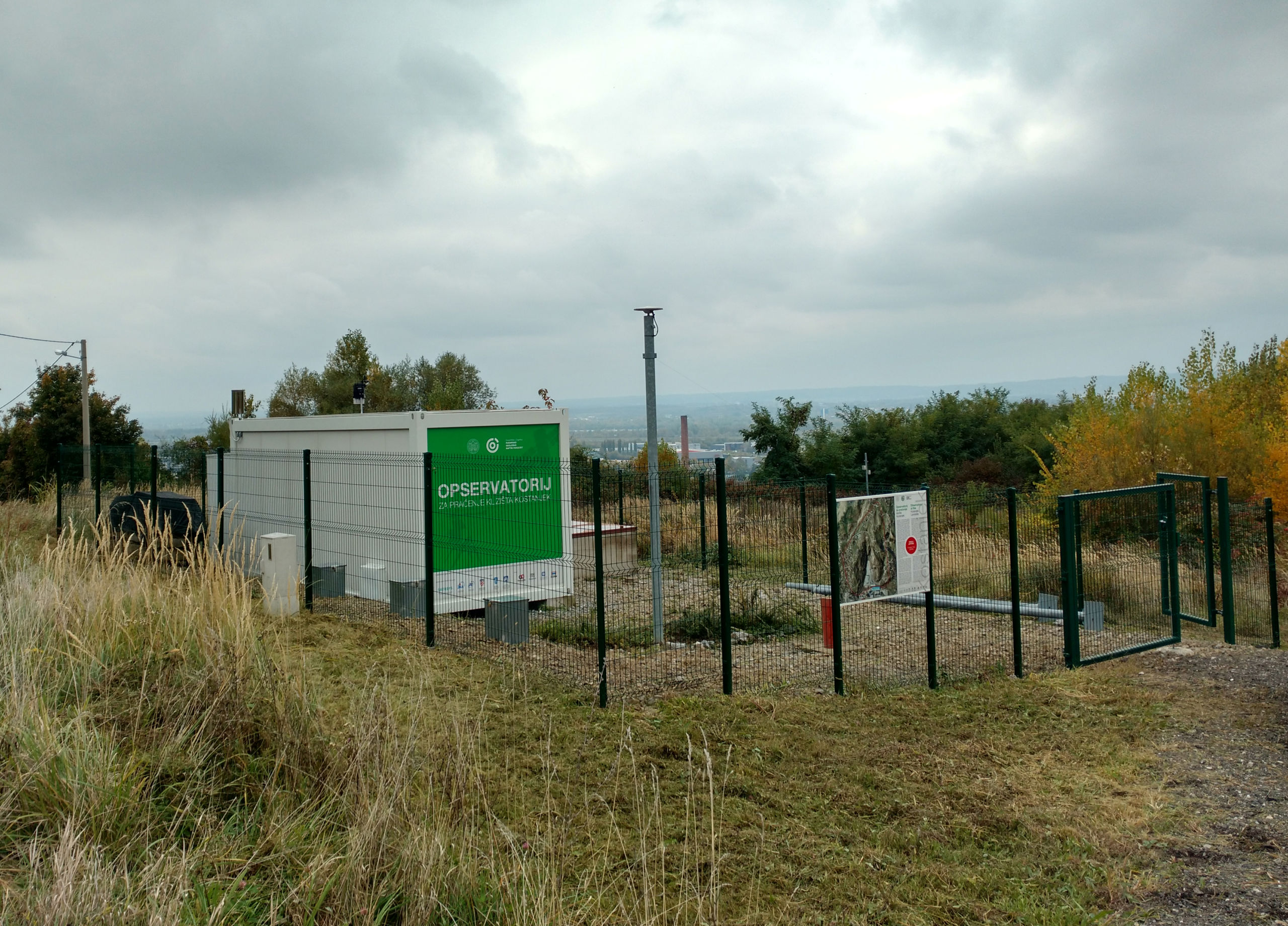
Photo of landslide
Google earth kmz file
Plan of landslide
Cross section of landslide
Reference (paper / report) (Insert link)
Testing graph
Monitoring graph