Main Information
LCI: IND2019808
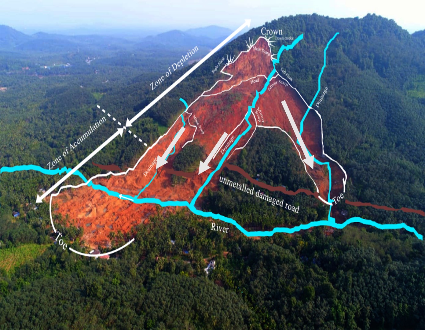
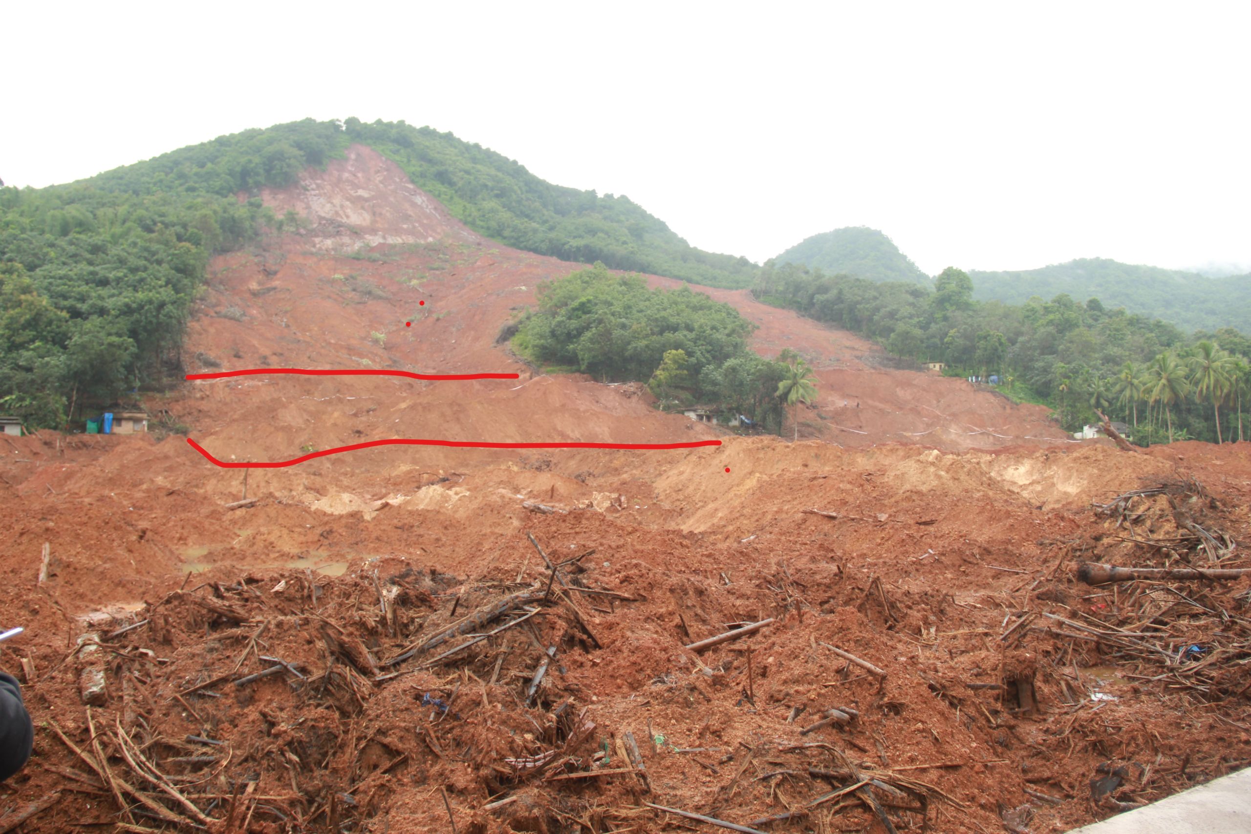
Month of August experienced heavy rainfall on the Western Ghat mountain ranges of southern India in 2019 with exceptionally heavy rainfall i.e. 400% over the normal average during 5 cumulative days resulting in the devastating landslide on 8th August 2019. It was difficult to estimate the actual loss however 69 casualties, 39 completely damaged houses along with roads, utilities and other infrastructure damages were recorded during our survey. The children and adults who managed to escape their death were completely traumatised and were unable to talk. Through field and desk geoscientific investigation it was found that the mismanagement of land use, unscientific slope modification, disruption of free flow of drainage, added with huge amounts of water due to heavy rainfall leading to supersaturation of highly weathered and structurally disposed debris material overlying Archaean bedrock and toe erosion due to flooded river resulted in this landslide. Although the slide happened in a rapid way but precursory signature as cracking and rumbling sound was heard before the actual event. However people were trapped and could not go away as their escape root was flooded. The landslide happened in the northern trifurcated downslope segments as the three 1st order drainage courses carried the discharge of debris and water. The communities living in high hazard prone areas need to be prepared as a resilient community by empowering them with deployment of multi-scale early warning and risk management systems.
Location
City / District: Malappuram
Province: Kerala
Country: India
Latitude: 11:24:37.29 N
Longitude: 76:14:10.25 E
Reporter
Reporter 1: Maneesha Vinodini Ramesh
Reporter 2: Maneesha Vinodini Ramesh
Landslide Type
Material: Debris, Earth
Movement: Flow
Velocity (mm/sec): Very Rapid (5×10¹ - 5×10³)
Depth (m): Deep-Moderate (20 - 50)
Slope (degree): Steep (30 - 40)
Volume (m³): Large (10⁶-10⁷)
Date of Occurence
Date of Occurence: 08/08/2019
Other Information
Land use (Source Area): Farming, River
Land use (Run-out/deposition area): Human settlement, Road, River
Other Activity: Currently active
Triggering Factor: Human activity and rainfall
Death(s) & Missing: 69
Houses and other structural damage: over 39 houses and a walkover bridge were completely washed away
Photo of landslide
Google earth kmz file
Plan of landslide