Xinmo rock avalanche
LCI : CHN1712151115| Main Information | |
| Landslide Name | : Xinmo rock avalanche |
| Latitude | : 32:04:47 N |
| Longitude | : 103:39:46 E |
| Location | |
| City / District | : Maoxian |
| Province | : Sichuan |
| Country | : China |
| Reporter | |
| Reporter 1 | : Qiang Xu |
| Reporter 2 | : Xuanmei Fan |
| Landslide Type | |
| Material | : Rock |
| Movement | : Slide, Complex |
| Velocity (mm/sec) | : Extremely Rapid |
| Depth (m) | : Moderate-Shallow |
| Slope (degree) | : Steep |
| Volume (m³) | : Very Large |
| Date of Occurence | |
| Date of Occurence | : Jun 24, 2017 |
| Other Information | |
| Land Use |
Source area : Forest Run-out/deposition area : Forest, Road, River |
| Other Activity | : Active in the past |
| Triggering Factor | : Rainfall and earthquake |
| Death(s) & Missing | : 83 |
| Houses and other structural damage | : 64 |
| Photo of landslide | : 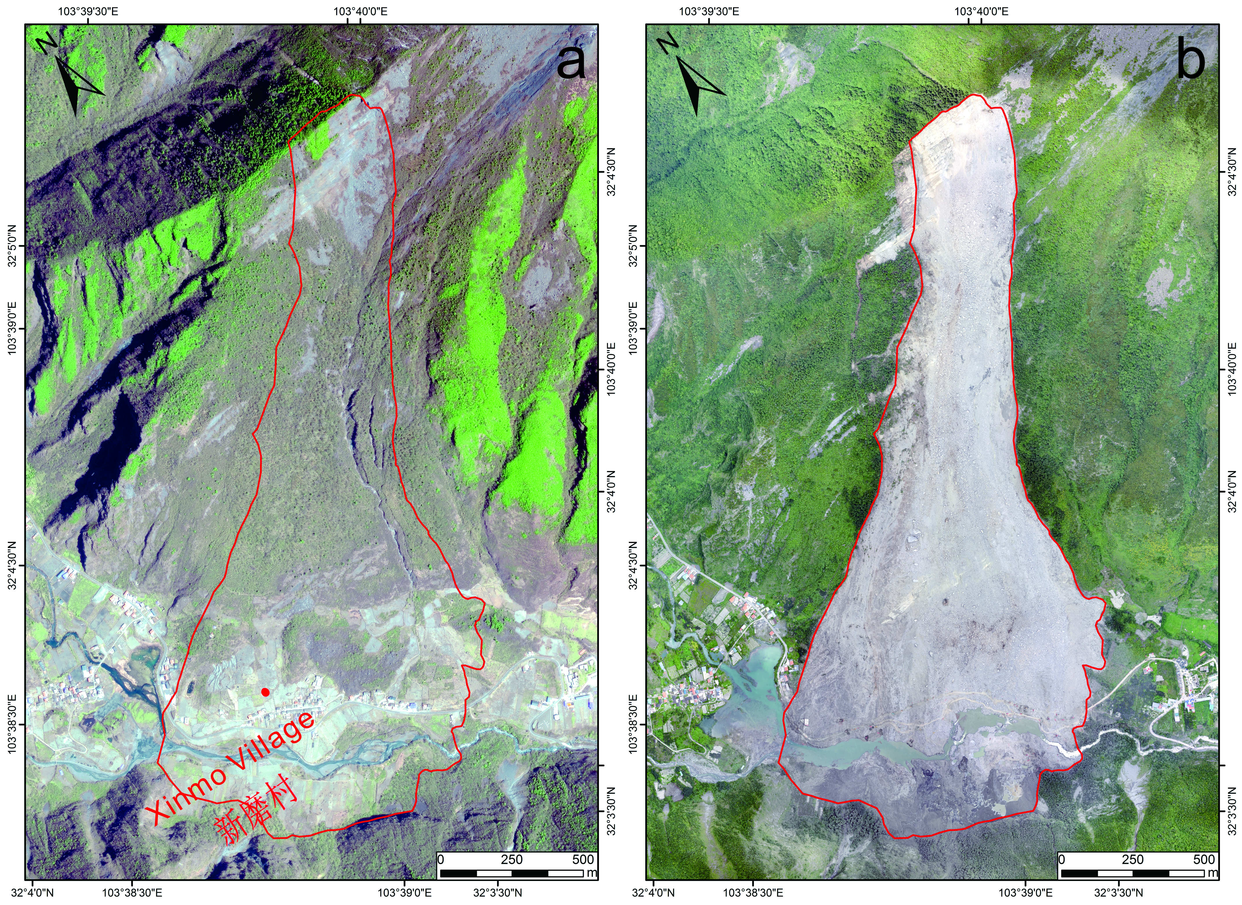 |
| Google earth kmz file | : Xinmo Landslide1513568762.kmz |
| Plan of landslide | : 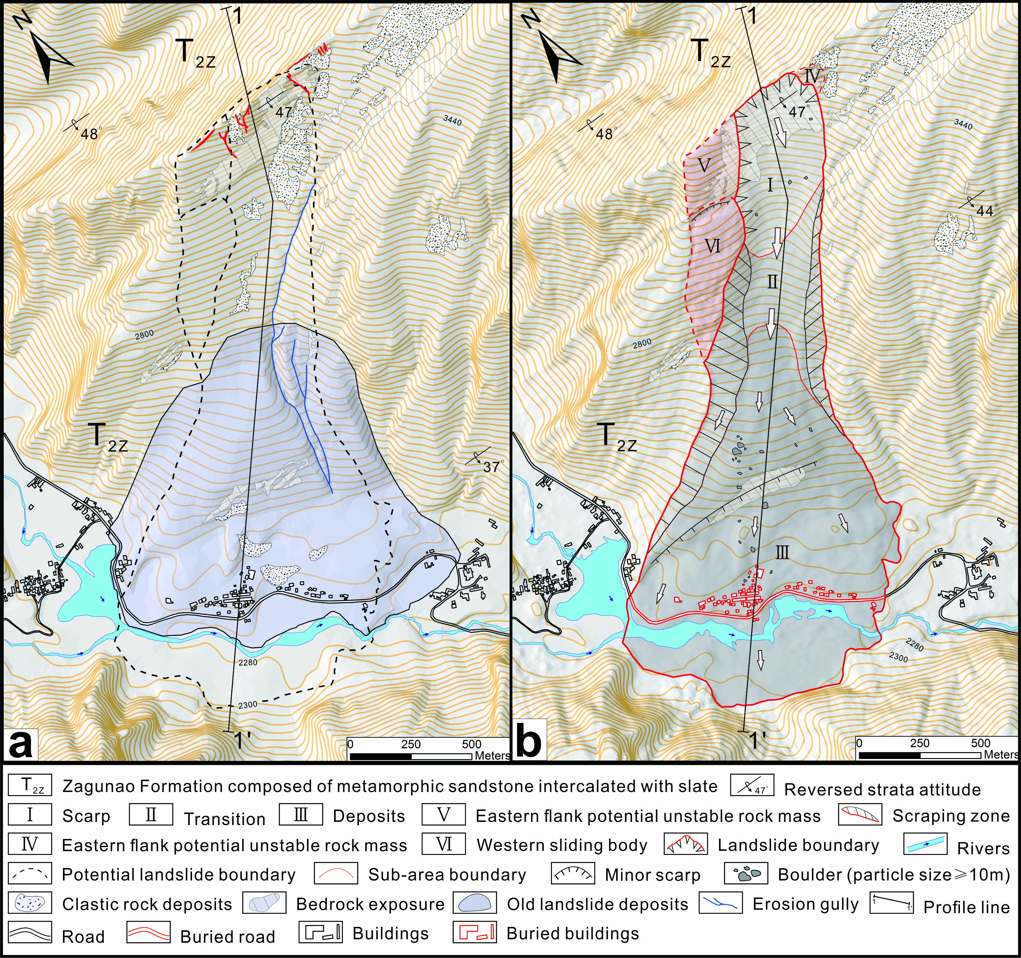 |
| Cross section of landslide | : 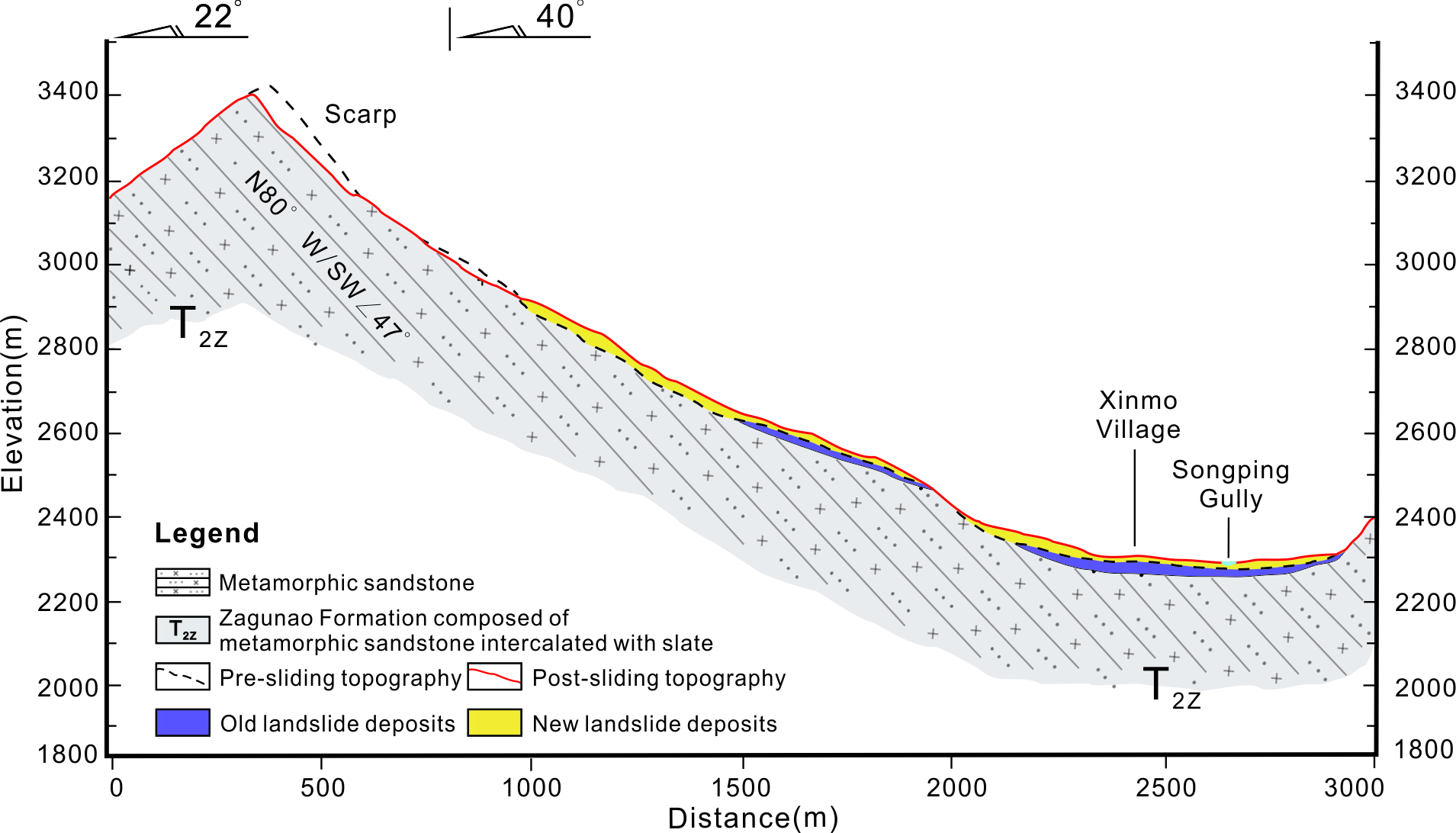 |
| Reference (paper/report) | : https://link.springer.com/article/10.1007/s10346-017-0907-7 |
| Testing graph | : - |
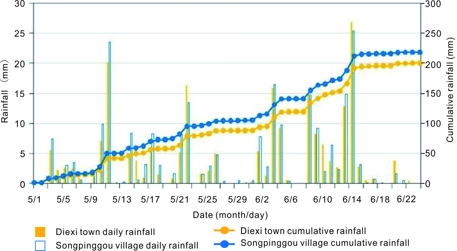
| Monitoring graph | : Fig.16.jpg |
| Video of moving landslides including 3D simulation | : - |
| Description | : |
The Xinmo rock avalanche occurred at 5:38 AM on the 24th June, 2017, destroyed the whole village of Xinmo, in Maoxian County, Sichuan Province, China. About 4.3 million m3 of rock detached from the crest of the mountain, gained momentum along a steep hillslope, entrained a large amount of pre-existing deposits, and hit the village at a velocity of 250 km/h. The impact produced a seismic shaking of ML = 2.3 magnitude. The sliding mass dammed the Songping gully with an accumulation body of 13 million m3. The avalanche buried 64 houses; 10 people were killed and 73 were reported missing. Source: Fan, X., Xu, Q., Scaringi, G. et al. Landslides (2017) 14: 2129. https://doi.org/10.1007/s10346-017-0907-7 |
|

