Unzen-Mayuyama megaslide
LCI : JPN1607121655| Main Information | |
| Landslide Name | : Unzen-Mayuyama megaslide |
| Latitude | : 32:45:51.51 N |
| Longitude | : 130:20:54.16 E |
| Location | |
| City / District | : Shimabara |
| Province | : Nagasaki |
| Country | : Japan |
| Reporter | |
| Reporter 1 | : Khang Dang |
| Reporter 2 | : Kyoji Sassa |
| Landslide Type | |
| Material | : Complex |
| Movement | : Slide |
| Velocity (mm/sec) | : Extremely Rapid |
| Depth (m) | : Very Deep |
| Slope (degree) | : Moderate |
| Volume (m³) | : Extremely Large |
| Date of Occurence | |
| Date of Occurence | : May 21, 1792 |
| Other Information | |
| Land Use |
Source area : Forest Run-out/deposition area : Farming, Urban area, Industrial use, Road, Railways, Sea/lake |
| Other Activity | : Active in the past |
| Triggering Factor | : Earthquake |
| Death(s) & Missing | : 15153 |
| Houses and other structural damage | : - |
| Photo of landslide | : 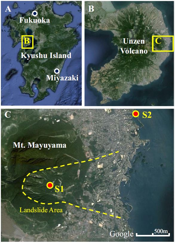 |
| Google earth kmz file | : 11478764606.kmz |
| Plan of landslide | :  |
| Cross section of landslide | : 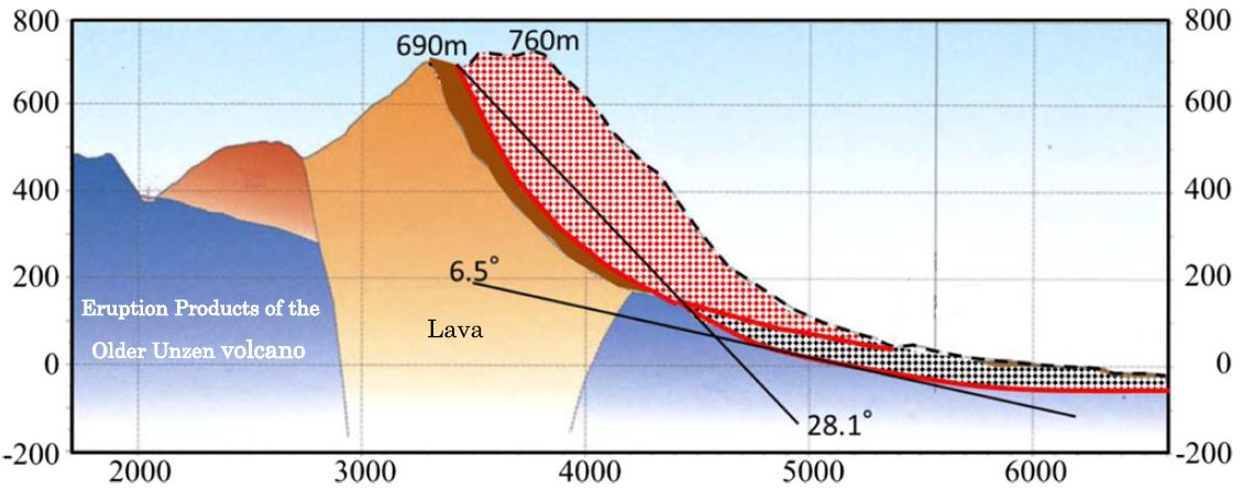 |
| Reference (paper/report) | : http://link.springer.com/article/10.1007/s10346-003-0004-y |
| Testing graph | : Fig1478764606.xlsx |
| Monitoring graph | : Iwate-Miyagi Earthquake CS1478764606.xlsx |
| Video of moving landslides including 3D simulation | : https://www.youtube.com/watch?v=GwAWjdXXNbk |
| Description | : |
The greatest landslide disaster in the history of Japan is the 1792 Unzen–Mayuyama megaslide (Nakada et al. 1992, 1999). Its volume was 3.4×10⁸ m3 and the maximum depth was 400 m; around 15,000 people were killed by the landslide and its resulting tsunami (Unzen Restoration Office of the Ministry of Land, Infrastructure and Transport of Japan 2002; 2003). This report was made based on the paper of Sassa et al. 2014 published in Landslides Journal. This report referred the research in the paper `Kyoji Sassa I Khang Dang I Bin He I Kaoru Takara I Kimio Inoue I Osamu Nagai (2014) A new high-stress undrained ring-shear apparatus and its application to the 1792 Unzen–Mayuyama megaslide in Japan. Landslides Vol. 11:827–842` |
|

