Shirur Landslide
LCI : IND2515051230| Main Information | |
| Landslide Name | : Shirur Landslide |
| Latitude | : 14:36:13 N |
| Longitude | : 74:22:15 E |
| Location | |
| City / District | : Uttara Kannada |
| Province | : Karnataka |
| Country | : India |
| Reporter | |
| Reporter 1 | : Priyajit Kundu |
| Reporter 2 | : Varun Menon |
| Landslide Type | |
| Material | : Rock, Debris, Earth, Complex |
| Movement | : Slide |
| Velocity (mm/sec) | : Extremely Rapid |
| Depth (m) | : Deep-Moderate |
| Slope (degree) | : Moderate |
| Volume (m³) | : Moderate-Small |
| Date of Occurence | |
| Date of Occurence | : Jul 16, 2024 |
| Other Information | |
| Land Use |
Source area : Forest, Wildland, Road Run-out/deposition area : Human settlement, Road, River |
| Other Activity | : Unknown |
| Triggering Factor | : Human activity and rainfall |
| Death(s) & Missing | : 8 |
| Houses and other structural damage | : 1 local shop and Electricity tower was washed away into river |
| Photo of landslide | : - |
| Google earth kmz file | : shirur landslide.jpg |
| Plan of landslide | : 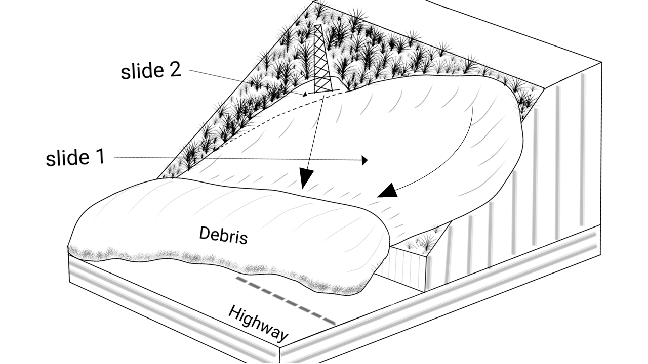 |
| Cross section of landslide | : - |
| Reference (paper/report) | : https://doi.org/10.1016/j.nhres.2025.01.005 |
| Testing graph | : - |
| Monitoring graph | : - |
| Video of moving landslides including 3D simulation | : - |
| Description | : |
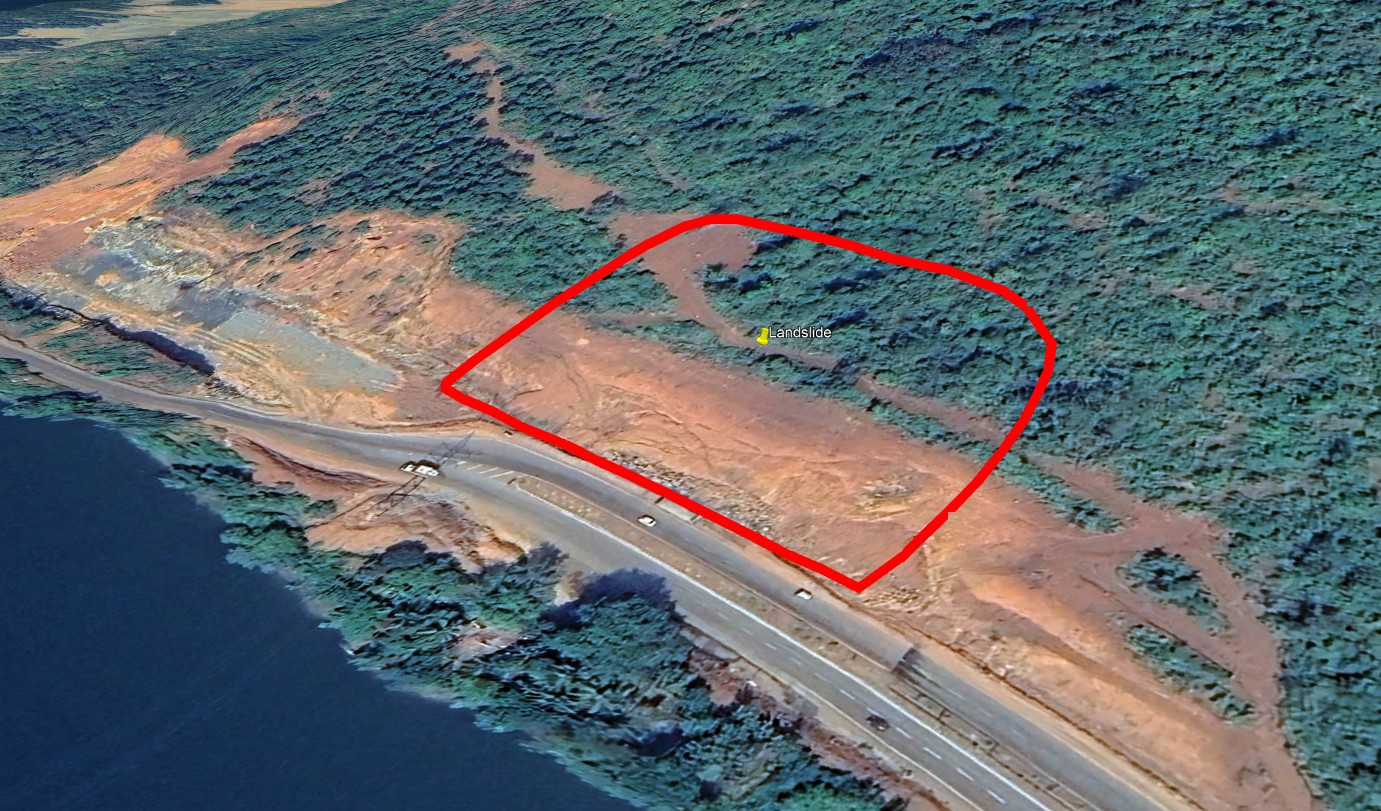
At 08:15 hours on 16 July 2024, a two-stage slope failure struck the northern embankment of National Highway 66 at Shirur village, Uttara Kannada, Karnataka. The first stage was a rotational slip with an arcuate failure surface about 60 m in radius, detached a soil block up to 28 m deep. According to field mapping and DEM analysis, the displaced volume is approximately 89000 m³. The base of an electric tower was crossed by the slip surface. The tower collapsed with a second small-scale slope failure due to a loss of support. Mobilised debris, a mix of silty sand, clay and scattered boulders, travelled across both lanes of the highway, burying vehicles and cutting traffic. Momentum carried the flow another 180 m into the adjoining Gangavali River, where it formed an elongate deposition bar that briefly obstructed the channel and generated a splash wave, damaging the opposite bank. The landslide took 8 lives of the people residing in the shop nearby, along with trucks and the driver who parked their vehicles in the location. Landslide was predominantly triggered by heavy rainfall (recorded value of 260mm in a neighbouring rain gauge) and anthropogenic activity like unprotected vertical cuts on the slope while widening the road. |
|

