Akatani landslide dam
LCI : JPN169161020| Main Information | |
| Landslide Name | : Akatani landslide dam |
| Latitude | : 34:7:25.69 N |
| Longitude | : 135:43:44.81 E |
| Location | |
| City / District | : Yoshino |
| Province | : Nara |
| Country | : Japan |
| Reporter | |
| Reporter 1 | : Pham Tien |
| Reporter 2 | : |
| Landslide Type | |
| Material | : Rock, Debris, Earth |
| Movement | : Slide |
| Velocity (mm/sec) | : Very Rapid |
| Depth (m) | : Deep |
| Slope (degree) | : Steep |
| Volume (m³) | : Very Large |
| Date of Occurence | |
| Date of Occurence | : Sep 04, 2011 |
| Other Information | |
| Land Use |
Source area : Forest Run-out/deposition area : Forest, River |
| Other Activity | : Active in the past |
| Triggering Factor | : Rainfall |
| Death(s) & Missing | : - |
| Houses and other structural damage | : - |
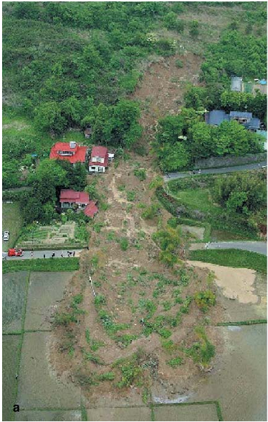
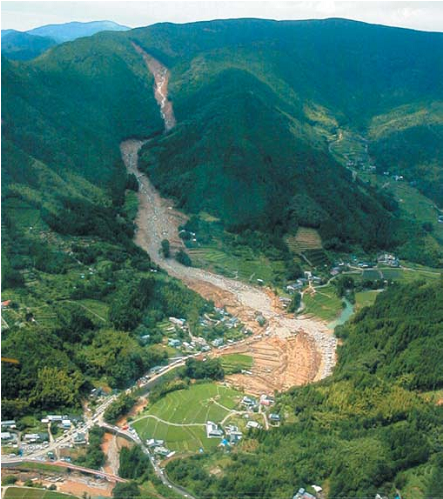
| Photo of landslide | : 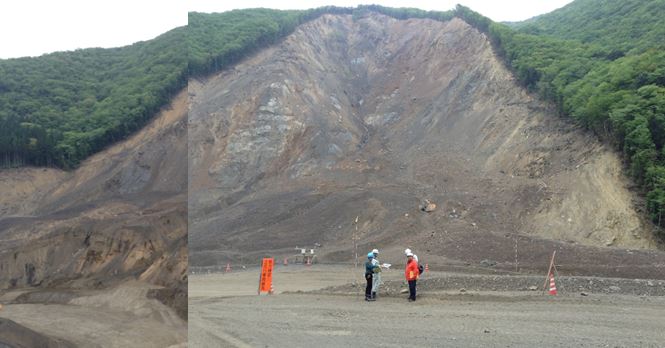 |
| Google earth kmz file | : Akatani landslide dam.kmz |
| Plan of landslide | : .JPG) |
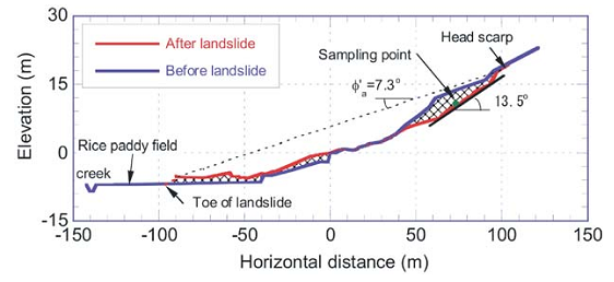
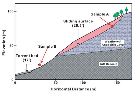
| Cross section of landslide | : 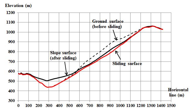 |
| Reference (paper/report) | : SABO (2013) A Pamphlet released in October, 2013 on overview of the 2011 disaster induced by Typhoon No. 12, Implementation of an urgent investigation and countermeasures to disaster areas. Kii Mountain District SABO Office, Kinki Regional Development Bureau. The Ministry of Land, Infrastructure, Transport and Tourism (MLIT). Available at http://www.kkr.mlit.go.jp/kiisanchi/outline/, 24 pages (in Japanese). |
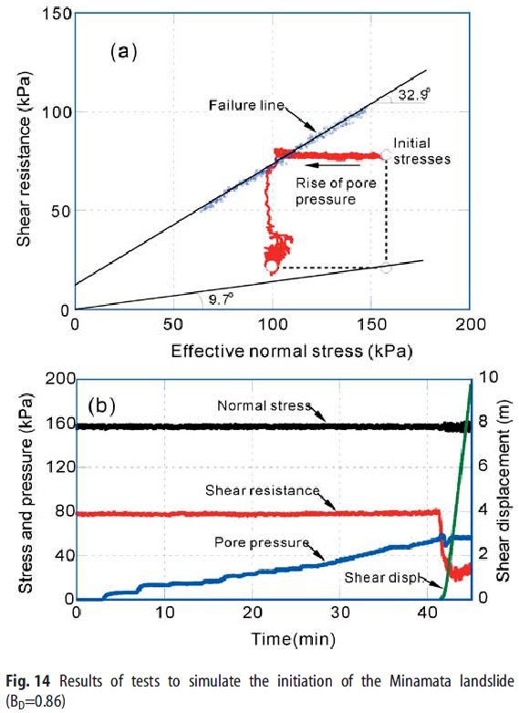
| Testing graph | : 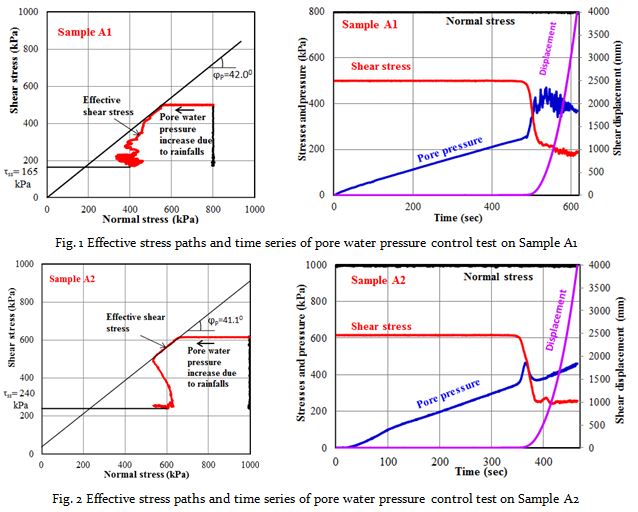 |
| Monitoring graph | : - |
| Video of moving landslides including 3D simulation | : - |
| Description | : |
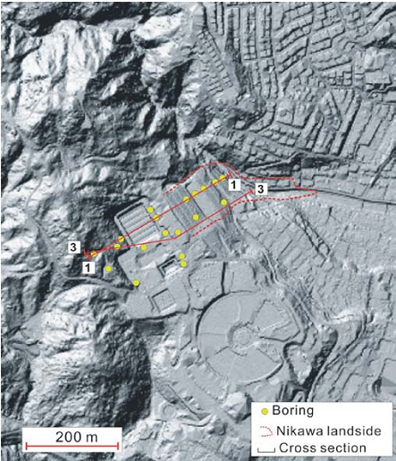
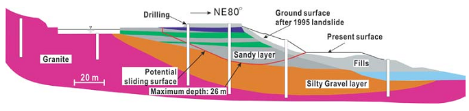
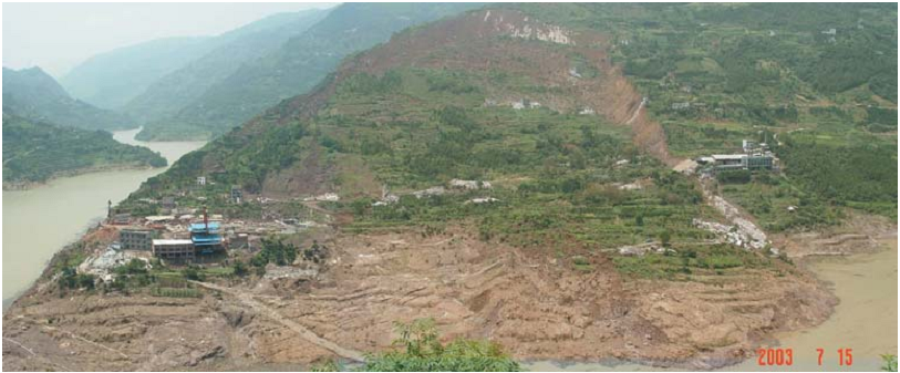
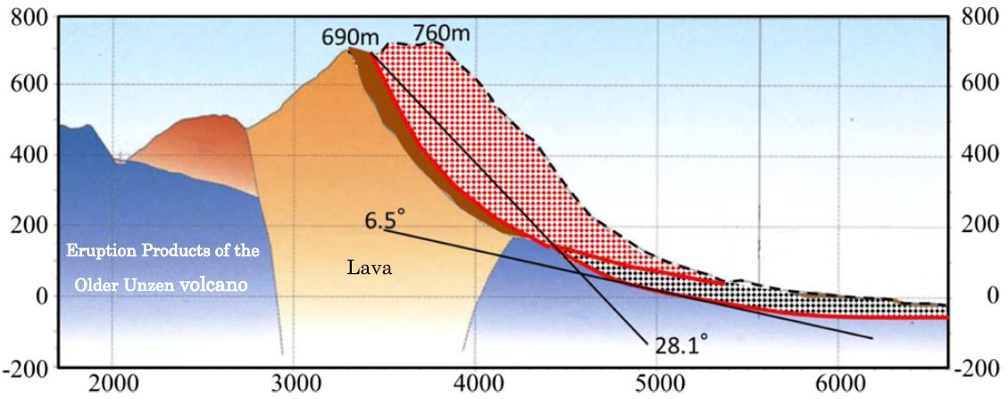
The Akatani landslide dam is the second largest landslide dam in Kii Peninsula, which triggered by heavy rainfall in Typhoon Talas on 4 September 2011. The dimensions of the Akatani landslide are about 1,100 m in length, 300 m to 500 m in width and over 65 m in a maximum depth. The impoundment capacity of Akatani dam is up to 9.5 million cubic meters in a large catchment of 13.2 square kilometers. The geology of the Akatani slopes mainly composes materials of mudstone and sandstone, and a part of tuffaceous shale on the head scarp in Miyama Accretionary Complex, Hidakagawa Group of the Cretaceous Shimanto Belt. The Akatani area was suffered from debris flows and erosion disasters in rainstorm seasons after the 2011 disasters. In order to prevent damages from potential risks of dam breach, debris flow and erosions in the future, structural countermeasures have been implementing in a wide area by the Ministry of Land, Infrastructure, Transport and Tourism (MLIT), such as building a system of checking dams and stabilizing the dam. |
|


