Bosmatto landslide
LCI : ITA2006221100| Main Information | |
| Landslide Name | : Bosmatto landslide |
| Latitude | : 45:45:40.22 N |
| Longitude | : 7:51:7.87 E |
| Location | |
| City / District | : Gressoney-Saint-Jean |
| Province | : Aosta |
| Country | : Italy |
| Reporter | |
| Reporter 1 | : Tommaso Carlà |
| Reporter 2 | : Veronica Tofani |
| Landslide Type | |
| Material | : Rock |
| Movement | : Slide |
| Velocity (mm/sec) | : Very Slow |
| Depth (m) | : Deep-Moderate |
| Slope (degree) | : Steep |
| Volume (m³) | : Large |
| Date of Occurence | |
| Date of Occurence | : Jan 01, 1970 |
| Other Information | |
| Land Use |
Source area : Forest, Wildland Run-out/deposition area : Urban area, Road |
| Other Activity | : Currently active |
| Triggering Factor | : Rainfall |
| Death(s) & Missing | : - |
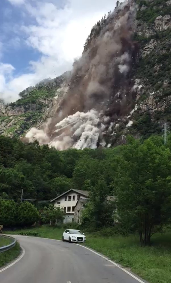
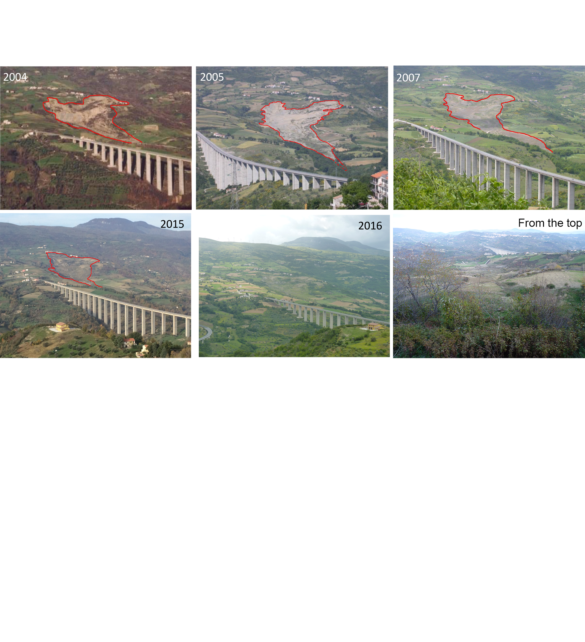
| Houses and other structural damage | : Widespread damage to buildings and infrastructures in October 2000 after a part of the landslide material was mobilized as a debris flow |
| Photo of landslide | : 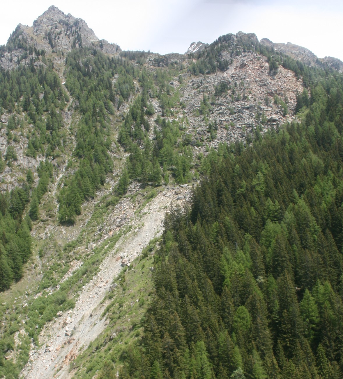 |
| Google earth kmz file | : Bosmatto landslide.kmz |
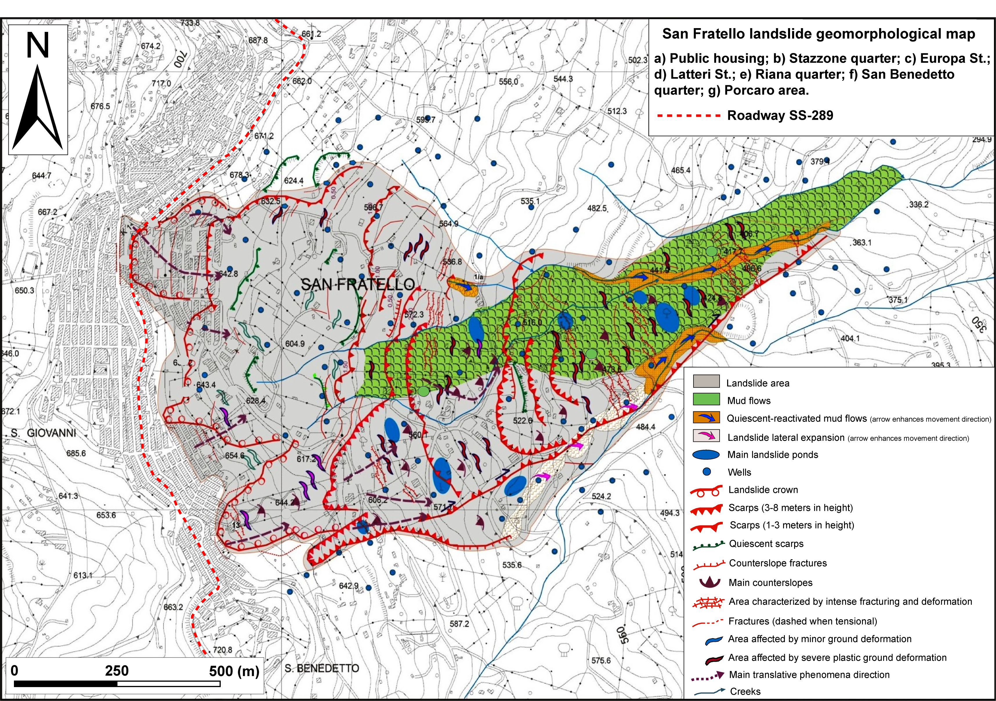
| Plan of landslide | : 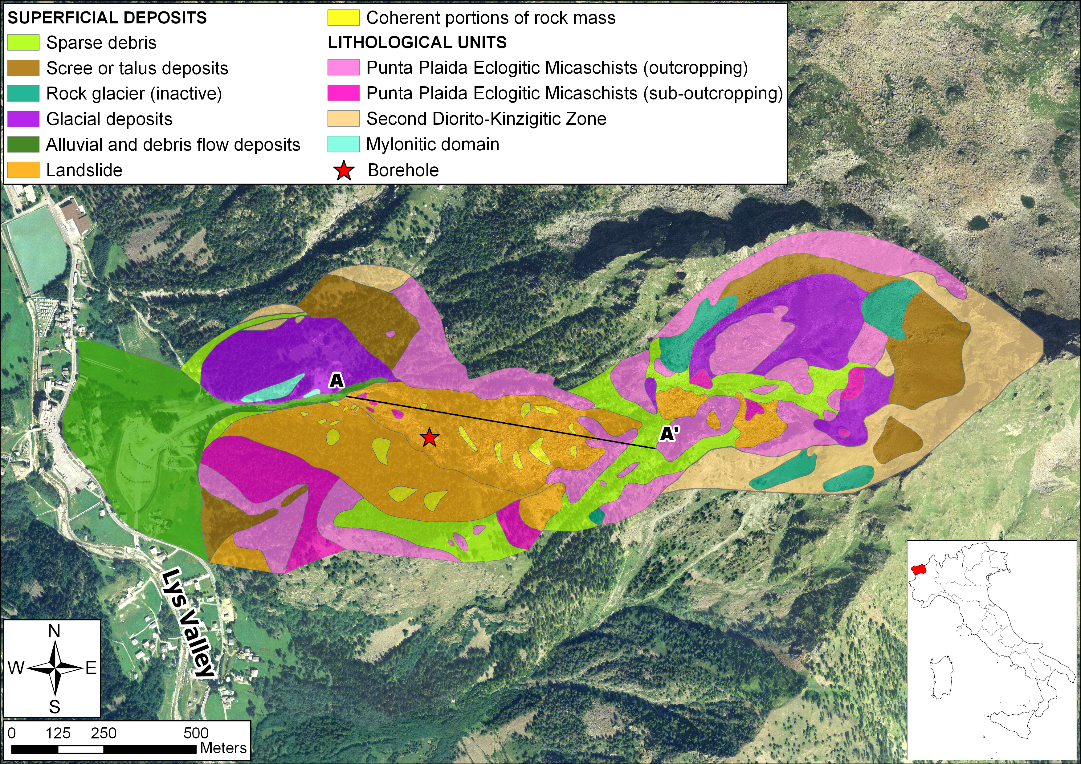 |
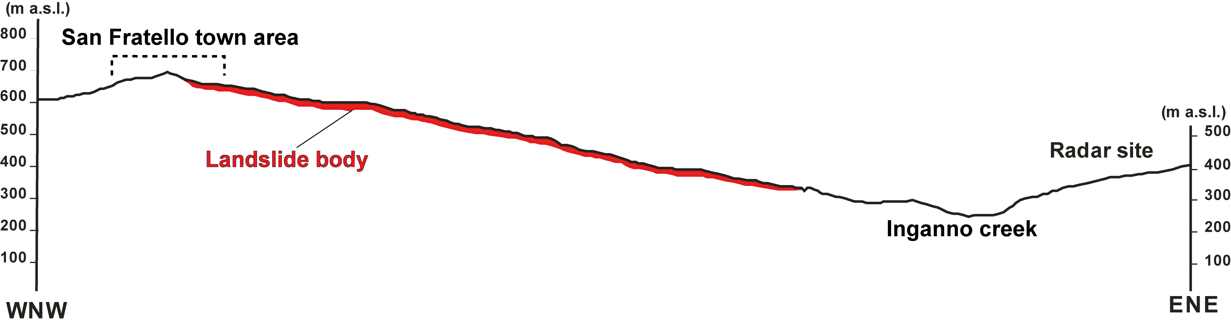
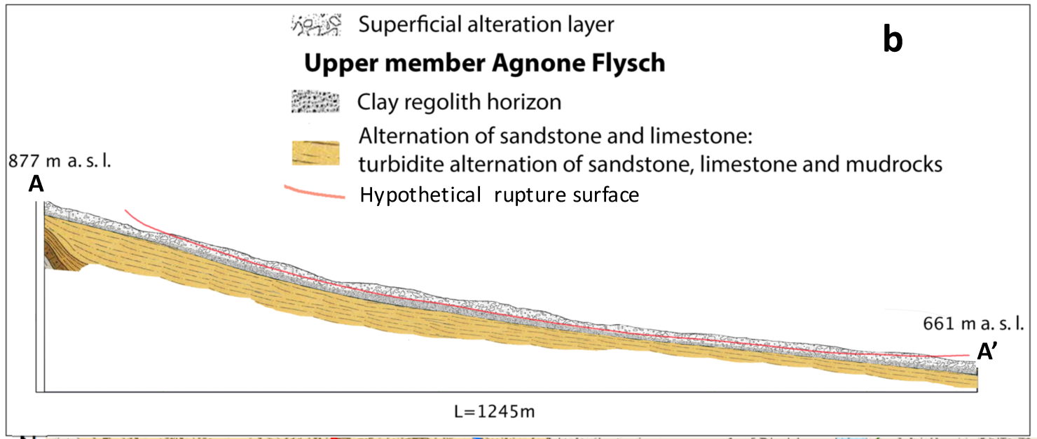
| Cross section of landslide | : 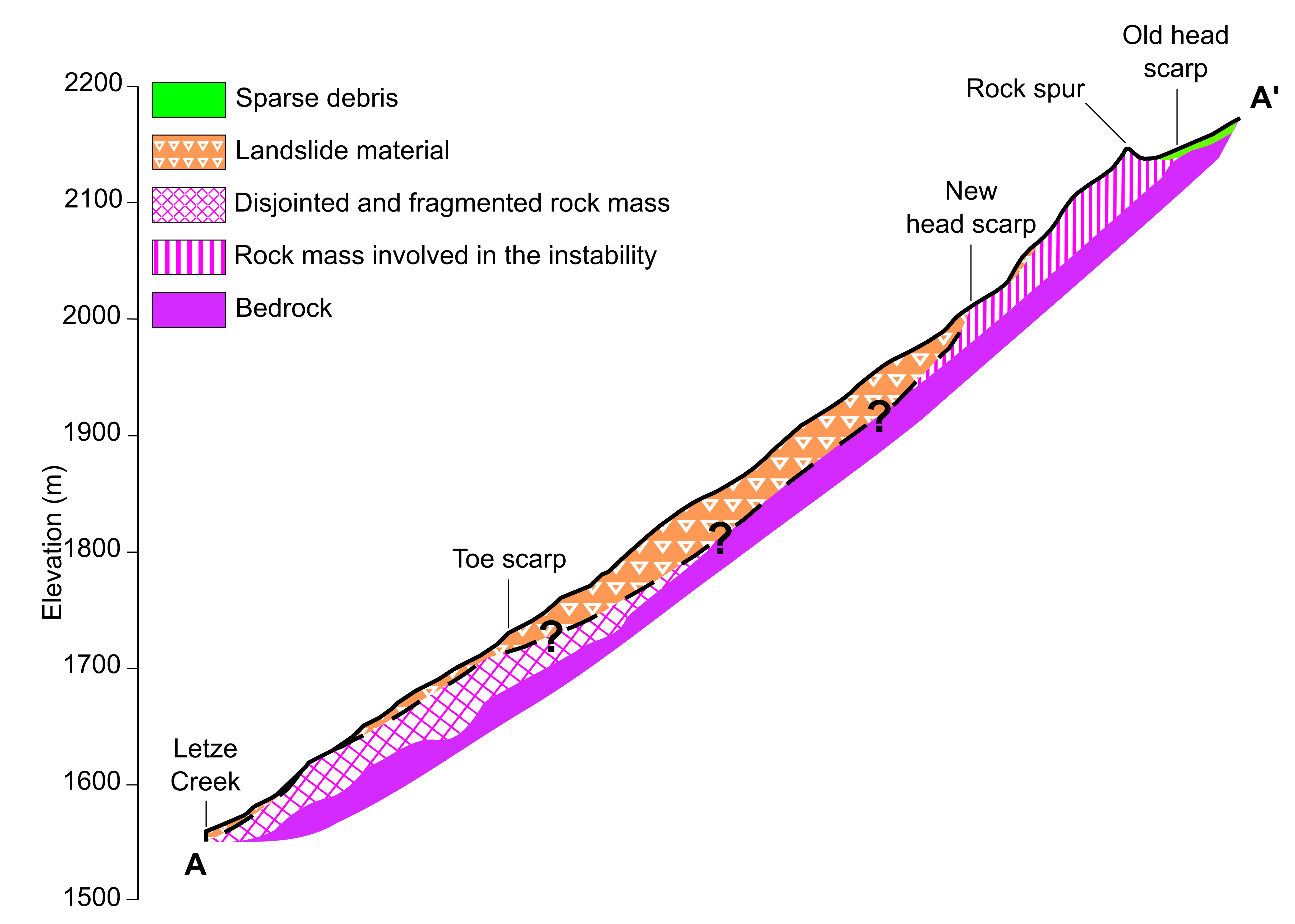 |
| Reference (paper/report) | : https://www.sciencedirect.com/science/article/pii/S0169555X19301084?viaihub |
| Testing graph | : - |
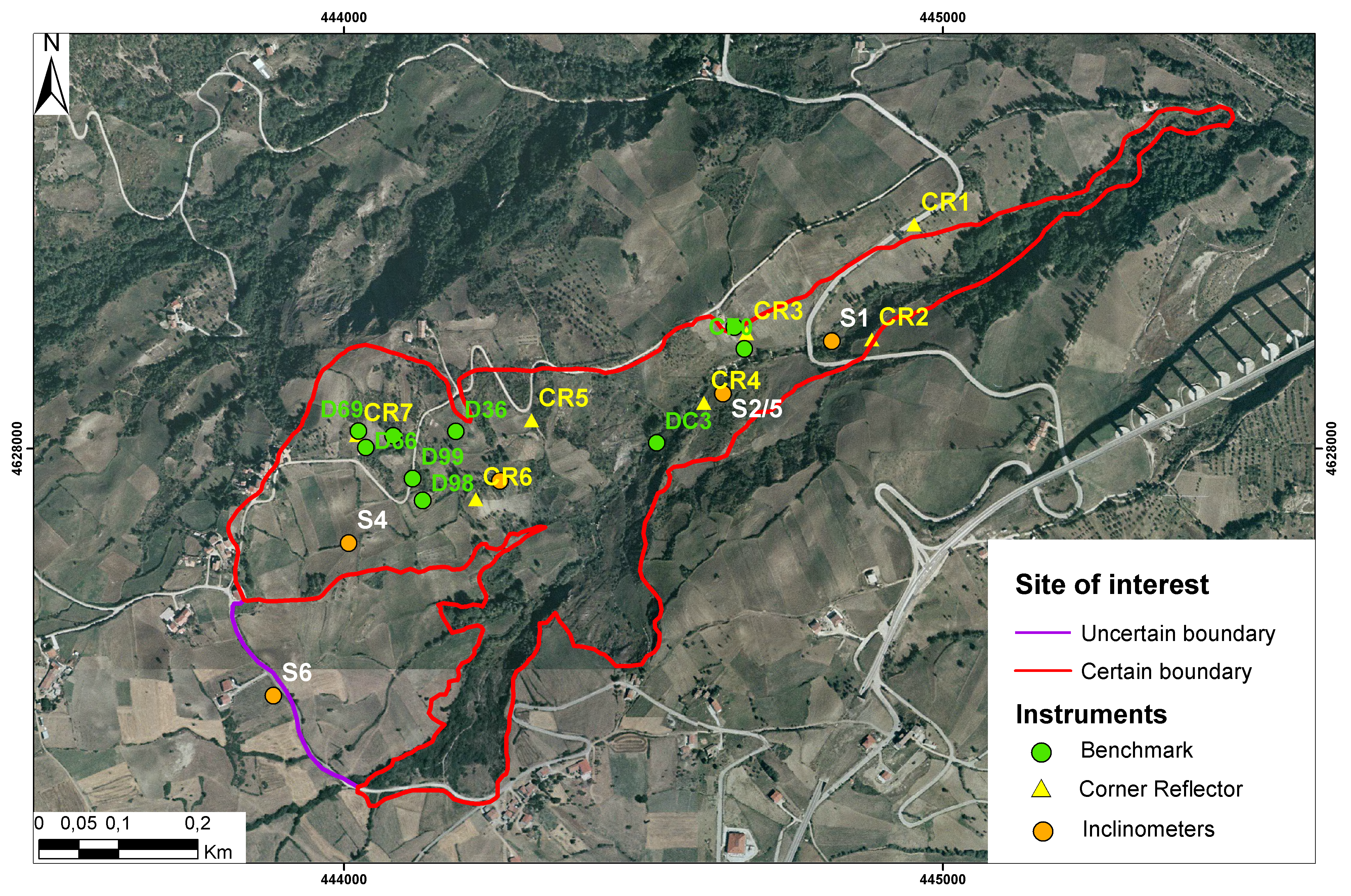
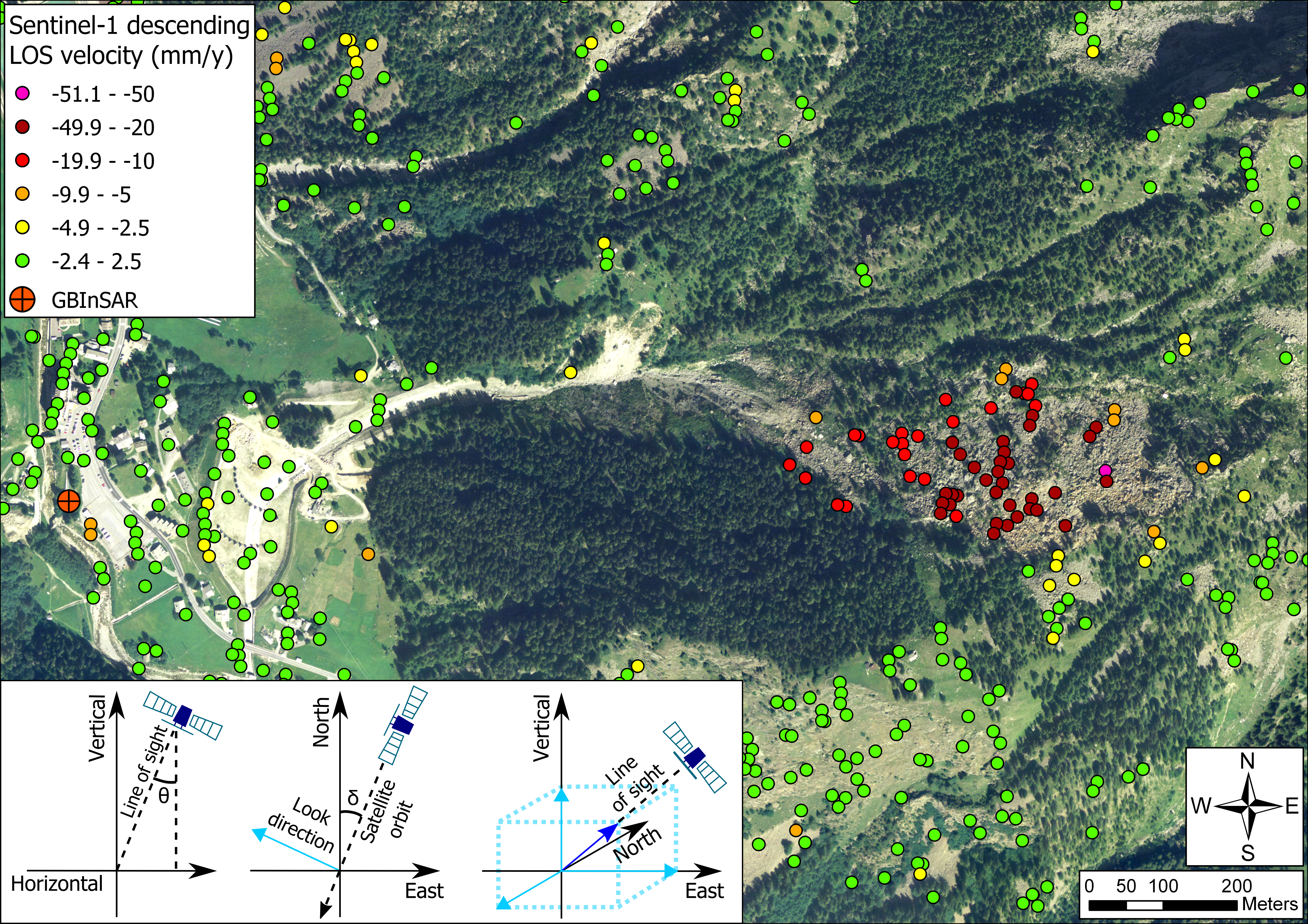
| Monitoring graph | : Sat_desc.png |
| Video of moving landslides including 3D simulation | : - |
| Description | : |
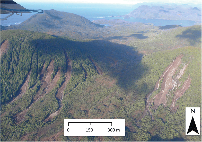
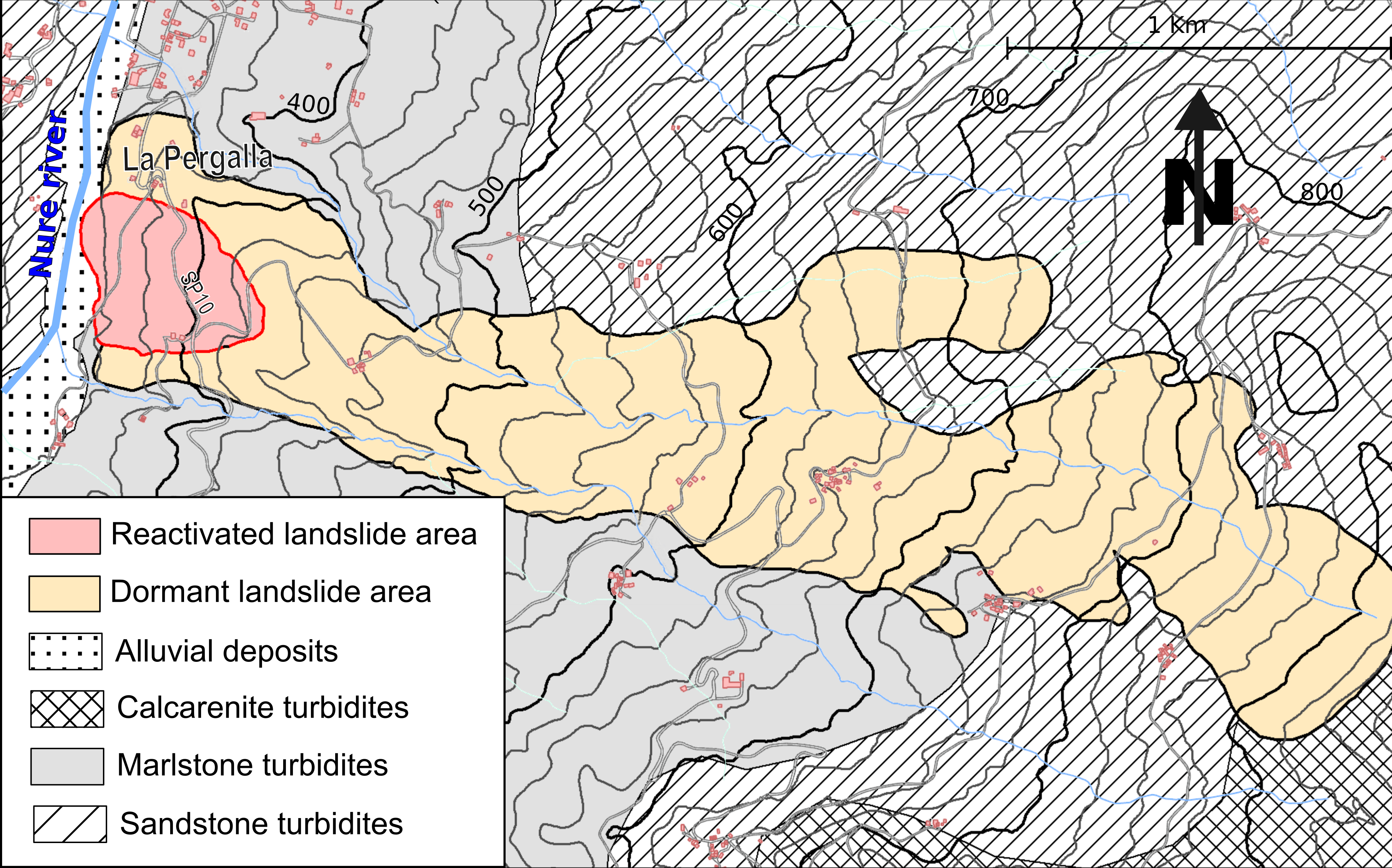
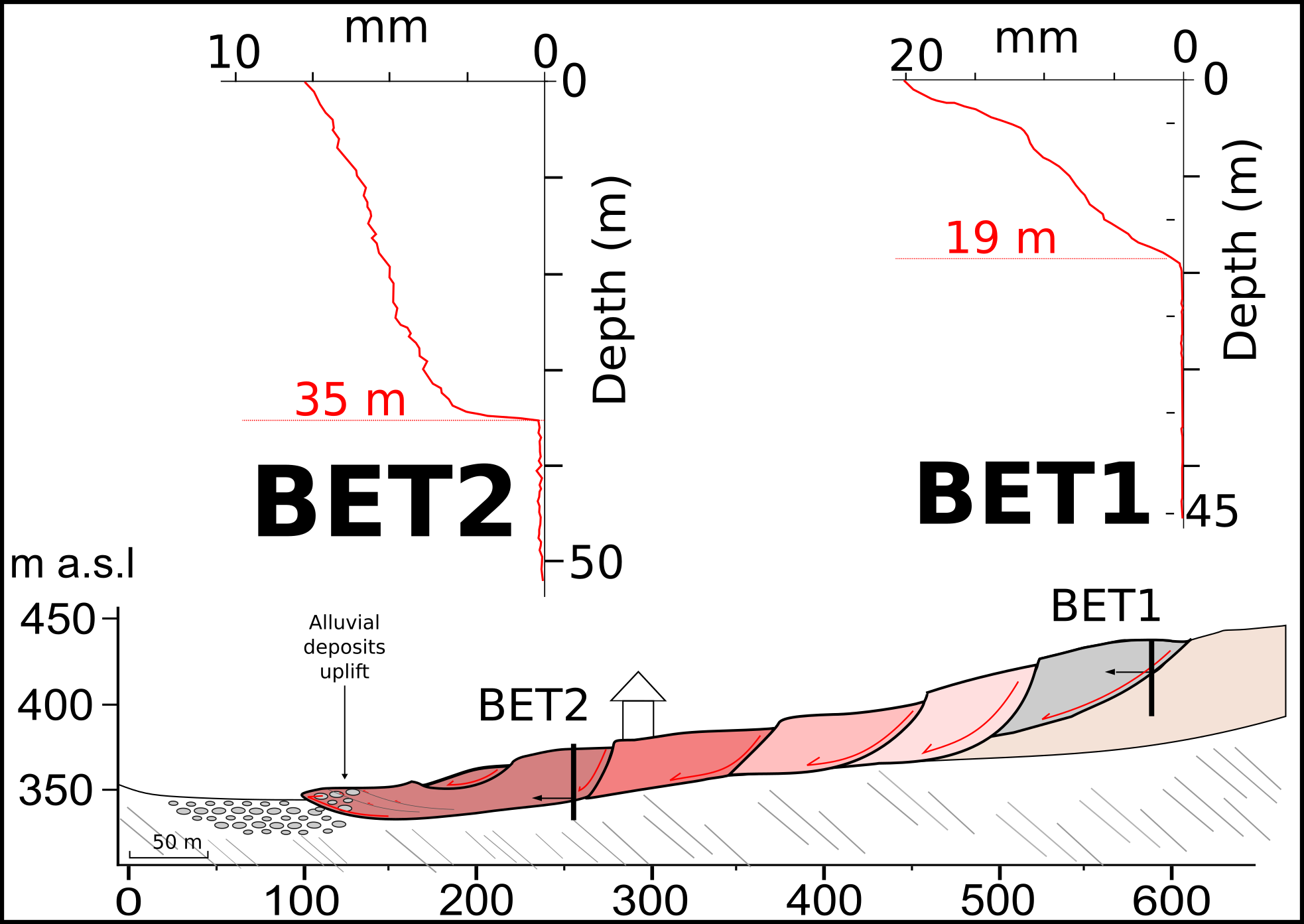
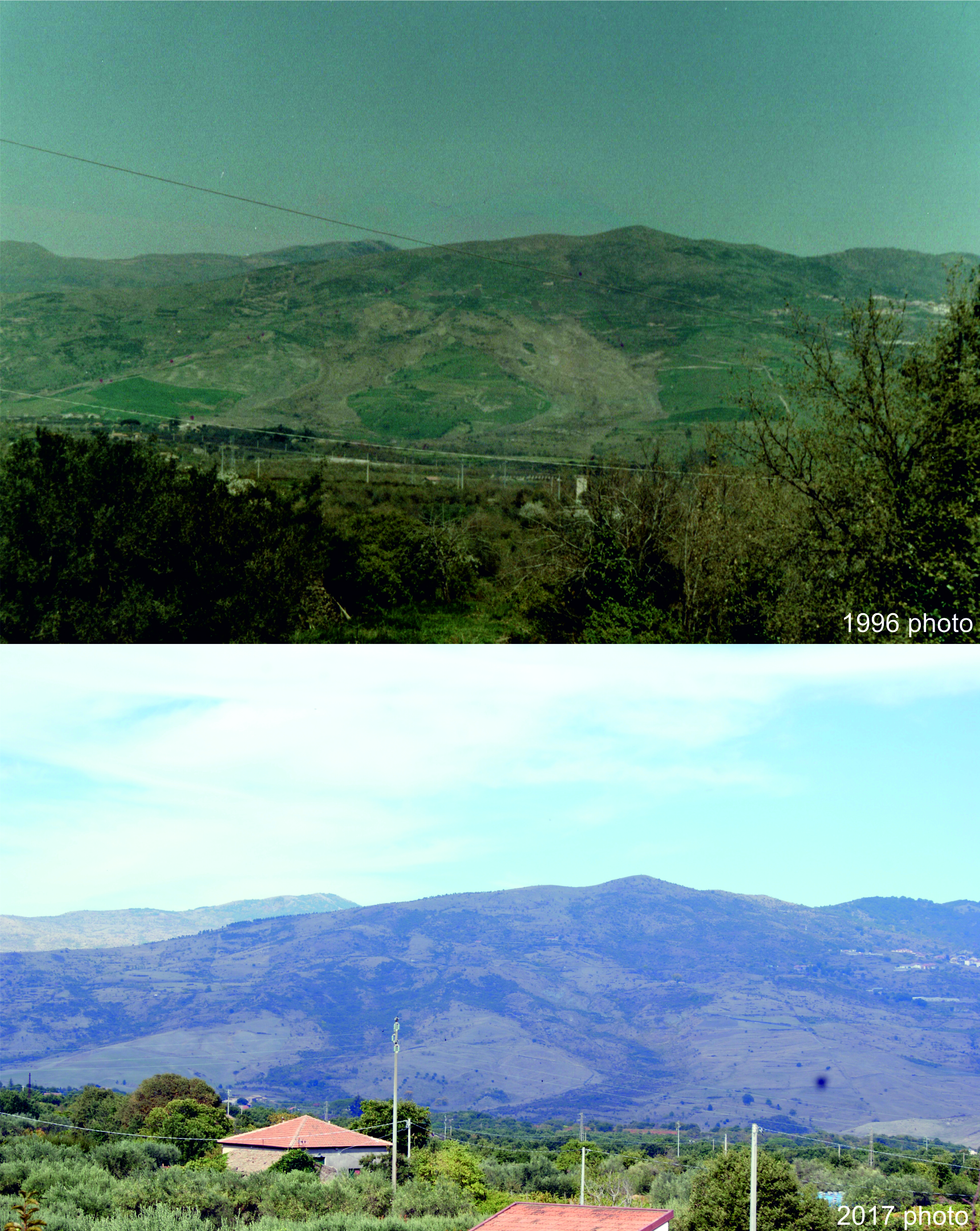
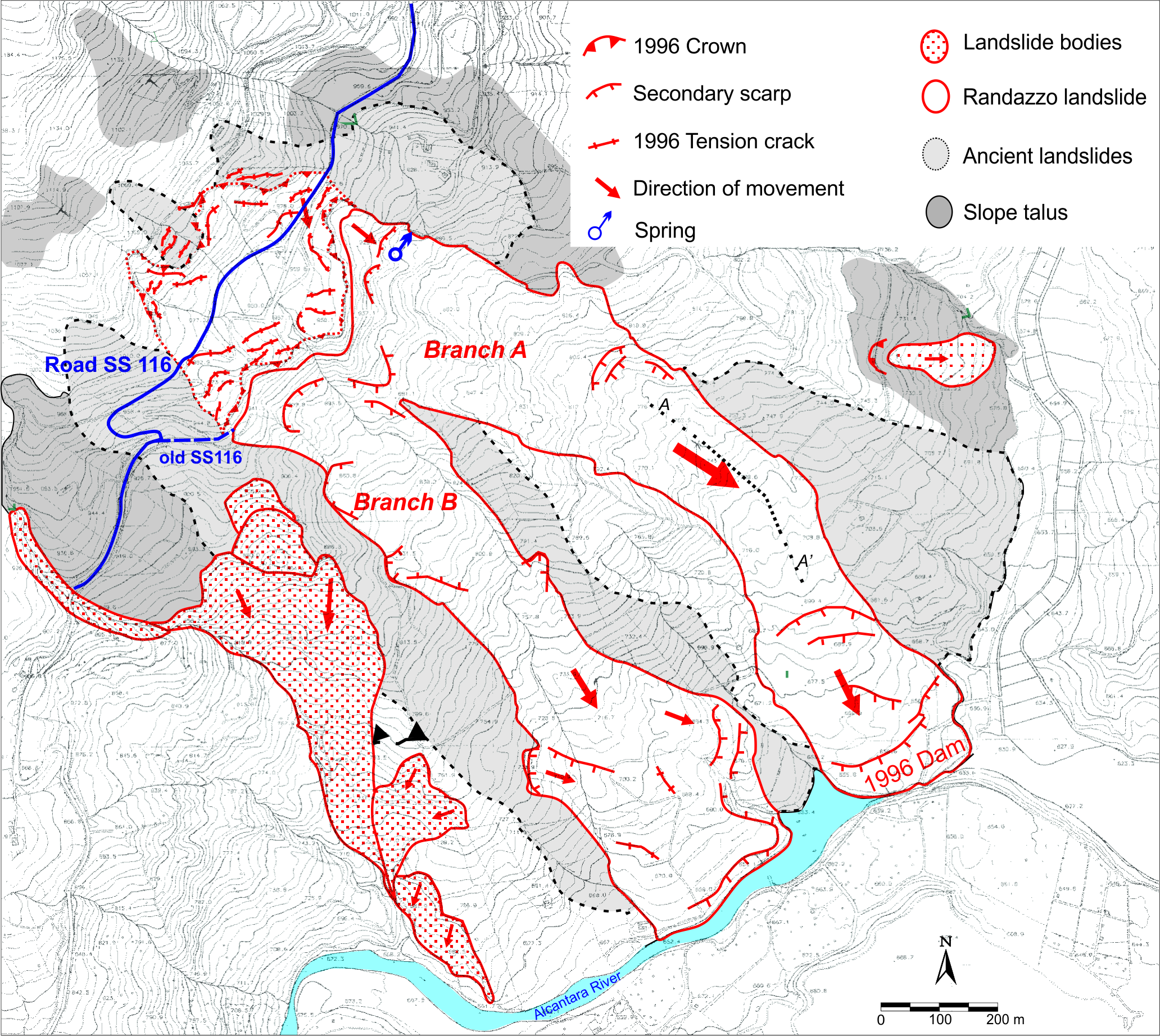
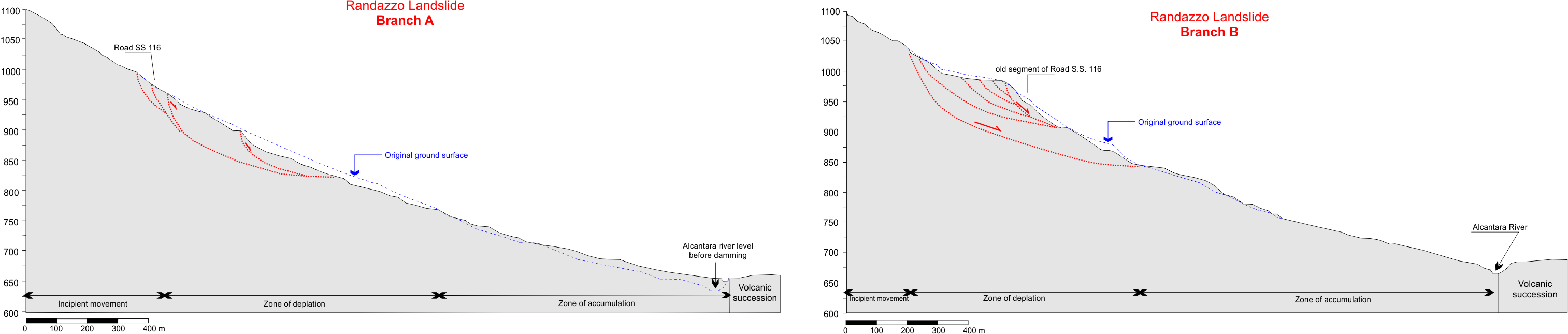
The Bosmatto landslide is an ancient, large instability in a steep (30° to 40°) West-facing slope in the Northwestern Alps, overhanging the roughly N-S trending glacial Lys Valley above the village of Gressoney Saint-Jean (Aosta Valley, Italy). The slope is split in two sectors with different state of activity: the southern inactive sector is completely vegetated by a dense high forest; the northern active sector (the one meant here as the “Bosmatto landslide”), extending longitudinally for at least 500 m and with a maximum width of approximately 300 m, lacks vegetation cover and appears as a highly chaotic mass of large disjointed blocks and fragments of metamorphic bedrock within a scarce sandy to gravelly matrix. Relatively coherent portions of rock mass are also present within the main body. The lower part of the slope is undercut by the deeply incised bed of the Letze Creek. In the head scarp area, and beyond the main landslide body up to an elevation of about 2300 m a.s.l., rocky outcrops are heavily fractured and show signs of possible deep-seated deformation. The transition from the toe of the landslide to the debris flow source area is outlined by a minor scarp at 1700 m a.s.l.. Below this point, five springs mark the point after which the Letze Creek has a perennial water flow, whereas water flow in the bed incisions upslope is intermittent or ephemeral. This hints at the presence of a complex water circulation system below the ground surface, possibly influencing the stability of the slope. A single borehole survey has been performed, in proximity of the minor scarp at 1700 m a.s.l. This indicated a 30-m thick layer of landslide material, separated from the bedrock by a roughly 10-m thick heavily deformed and brecciated zone with silty-sandy gauge layers that may act as a preferential plane of weakness. |
|


.png)