Agnone Landslide
LCI : ITA1809291655| Main Information | |
| Landslide Name | : Agnone Landslide |
| Latitude | : 41:48:03 N |
| Longitude | : 14:19:36 E |
| Location | |
| City / District | : Agnone |
| Province | : Isernia, Molise Region |
| Country | : Italy |
| Reporter | |
| Reporter 1 | : Matteo Del Soldato |
| Reporter 2 | : |
| Landslide Type | |
| Material | : Rock, Debris, Earth, Complex |
| Movement | : Slide, Flow, Complex |
| Velocity (mm/sec) | : Very Slow |
| Depth (m) | : Deep-Moderate |
| Slope (degree) | : Moderate |
| Volume (m³) | : Large |
| Date of Occurence | |
| Date of Occurence | : Jan 24, 2003 |
| Other Information | |
| Land Use |
Source area : Farming, Human settlement, Road Run-out/deposition area : Farming, Road, River |
| Other Activity | : Currently active |
| Triggering Factor | : Snow melting |
| Death(s) & Missing | : - |
| Houses and other structural damage | : 13 |
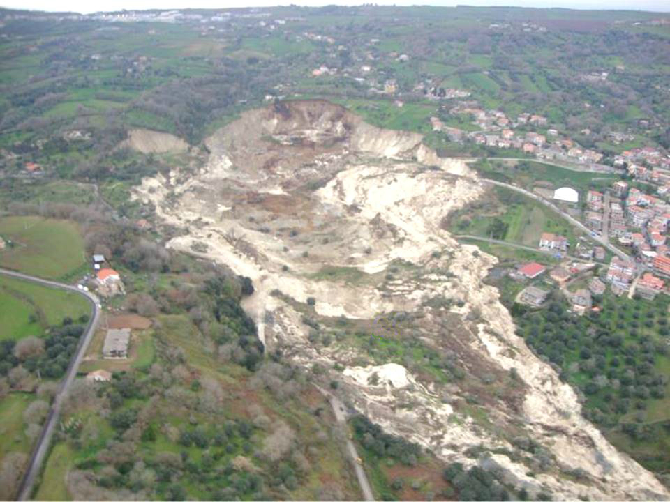
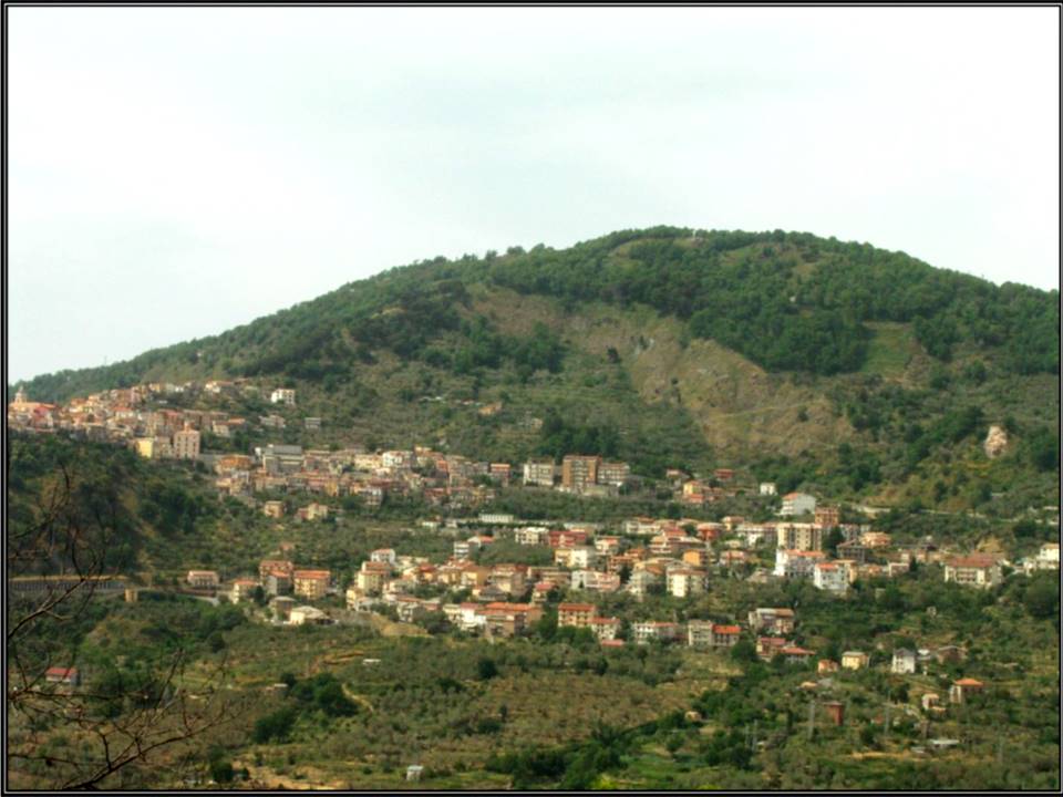
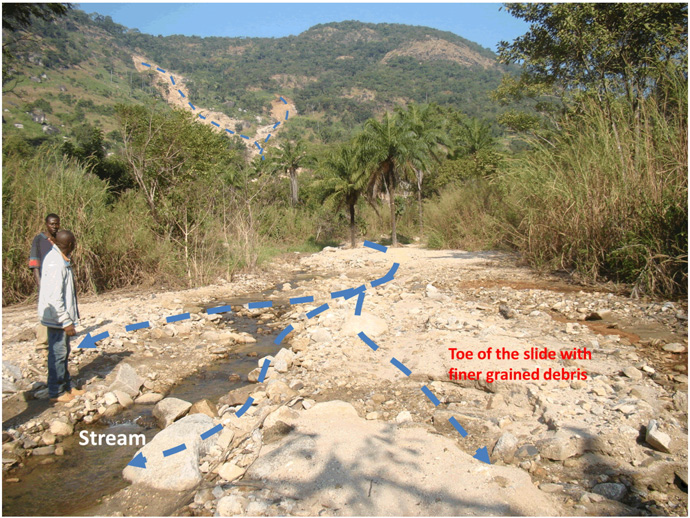
| Photo of landslide | : 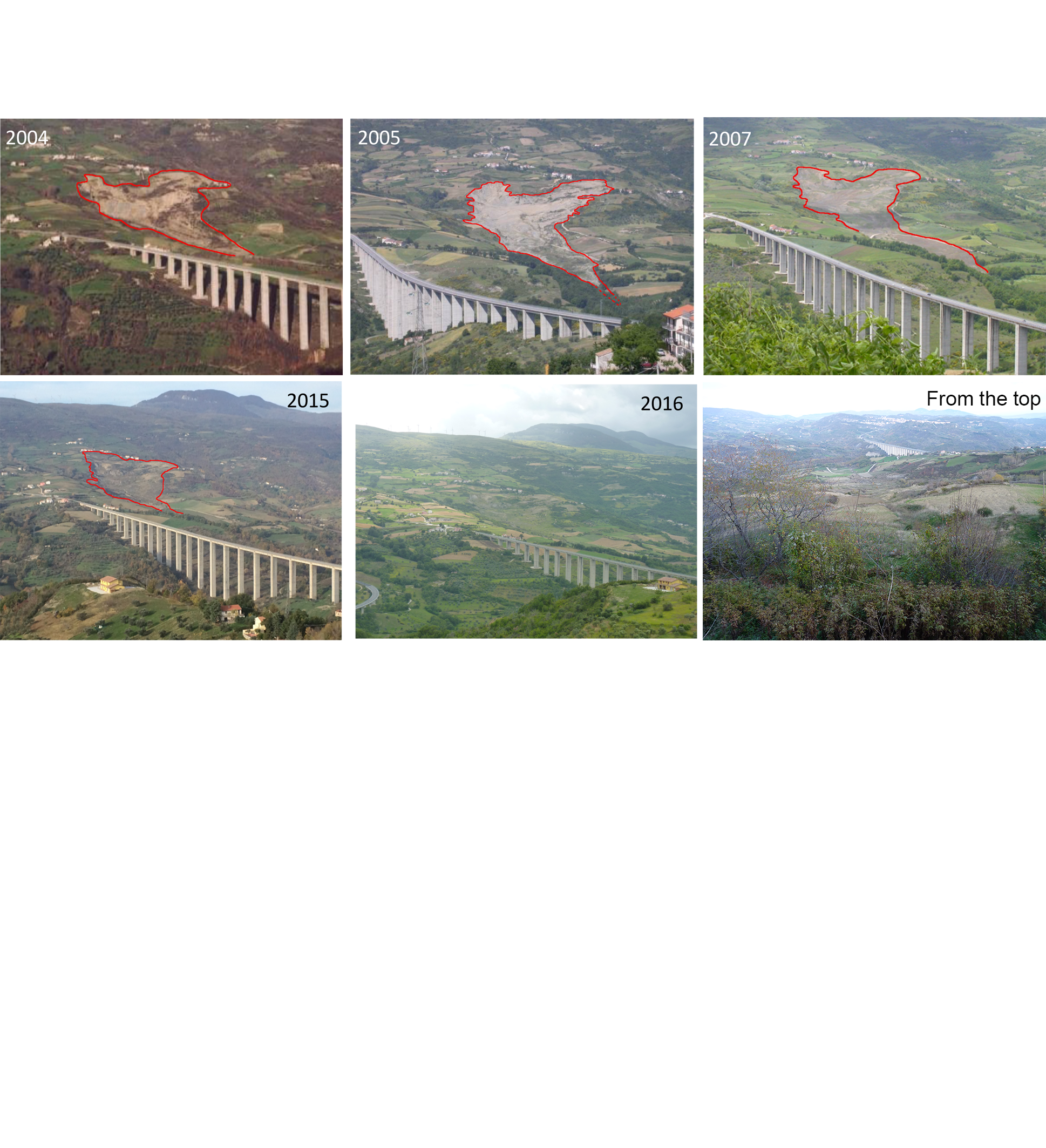 |
| Google earth kmz file | : AgnoneLandslide.kmz |
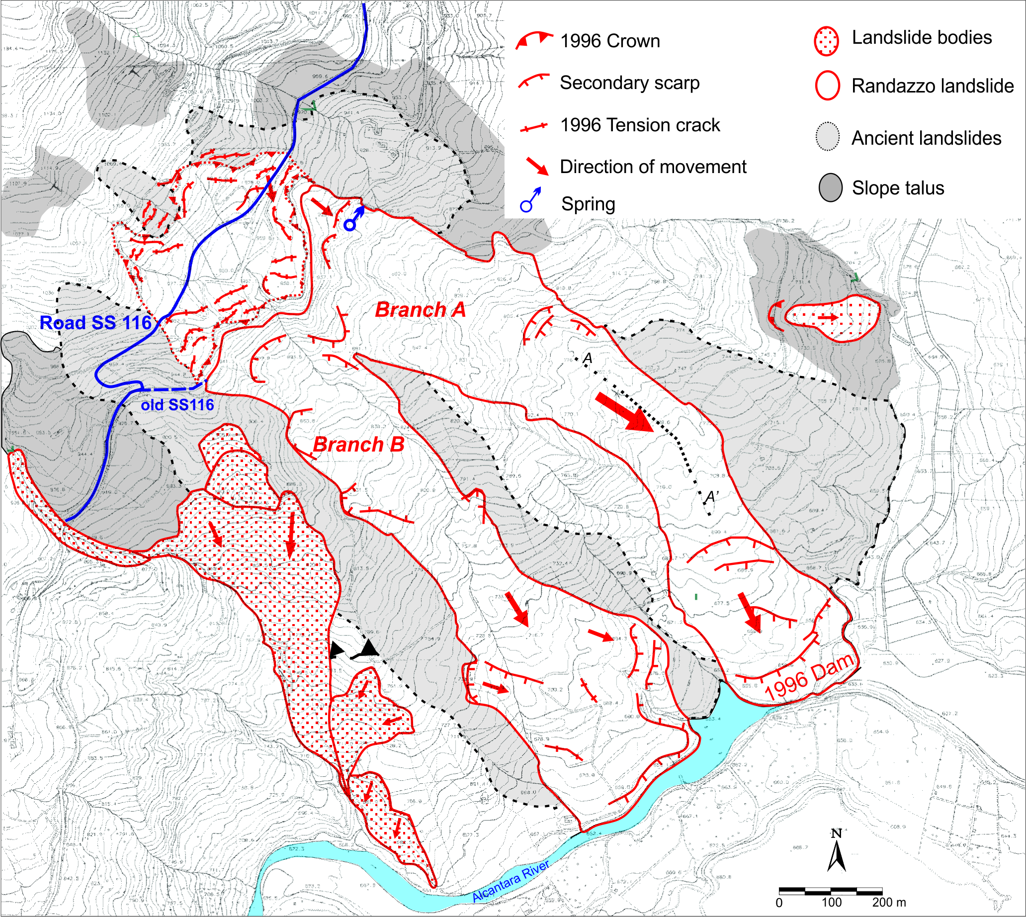
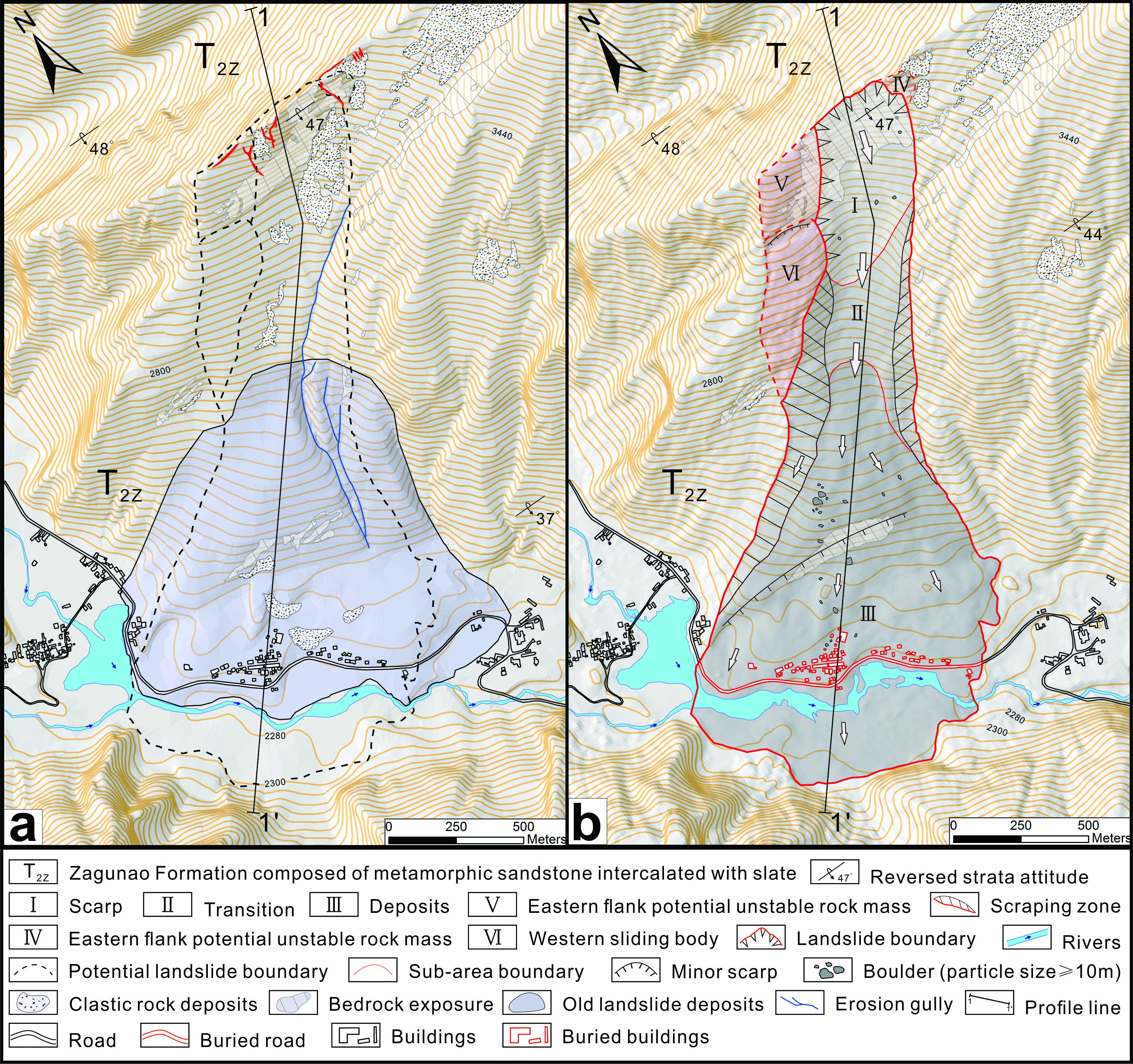
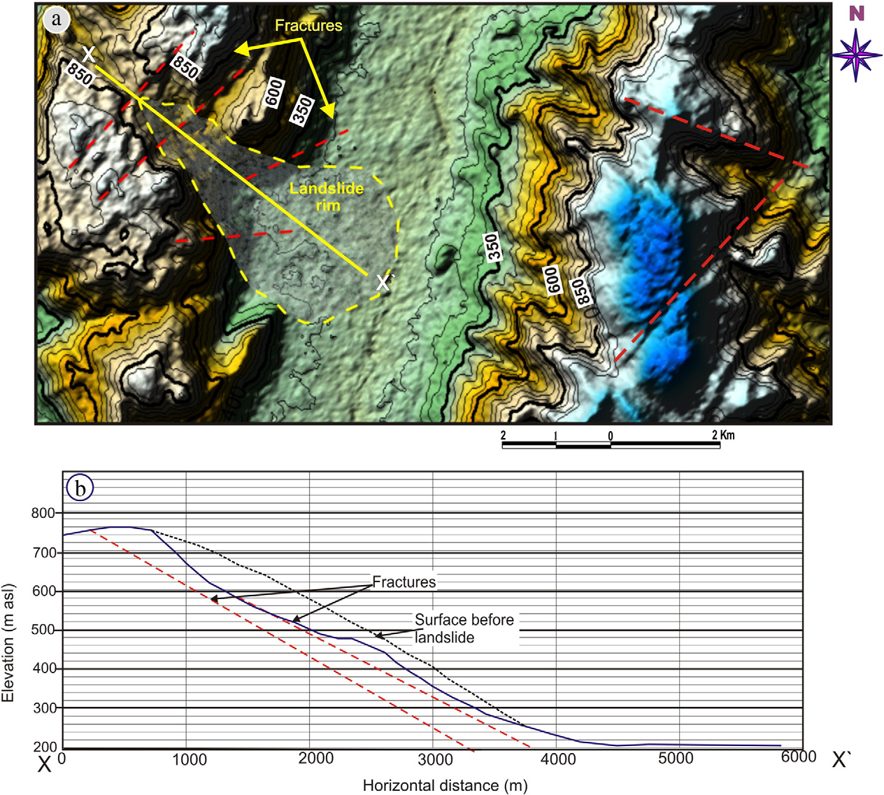
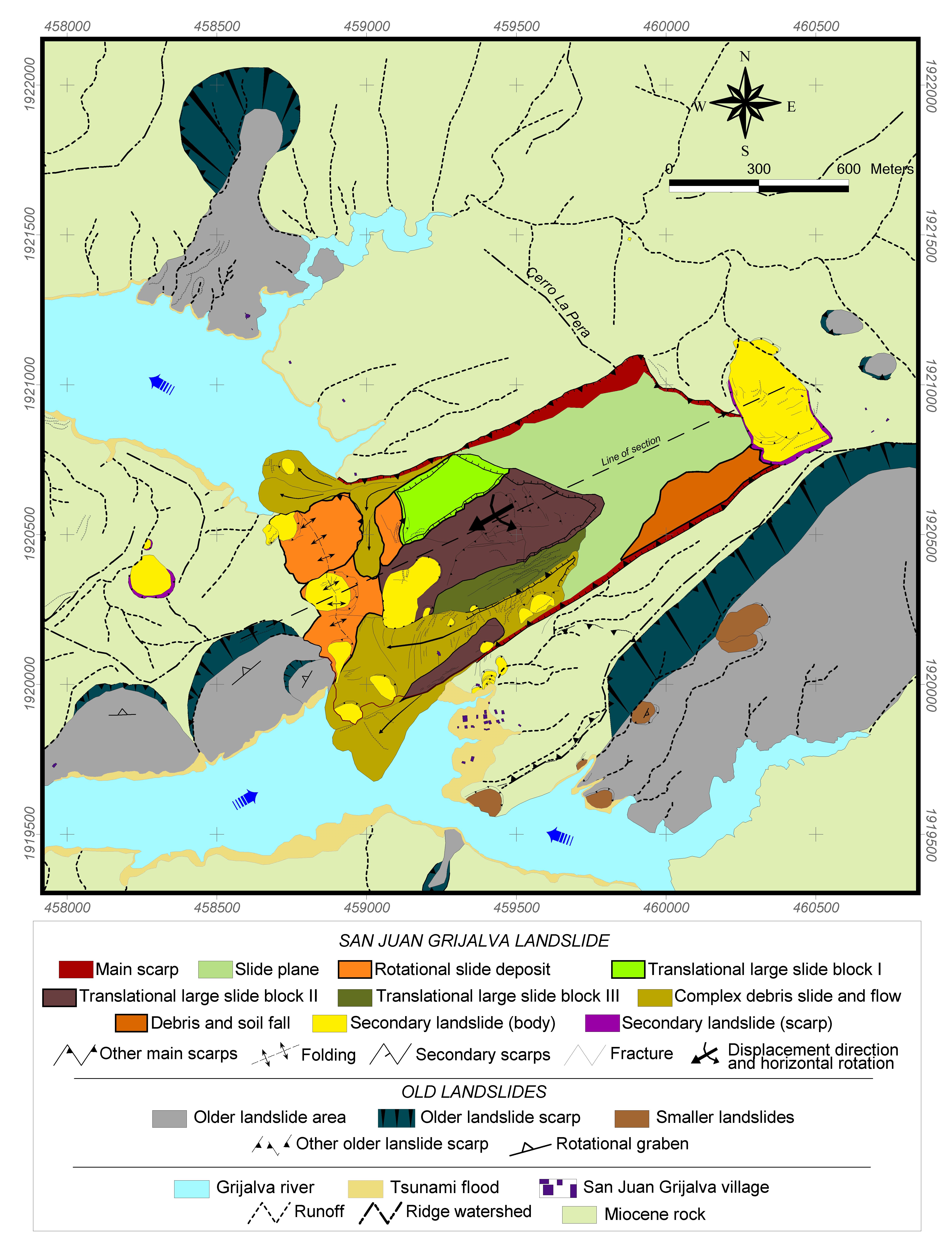
| Plan of landslide | : 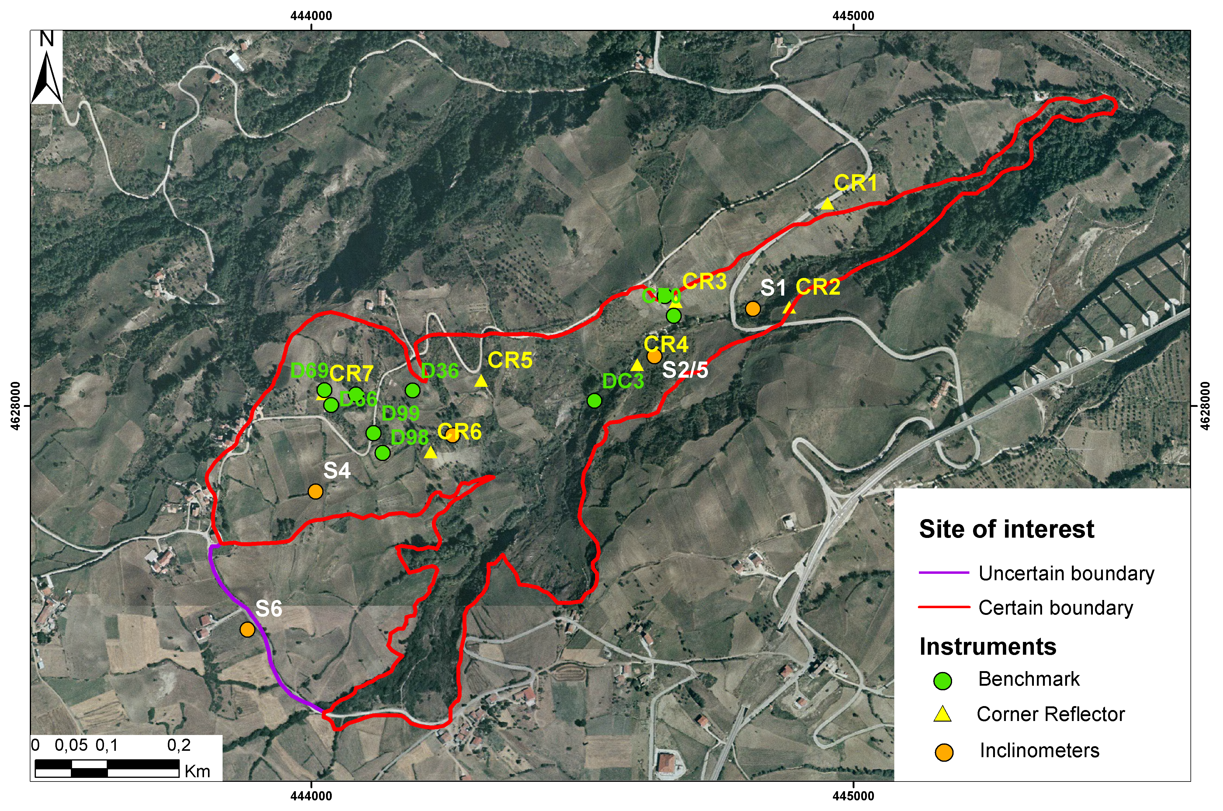 |
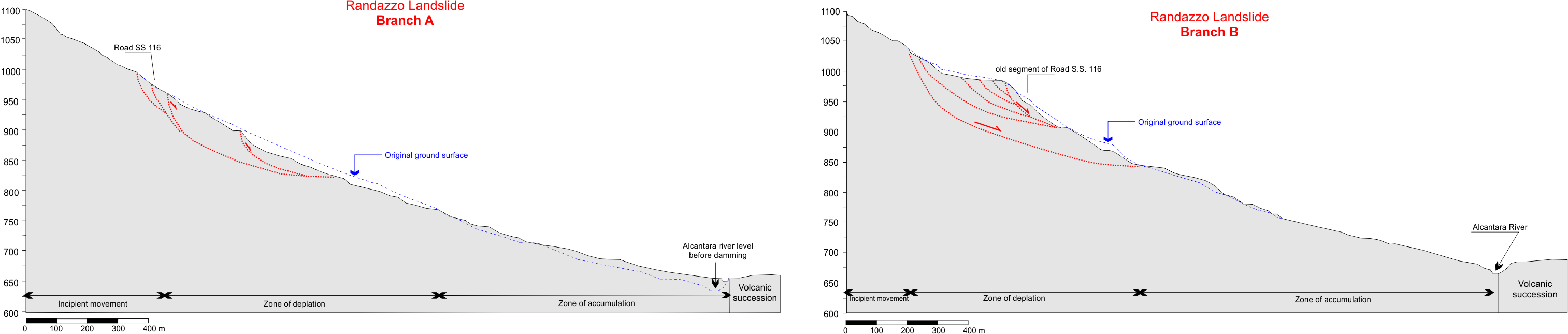
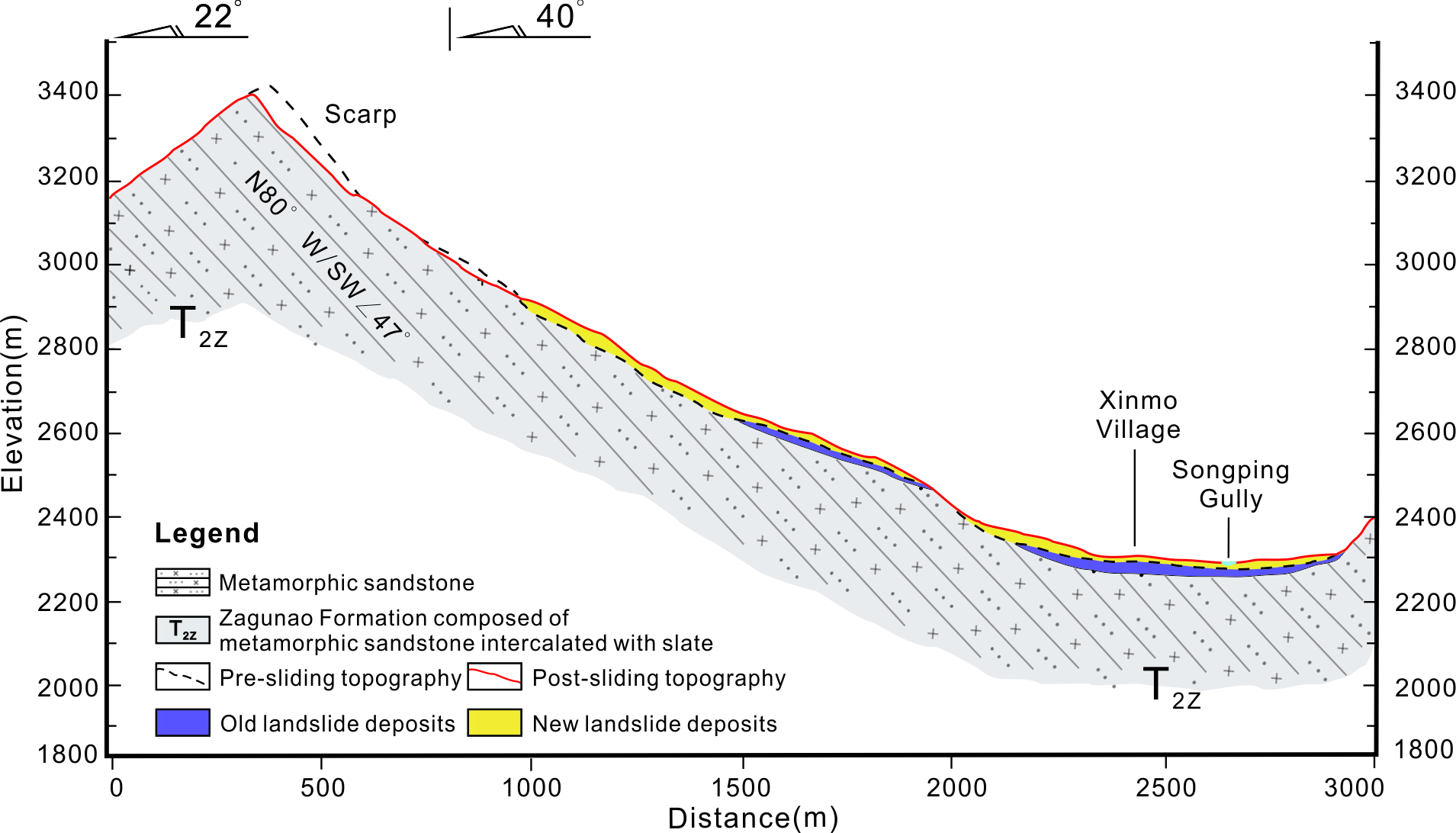
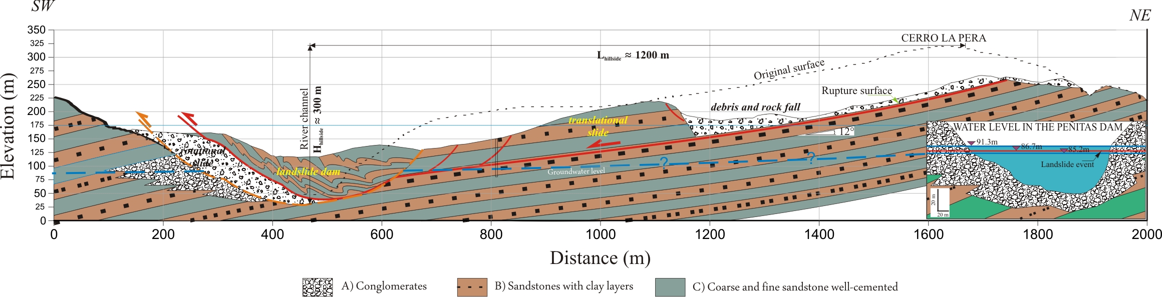
| Cross section of landslide | : 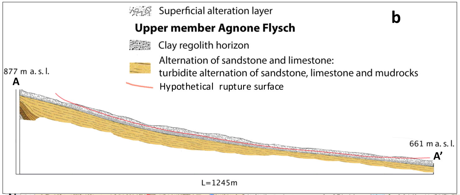 |
| Reference (paper/report) | : https://link.springer.com/article/10.1007/s10346-018-1015-z https://link.springer.com/article/10.1007/s10064-018-1303-9 https://rua.ua.es/dspace/bitstream/10045/65268/1/2016_Del-Soldato_etal_RendOnlineSocGeolIt_139_final.pdf https://books.google.it/books?hl=it&lr=&id=FwrNBQAAQBAJ&oi=fnd&pg=PA299&dq=Agnone+landslide&ots=LtnRTcdgSq&sig=sc1E3Nnbg9njO3R_G5M25RFIq0k#v=onepage&q=Agnonelandslide&f=false |
| Testing graph | : - |
| Monitoring graph | : AgnoneLandslideMonitoring.tif |
| Video of moving landslides including 3D simulation | : - |
| Description | : |
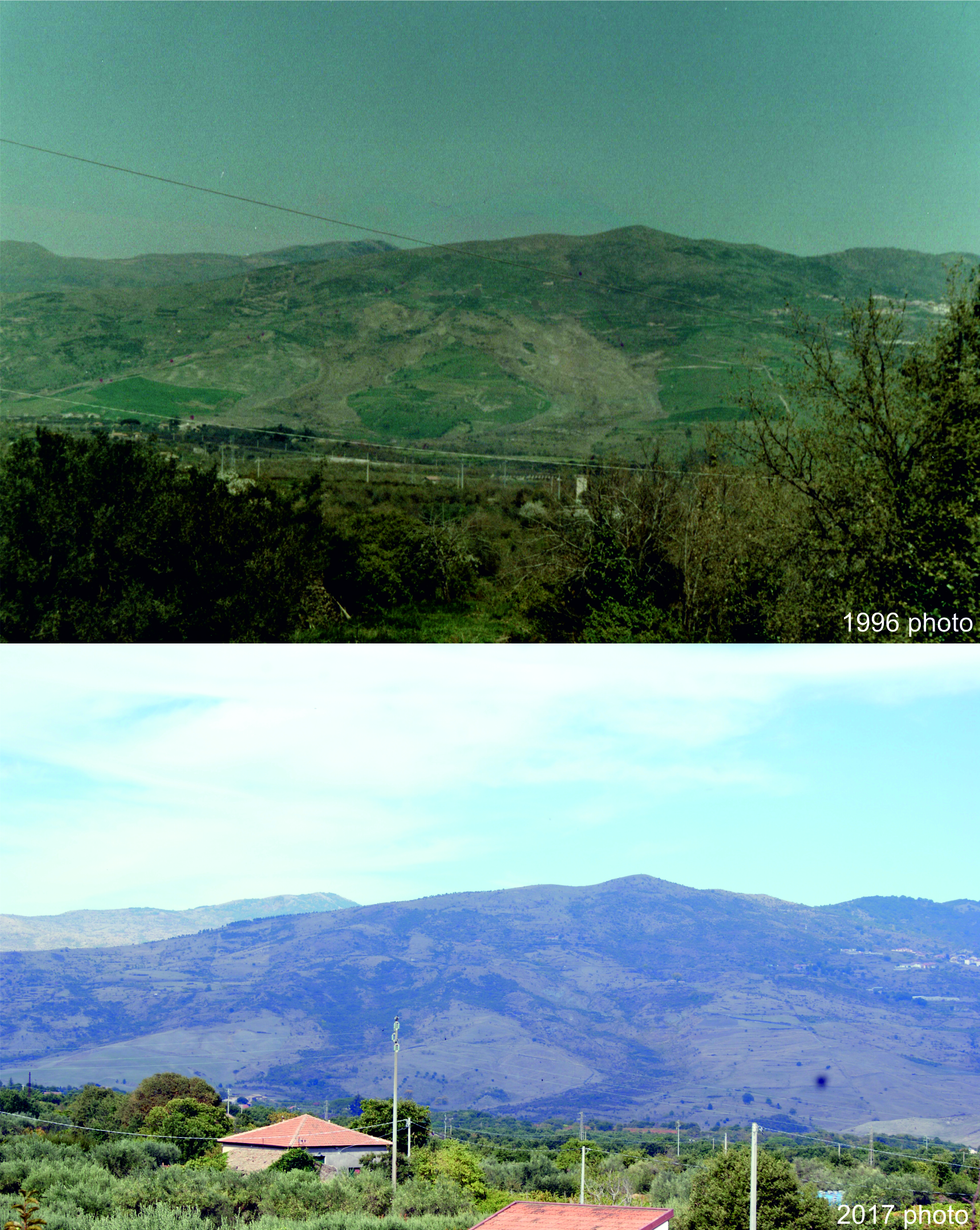
Landslides have been known in the municipality of Agnone since at least the beginning of the twentieth century. The oldest report describing an instability event refers to a phenomenon that occurred in March 1905 in the San Nicola Valley due to the combination of a period of intense rainfall combined with snow-melting. This event damaged the bridge that carried the main access road to the historical center of Agnone. The municipality of Agnone has been successively affected by several small and large landslide events. Archival and bibliographical landslide research, reported in the nationwide AVI Project, revealed more than 60 landslides that occurred in the municipality of Agnone and the surrounding territory. After an intense rainfall event that affected southern Italy between the 23rd and the 27th of January 2003, with more than 200 mm of rain falling over 72h, an important remobilization involved a large area of the historically dormant Agnone landslide due to an unusual increase in pore pressure. The event caused deformations over the whole basin and forcing the local authorities to adopt restrictive measures for 13 edifices occupied by 17 families located within and nearby the landslide. Furthermore, two country roads adjacent to the landslide remained closed due to the substantial damage caused by the reactivation. The mass movement subsequently reactivated in 2004, 2005 and between 2006 and 2007, induced the local administration to allocate resources for some urgent interventions to intercept superficial waters and drain a pond formed in the upper portion of the affected area, in addition to geomorphological reshaping work. Inclinometer and GPS stations were installed and the landslide was monitored by PS data. Sources: Del Soldato, M., Riquelme, A., Bianchini, S., Tomàs, R., Di Martire, D., De Vita, P., Moretti S. & Calcaterra, D. (2018). Multisource data integration to investigate one century of evolution for the Agnone landslide (Molise, southern Italy). Landslides, 1-16. Del Soldato, M., Di Martire, D., Bianchini, S., Tomás, R., De Vita, P., Ramondini, M., Casagli N. & Calcaterra, D. (2018). Assessment of landslide-induced damage to structures: the Agnone landslide case study (southern Italy). Bulletin of Engineering Geology and the Environment, 1-22. |
|


