Ichinose landslide
LCI : JPN2410011750| Main Information | |
| Landslide Name | : Ichinose landslide |
| Latitude | : 37:20:35.92 N |
| Longitude | : 136:54:46.12 E |
| Location | |
| City / District | : Wajima |
| Province | : Ishikawa |
| Country | : Japan |
| Reporter | |
| Reporter 1 | : Doan Loi |
| Reporter 2 | : |
| Landslide Type | |
| Material | : Earth |
| Movement | : Slide |
| Velocity (mm/sec) | : Very Rapid |
| Depth (m) | : Deep |
| Slope (degree) | : Gentle |
| Volume (m³) | : Large |
| Date of Occurence | |
| Date of Occurence | : Jan 01, 2024 |
| Other Information | |
| Land Use |
Source area : Forest Run-out/deposition area : Farming, Human settlement, Road |
| Other Activity | : Active in the past |
| Triggering Factor | : Earthquake |
| Death(s) & Missing | : - |
| Houses and other structural damage | : 10 |
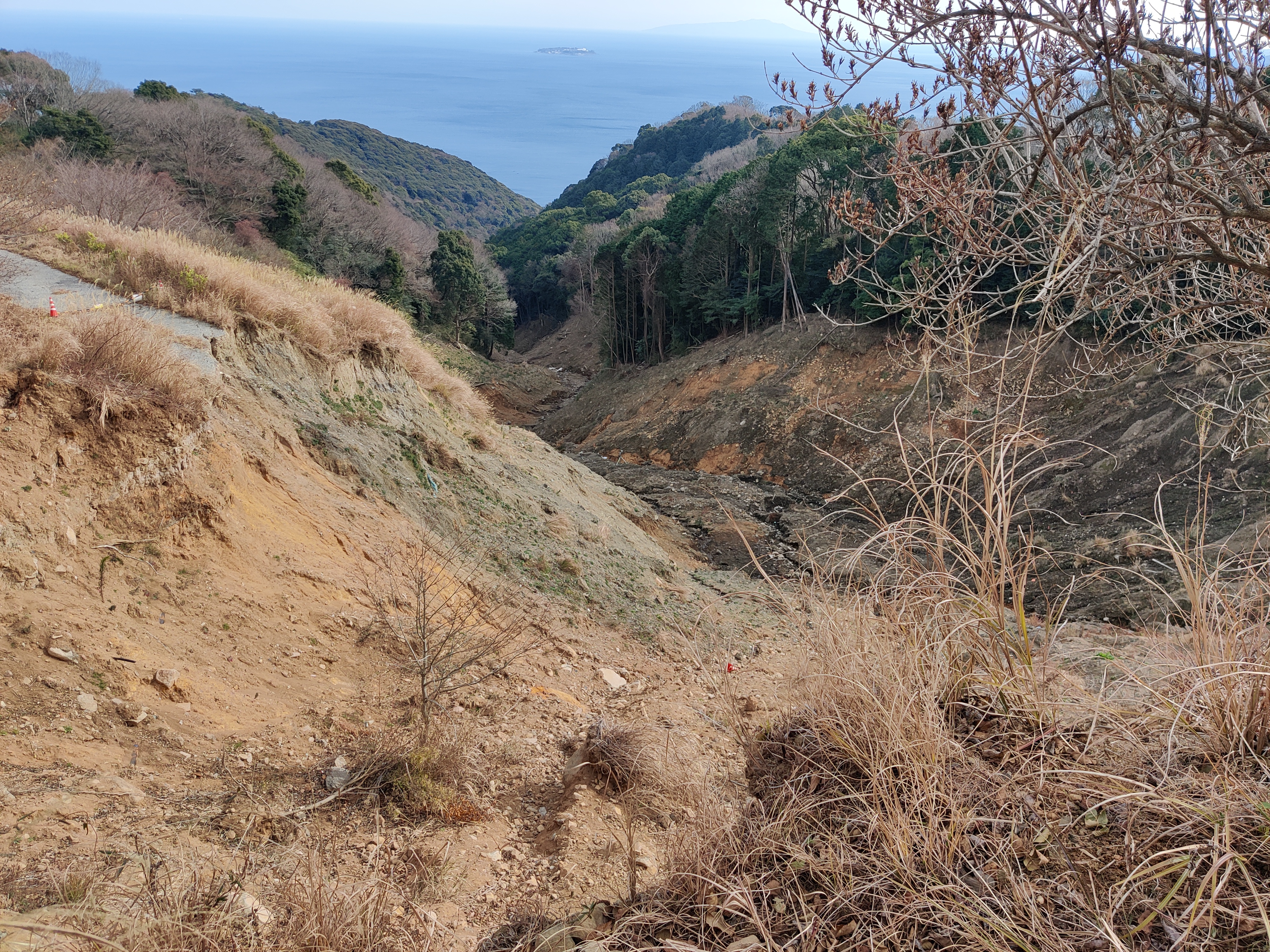
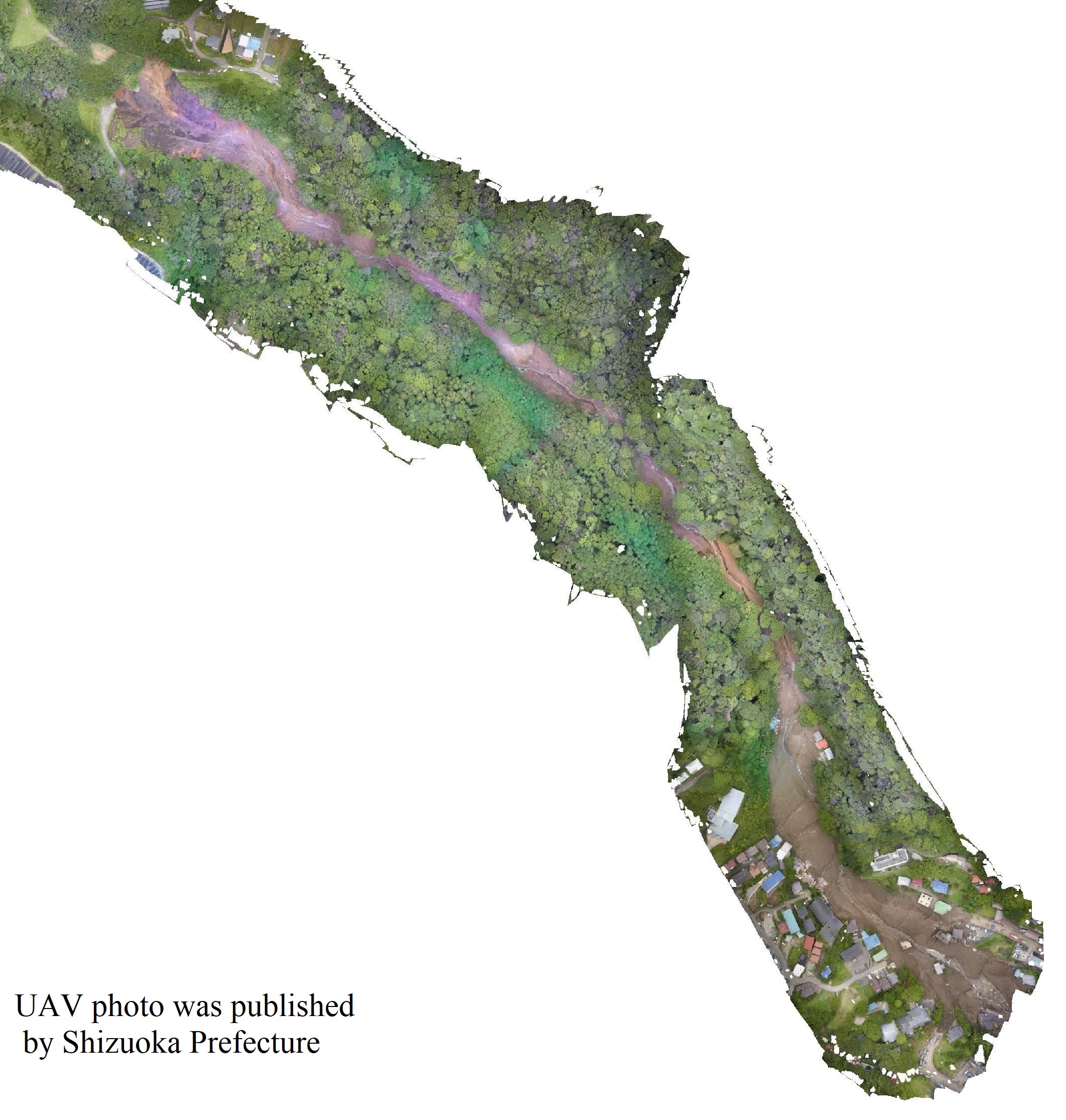
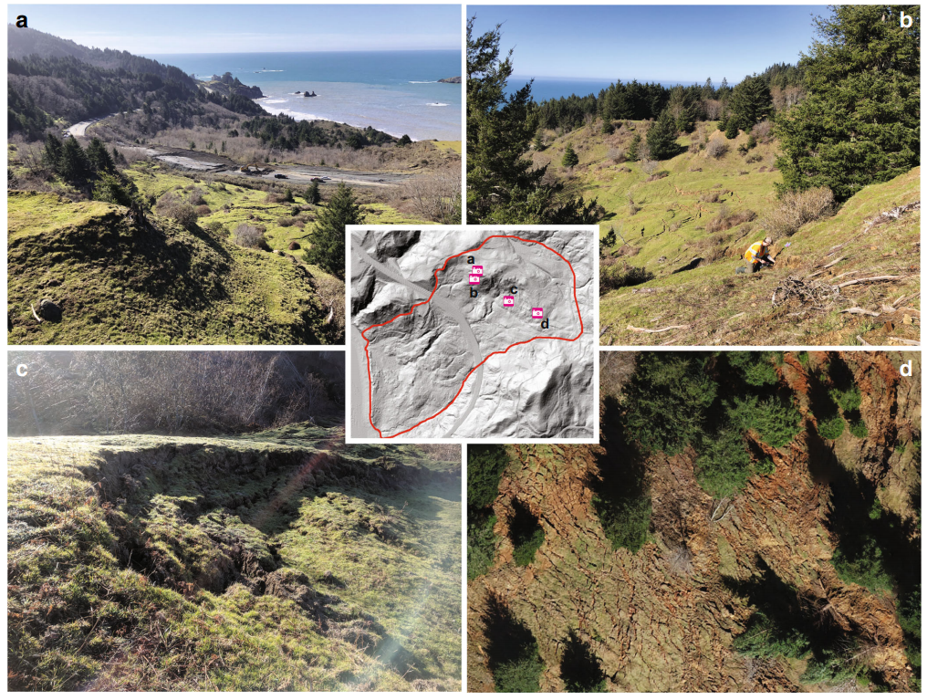
| Photo of landslide | :  |
| Google earth kmz file | : Ichinose landslide1727772479.kmz |
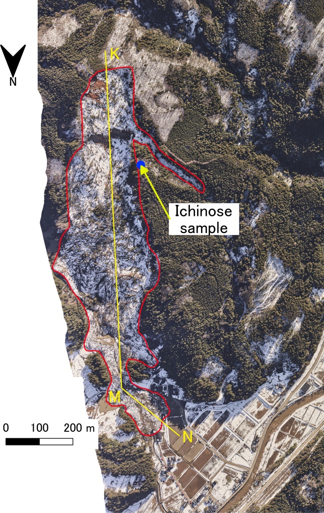
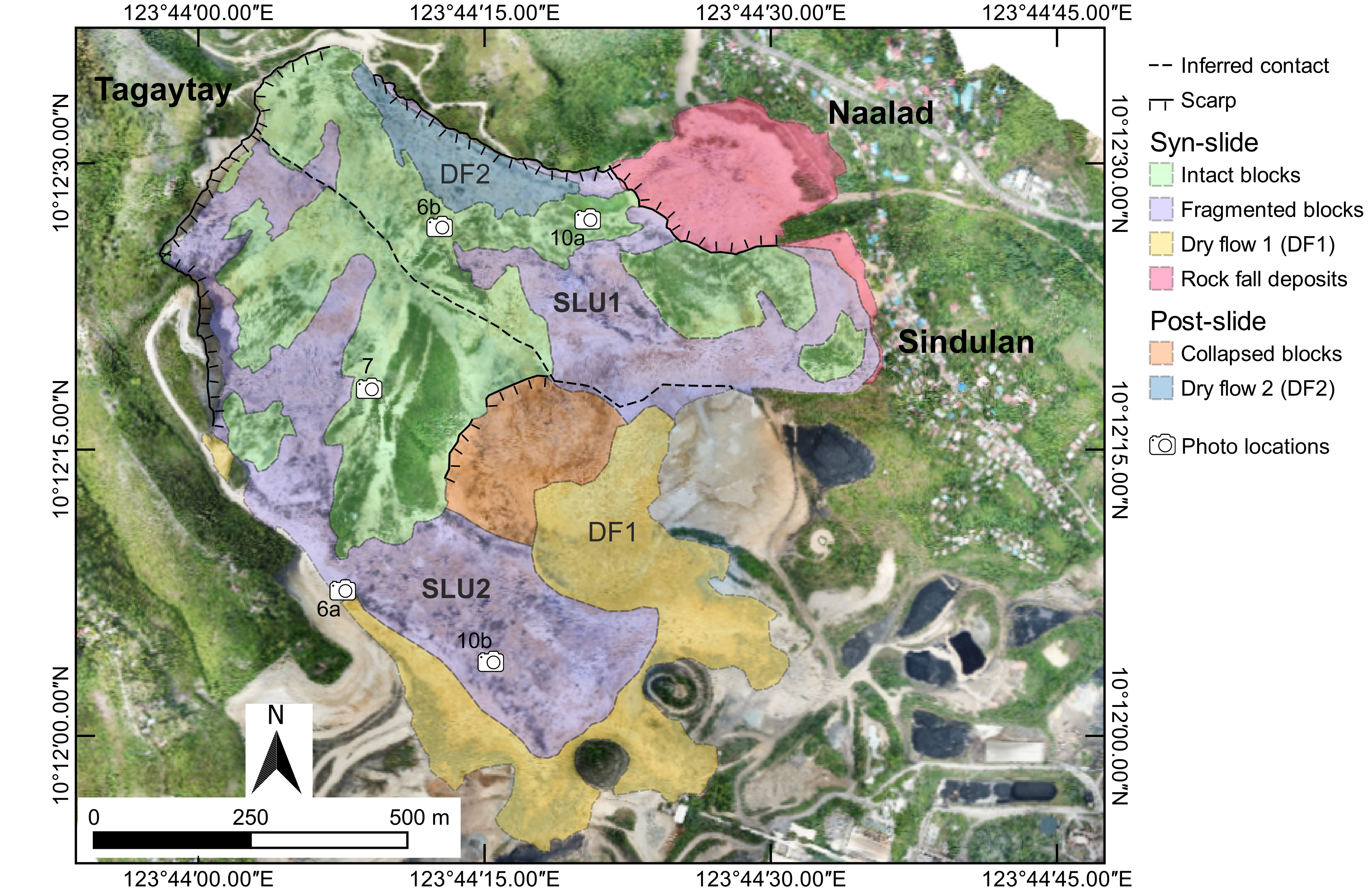
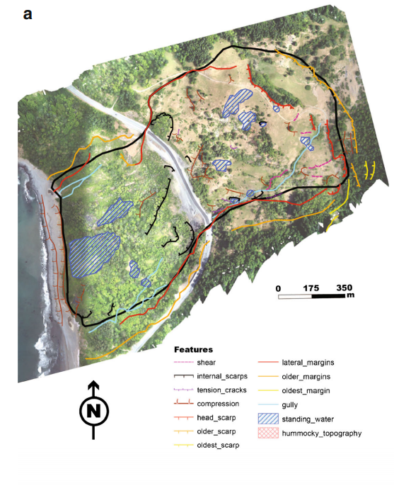
| Plan of landslide | : |
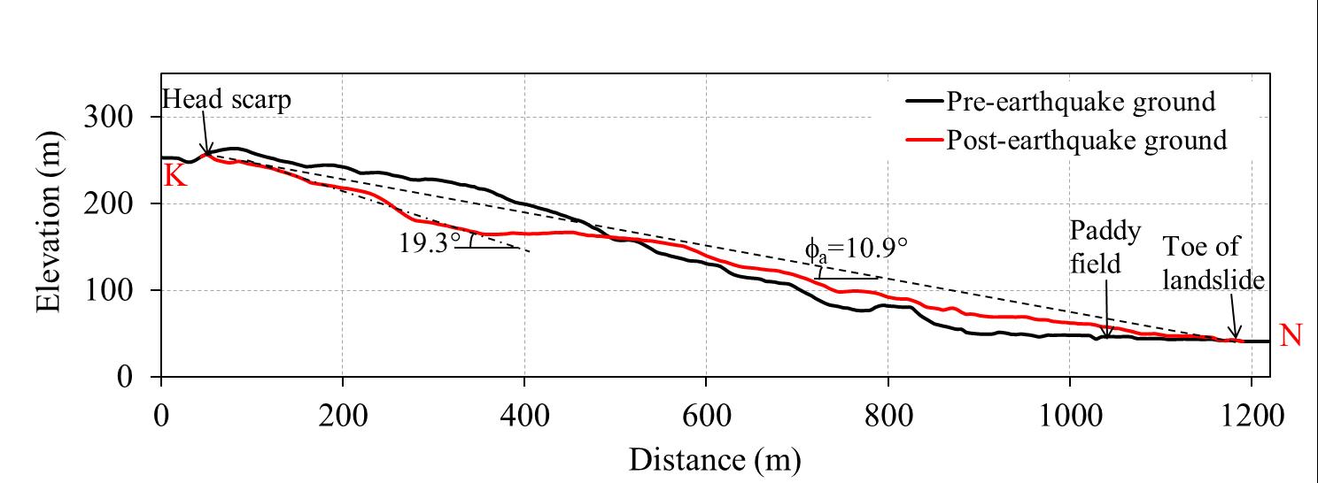
| Cross section of landslide | :  |
| Reference (paper/report) | : https://link.springer.com/article/10.1007/s10346-024-02333-6 |
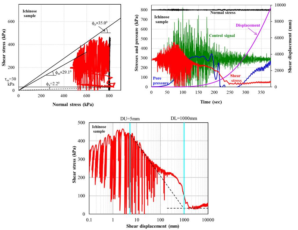
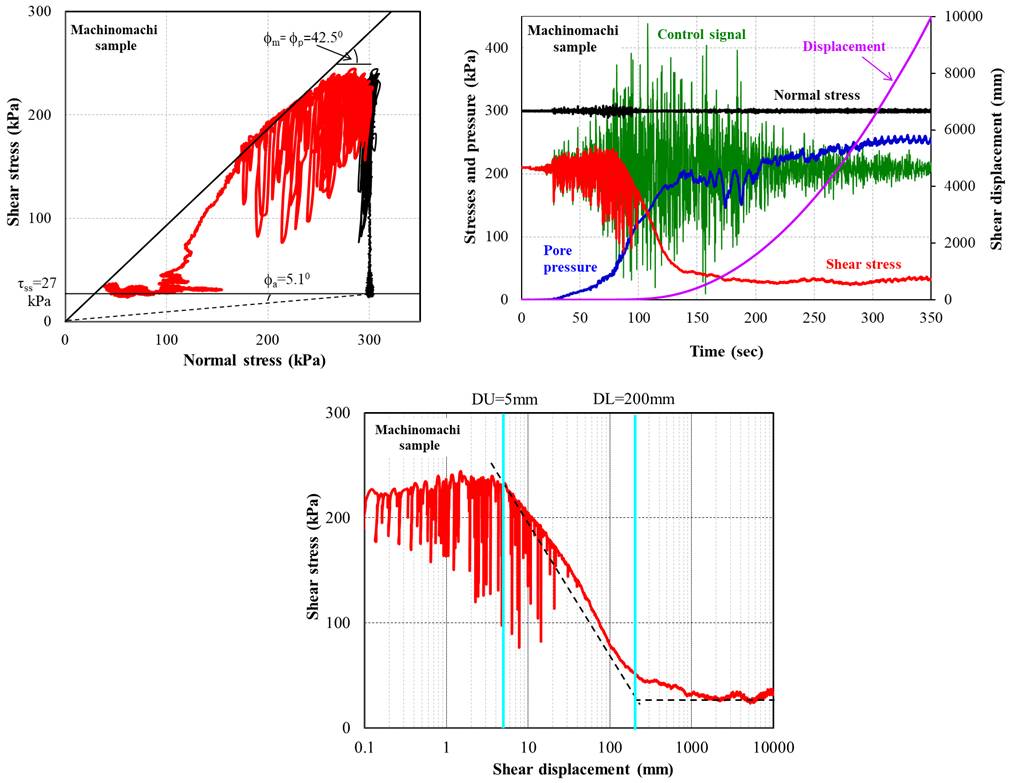
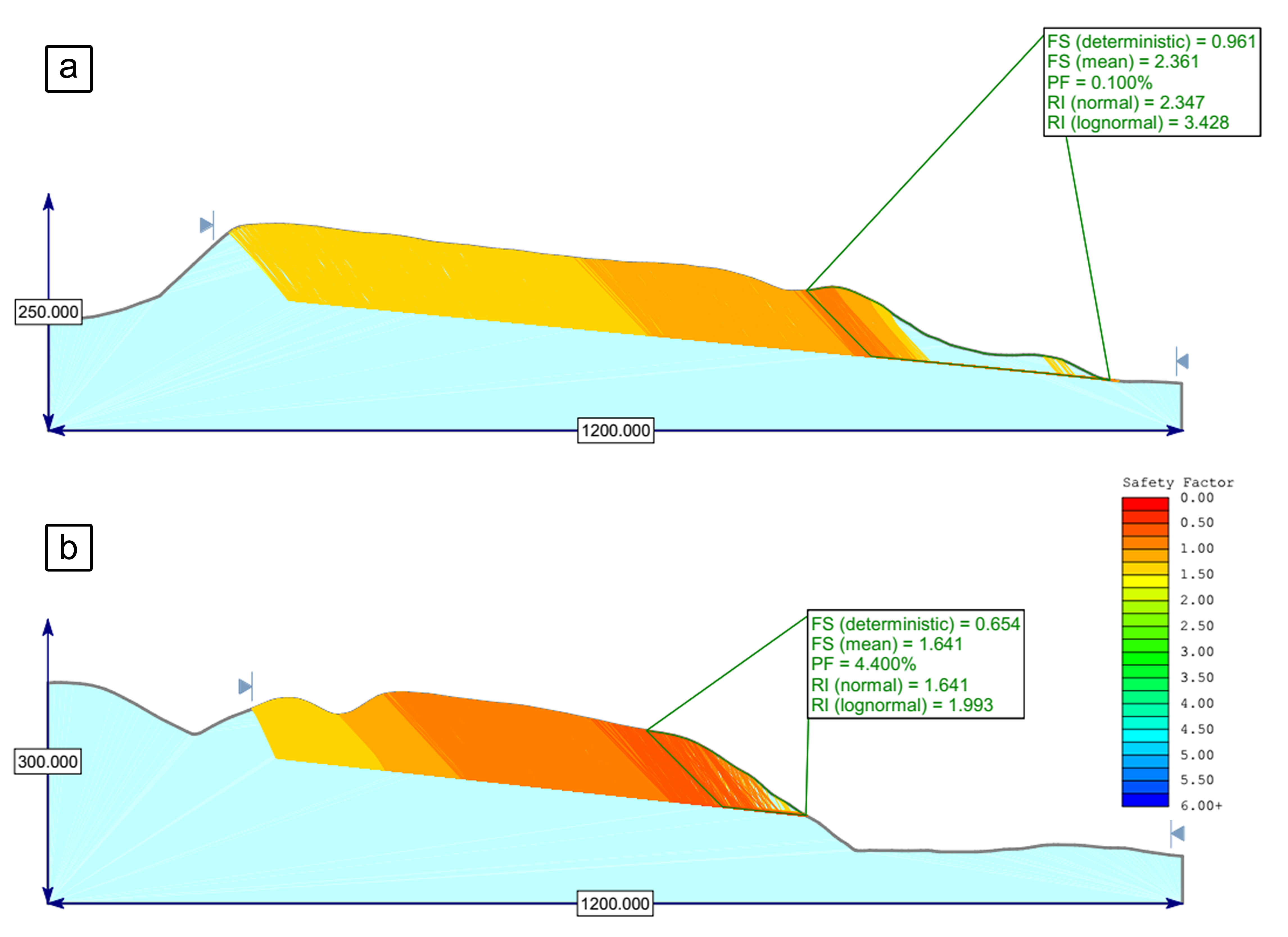
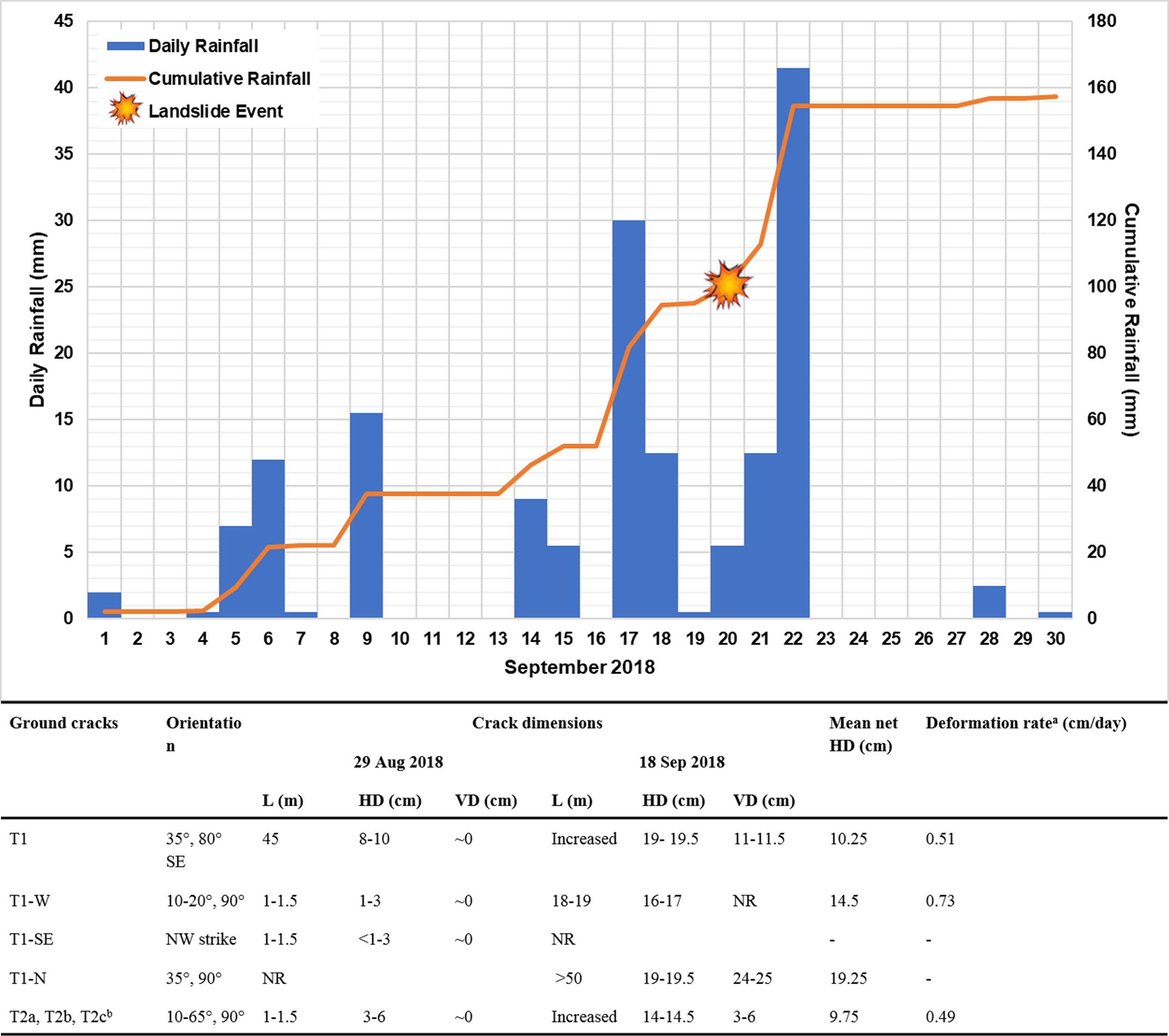
| Testing graph | :  |
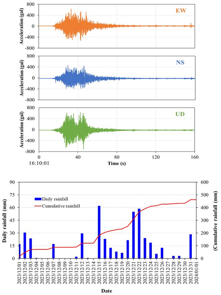
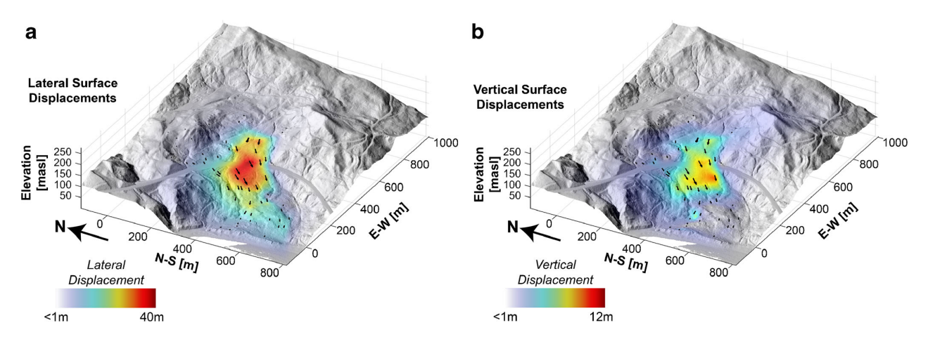
| Monitoring graph | :  |
| Video of moving landslides including 3D simulation | : https://youtu.be/3yh2xIYmaJw |
| Description | : |
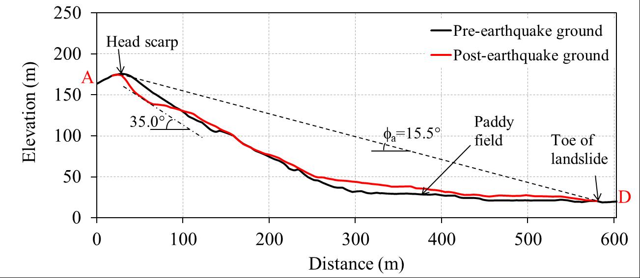
At 16:10 (JST) on January 1, 2024, an intense earthquake struck the Noto Peninsula area of Ishikawa Prefecture, Japan. The Japan Meteorological Agency (JMA) magnitude MJMA was 7.6, and the epicenter was 37.498° North and 137.242° East. The cascading effects of the Noto earthquake caused extensive damage on the Noto Peninsula, particularly in Wajima, Suzu, Noto, and Anamizu. As of 14:00 on March 26, this earthquake claimed 244 lives (15 people were reported as disaster-related deaths) and damaged 74,923 houses (Ishikawa Prefecture report, 2024). Shortly after the event, the Geospatial Information Authority of Japan mapped and published the locations of the landslides. The 2024 Noto Peninsula earthquake triggered more than 2300 landslides over a wide area. Although shallow, distributed landslides were common, long-traveling landslides caused significant damage. The Ichinose landslide was in Ichinose-cho, Wajima City, Ishikawa Prefecture, about 30 km from the epicenter. The slope was gentle, as the slope angle measured was less than 20°. The Ichinose landslide is about 440 m long, 200 m wide and 50 m thick. The apparent angle calculated from the line connecting the head scarp to the toe of the landslide was 10.9°, indicating high mobility. The displaced landslide mass traveled more than 1 km and deposited on a flat rice paddy. – – – – – Source: Loi, D.H., Jayakody, S., Sassa, K. et al. Landslides triggered by the 2024 Noto Peninsula earthquake. Landslides 21, 2583–2590 (2024). https://doi.org/10.1007/s10346-024-02333-6 |
|


