Naga Landslide
LCI : PHL2009221500| Main Information | |
| Landslide Name | : Naga Landslide |
| Latitude | : 10:12:30.58 N |
| Longitude | : 123:45:32,57 E |
| Location | |
| City / District | : Naga |
| Province | : Cebu |
| Country | : Philippines |
| Reporter | |
| Reporter 1 | : John Romel Flora |
| Reporter 2 | : Sandra Catane |
| Landslide Type | |
| Material | : Rock |
| Movement | : Complex |
| Velocity (mm/sec) | : Very Rapid |
| Depth (m) | : Deep-Moderate |
| Slope (degree) | : Extremely steep |
| Volume (m³) | : Very Large |
| Date of Occurence | |
| Date of Occurence | : Sep 20, 2018 |
| Other Information | |
| Land Use |
Source area : Farming, Human settlement, Industrial use, Road Run-out/deposition area : Farming, Urban area, Industrial use, Road, River |
| Other Activity | : Active in the past |
| Triggering Factor | : Human activity |
| Death(s) & Missing | : 134 |
| Houses and other structural damage | : 57 |
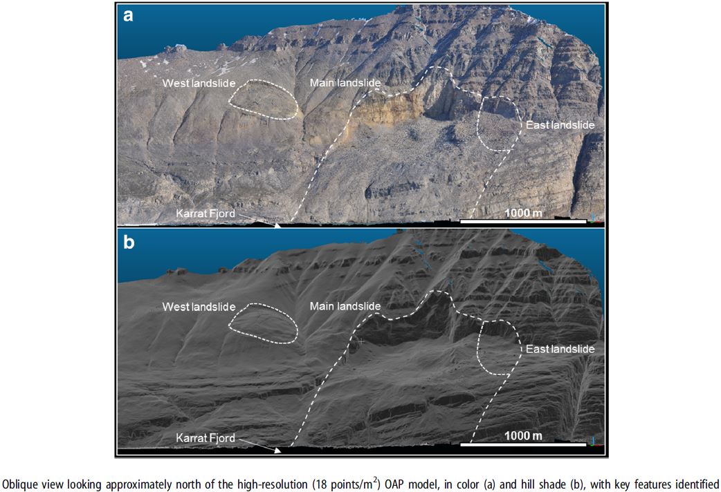
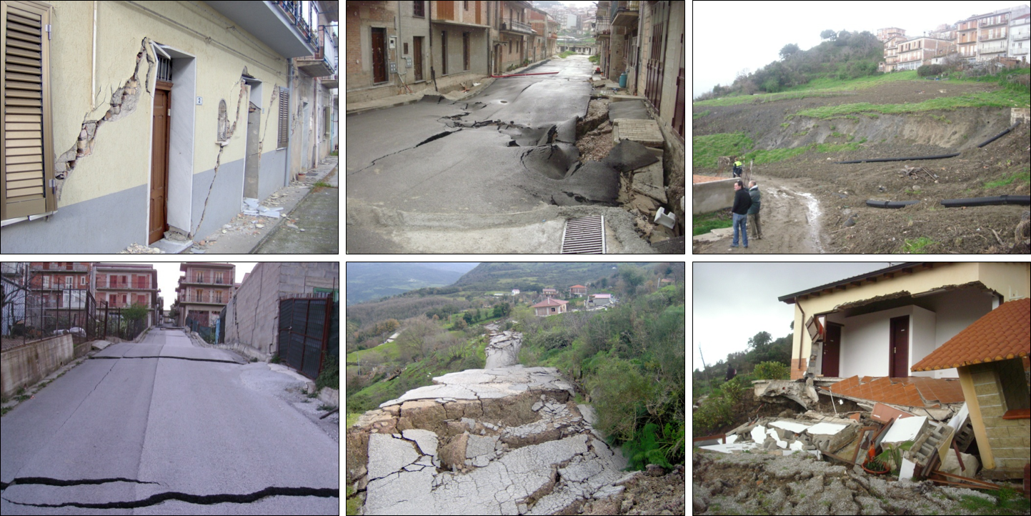
| Photo of landslide | : 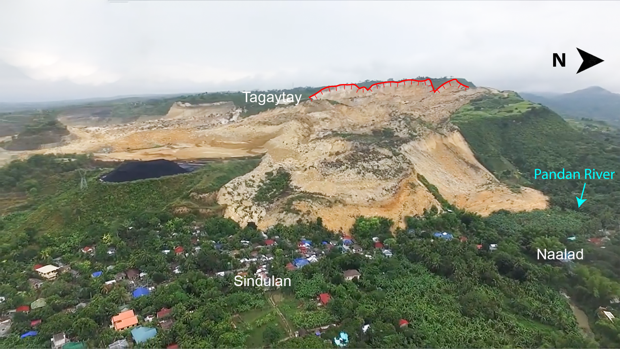 |
| Google earth kmz file | : Naga landslide extent.kmz |
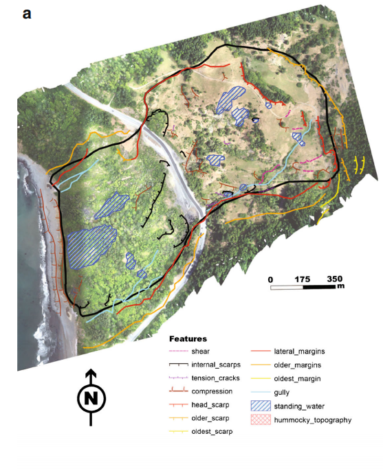
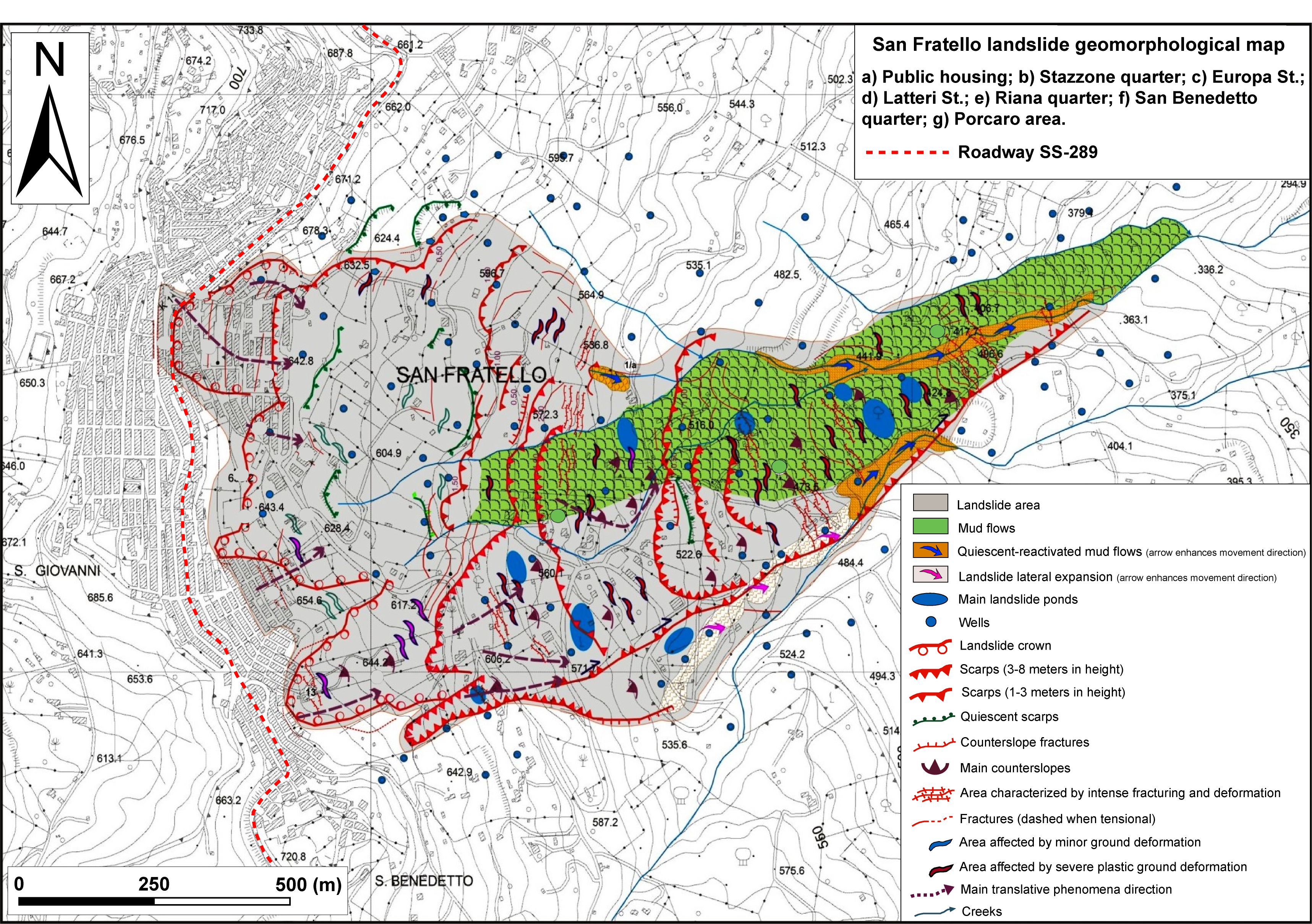
| Plan of landslide | : 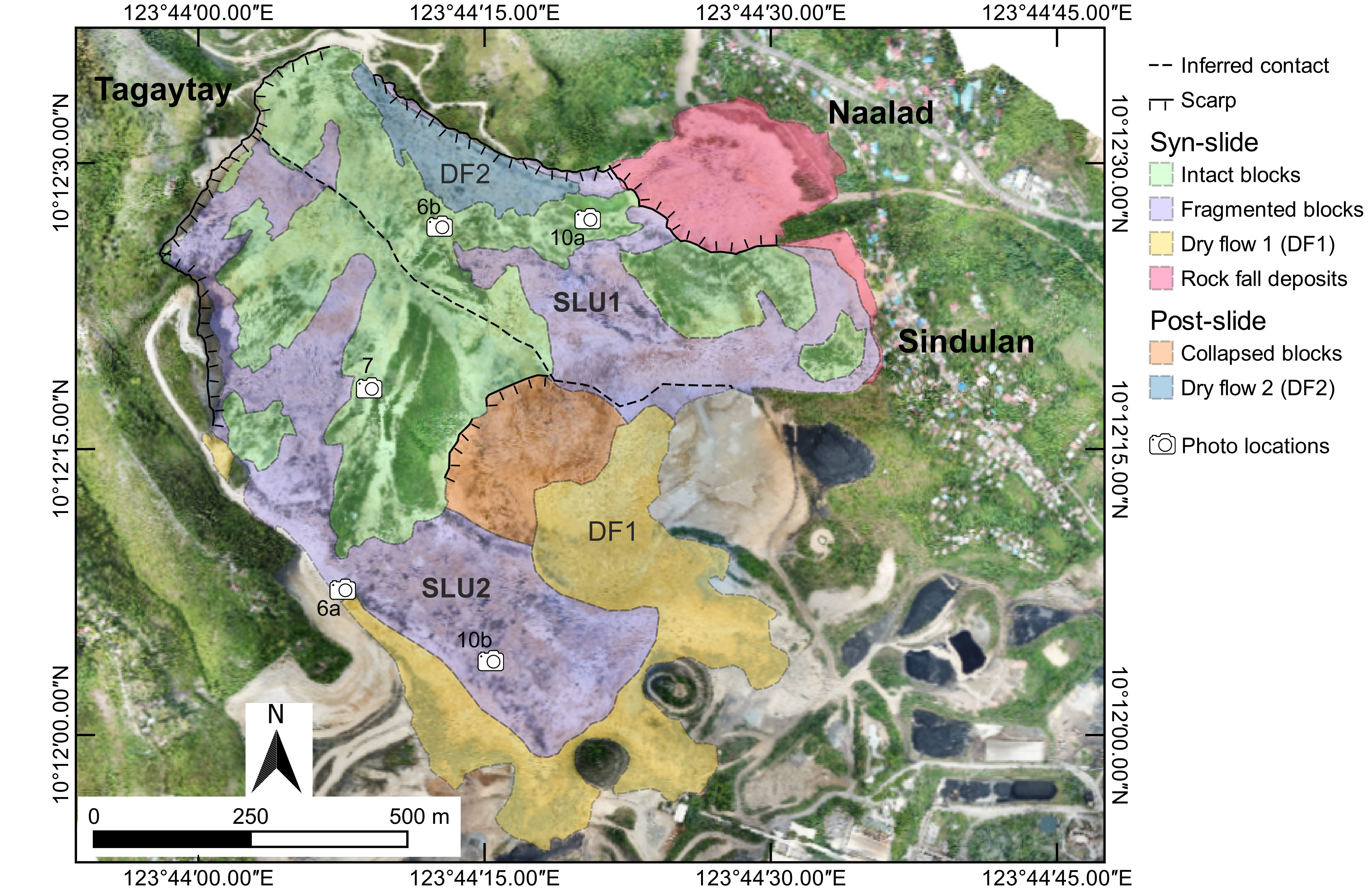 |
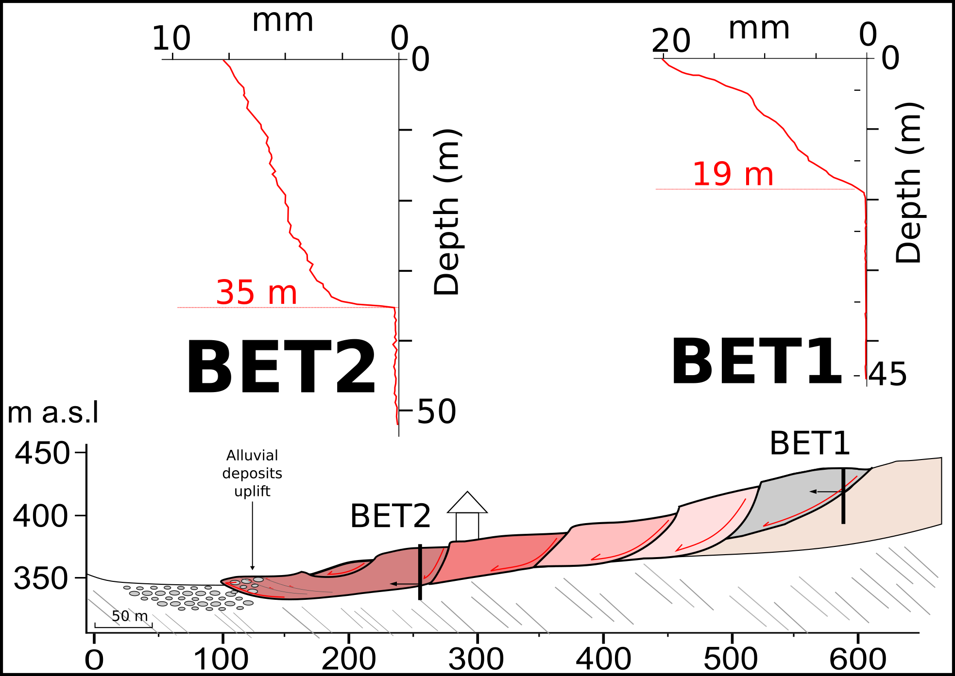
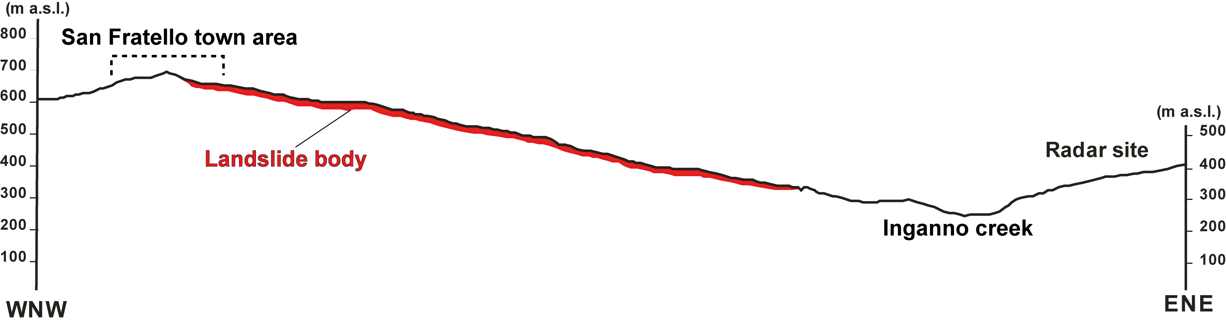
| Cross section of landslide | : 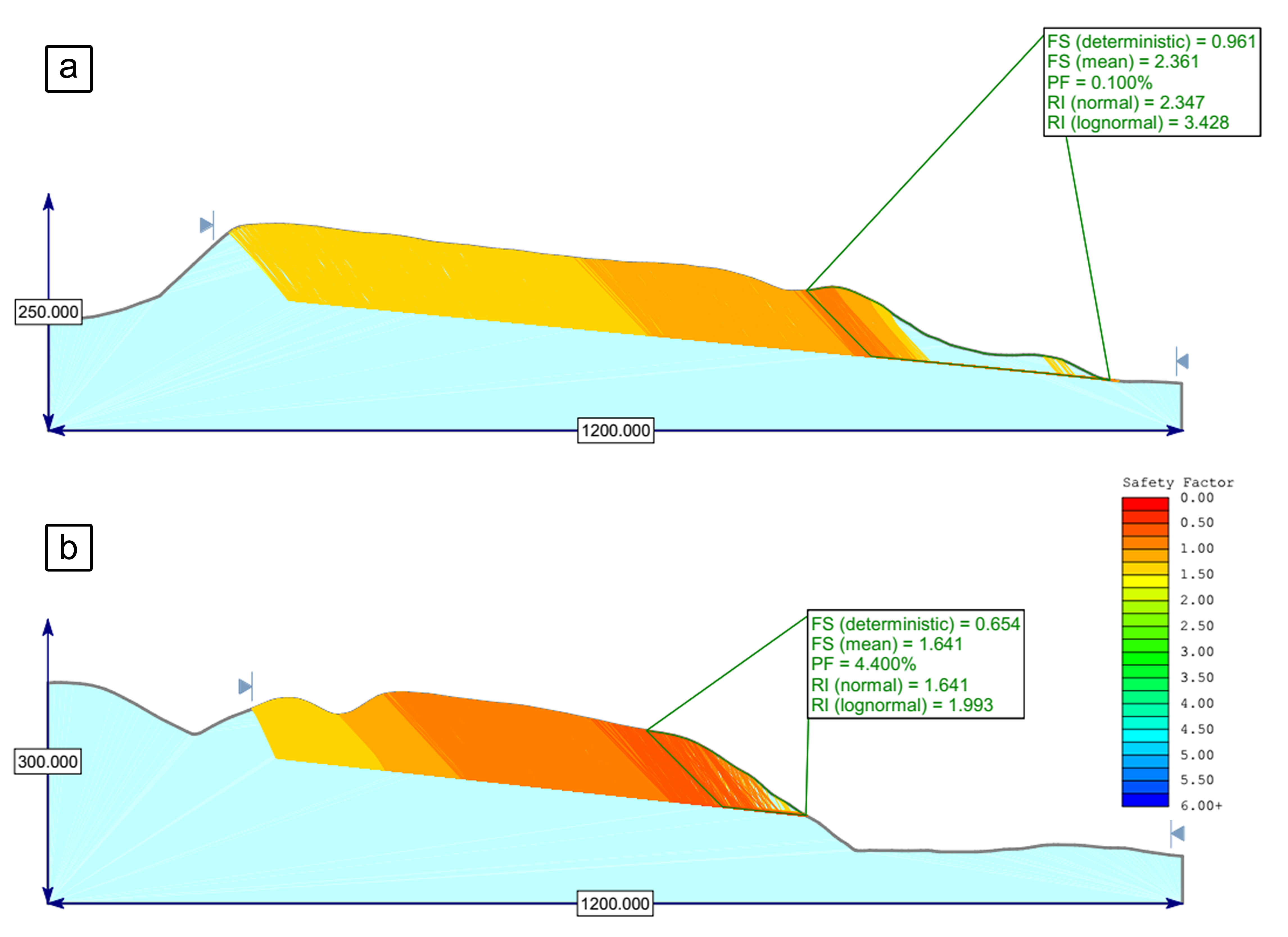 |
| Reference (paper/report) | : https://link.springer.com/article/10.1007/s10346-019-01212-9 |
| Testing graph | : - |
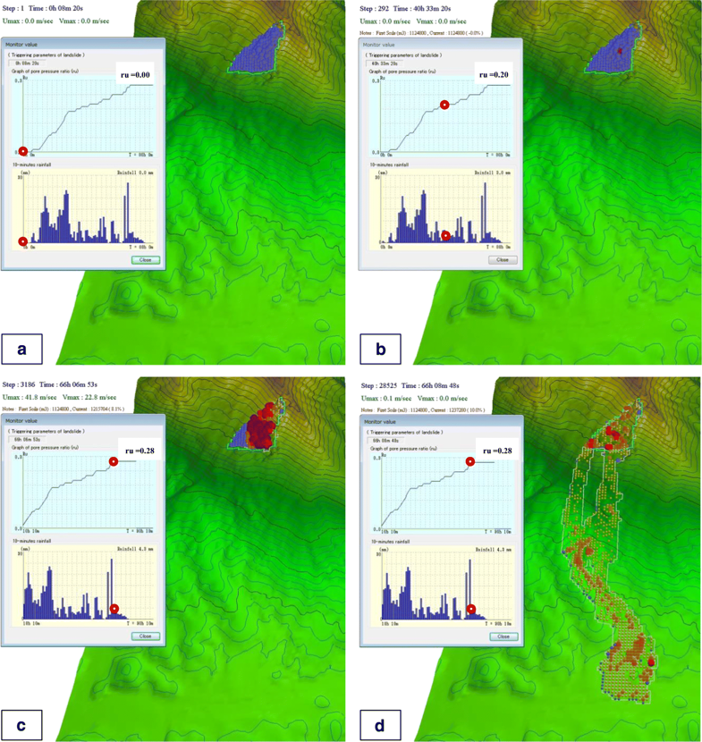
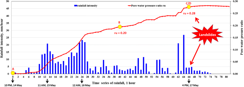
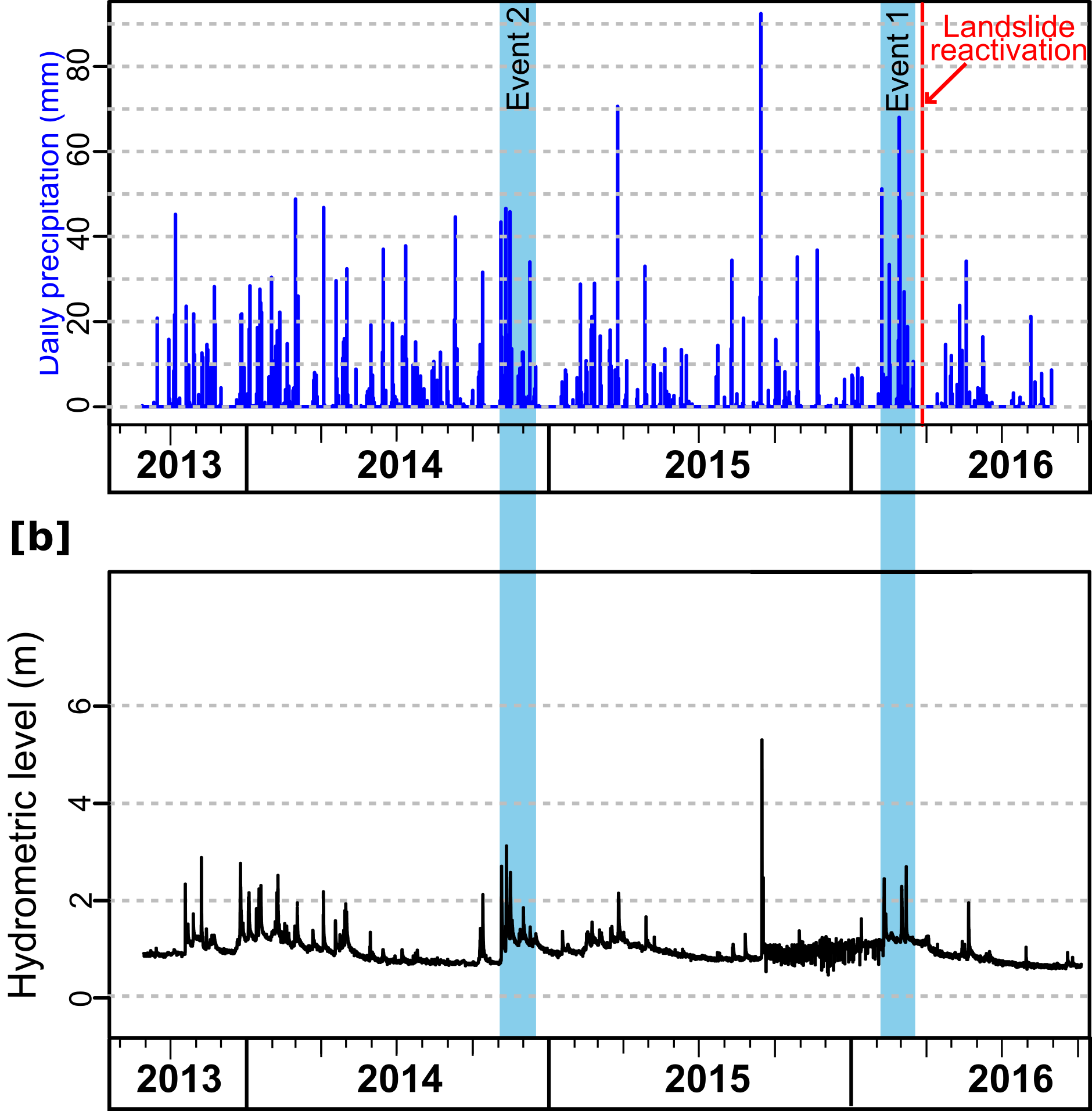
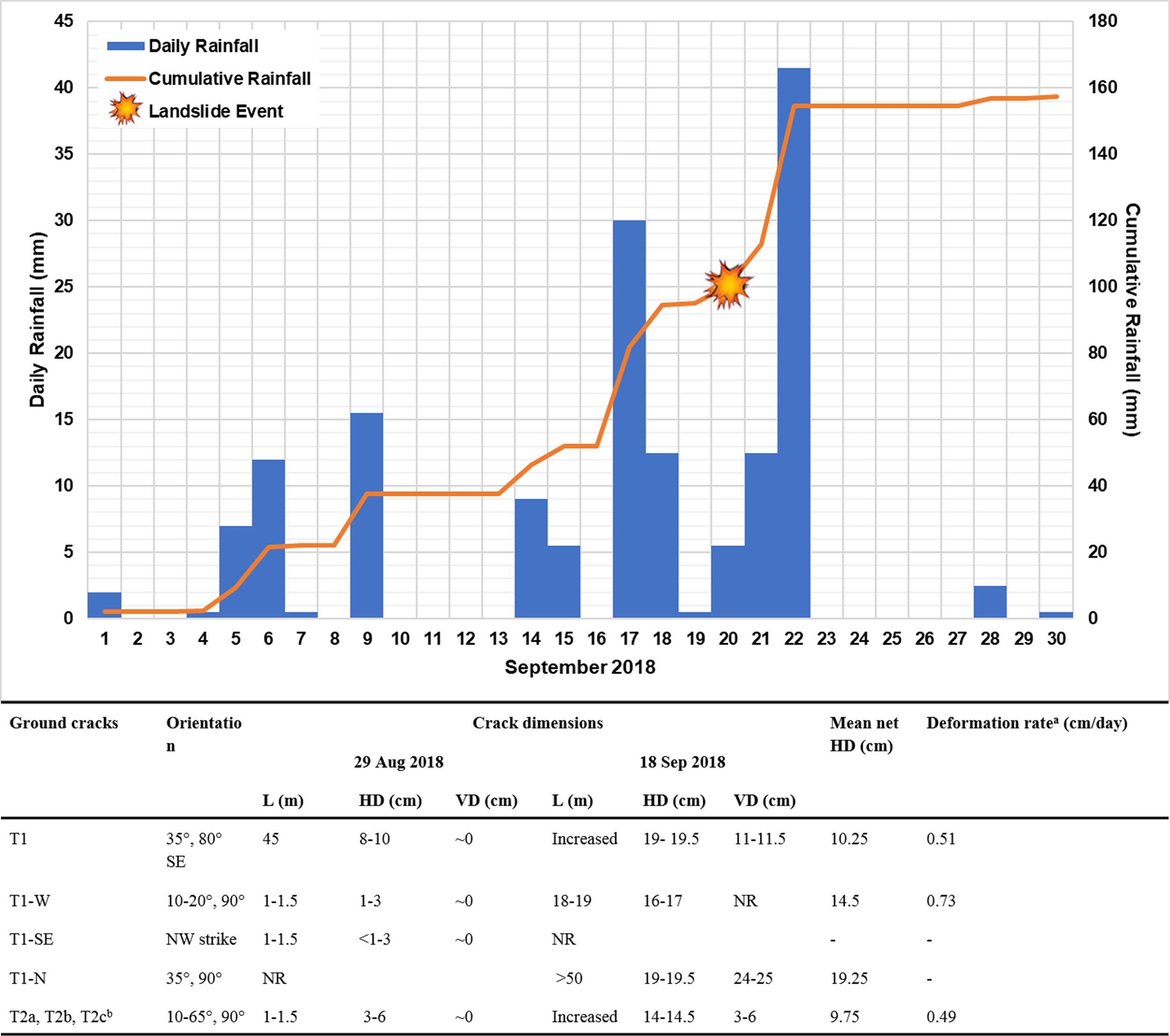
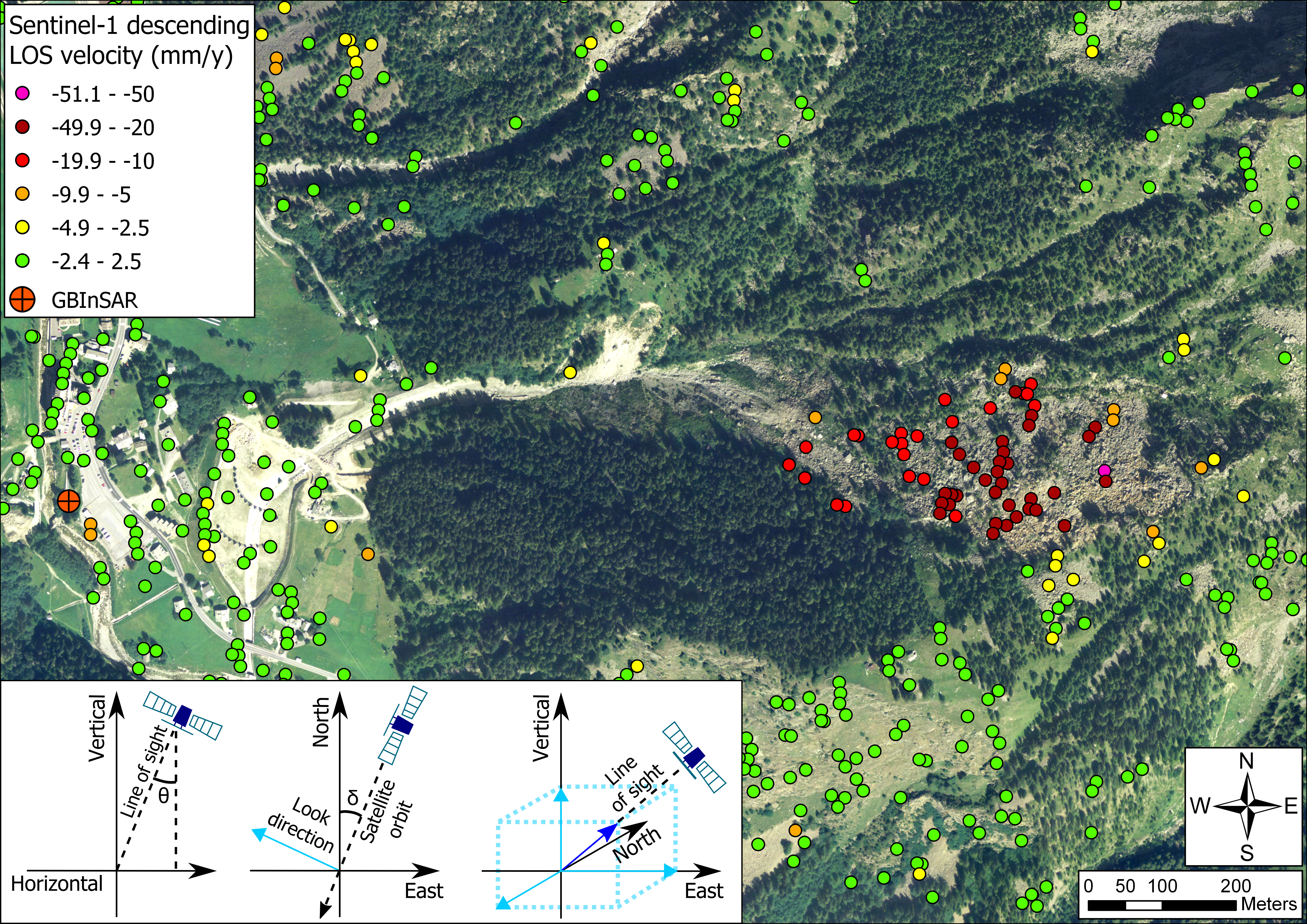
| Monitoring graph | : Naga Lsl Rainfall and Cracks.png |
| Video of moving landslides including 3D simulation | : https://youtu.be/hseA0jvrksQ |
| Description | : |
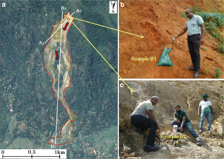
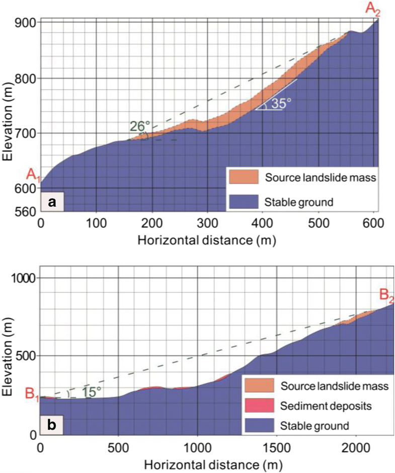
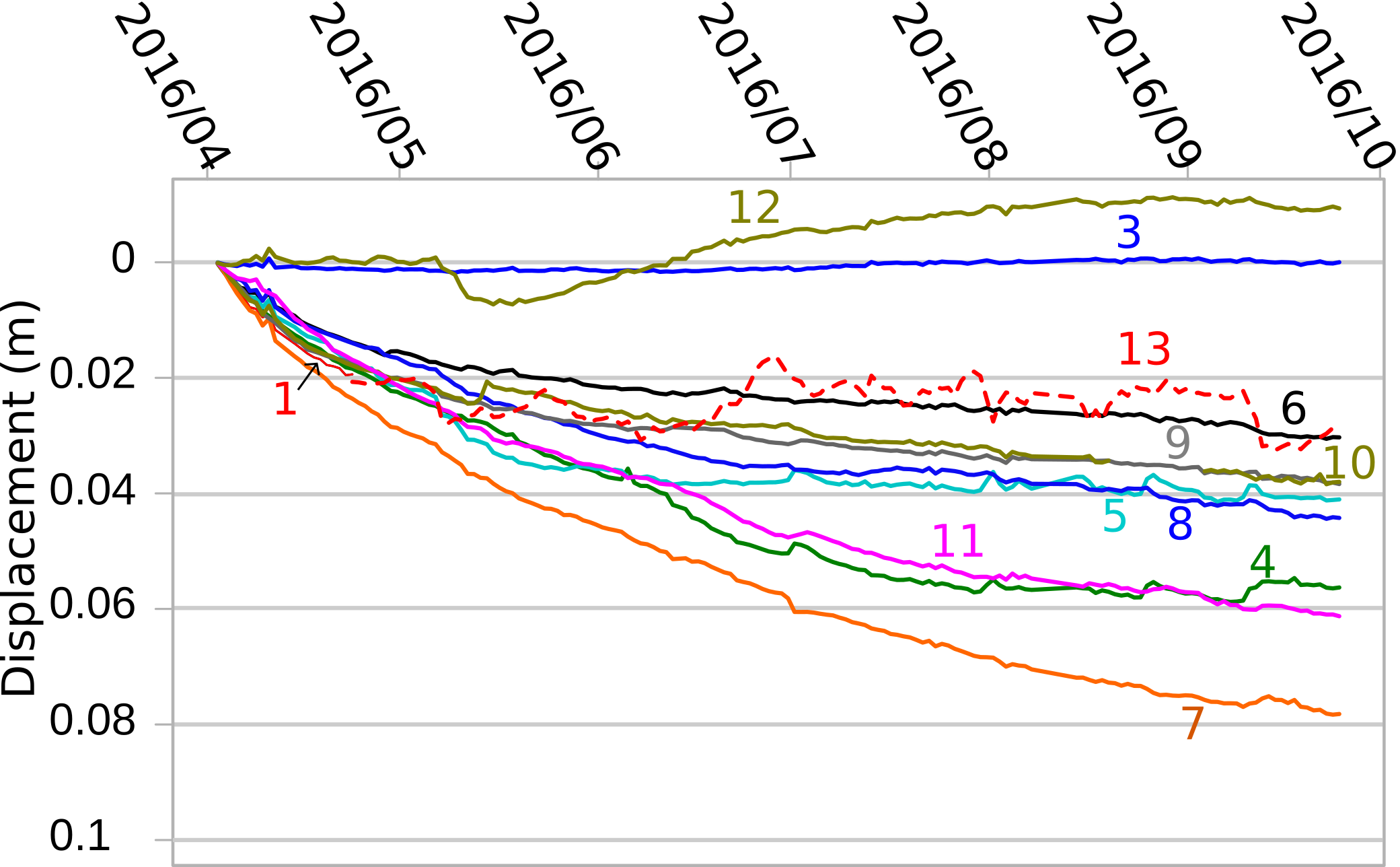
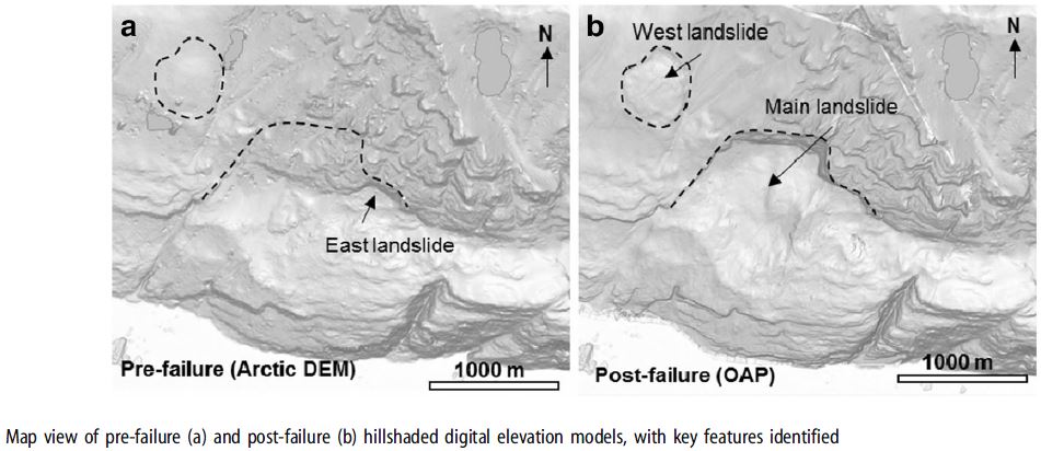
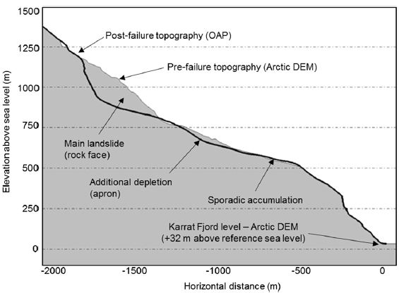
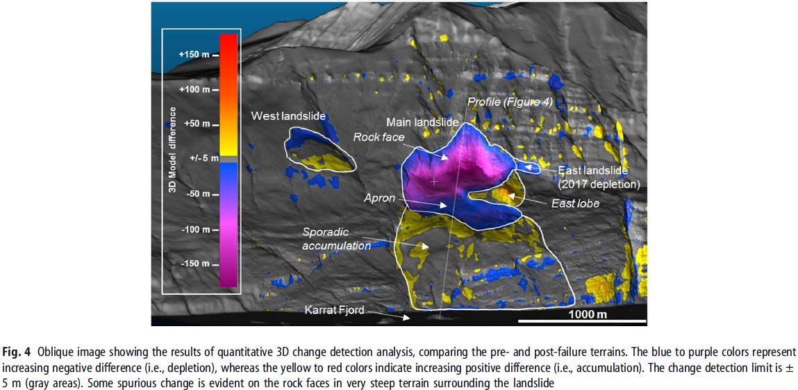
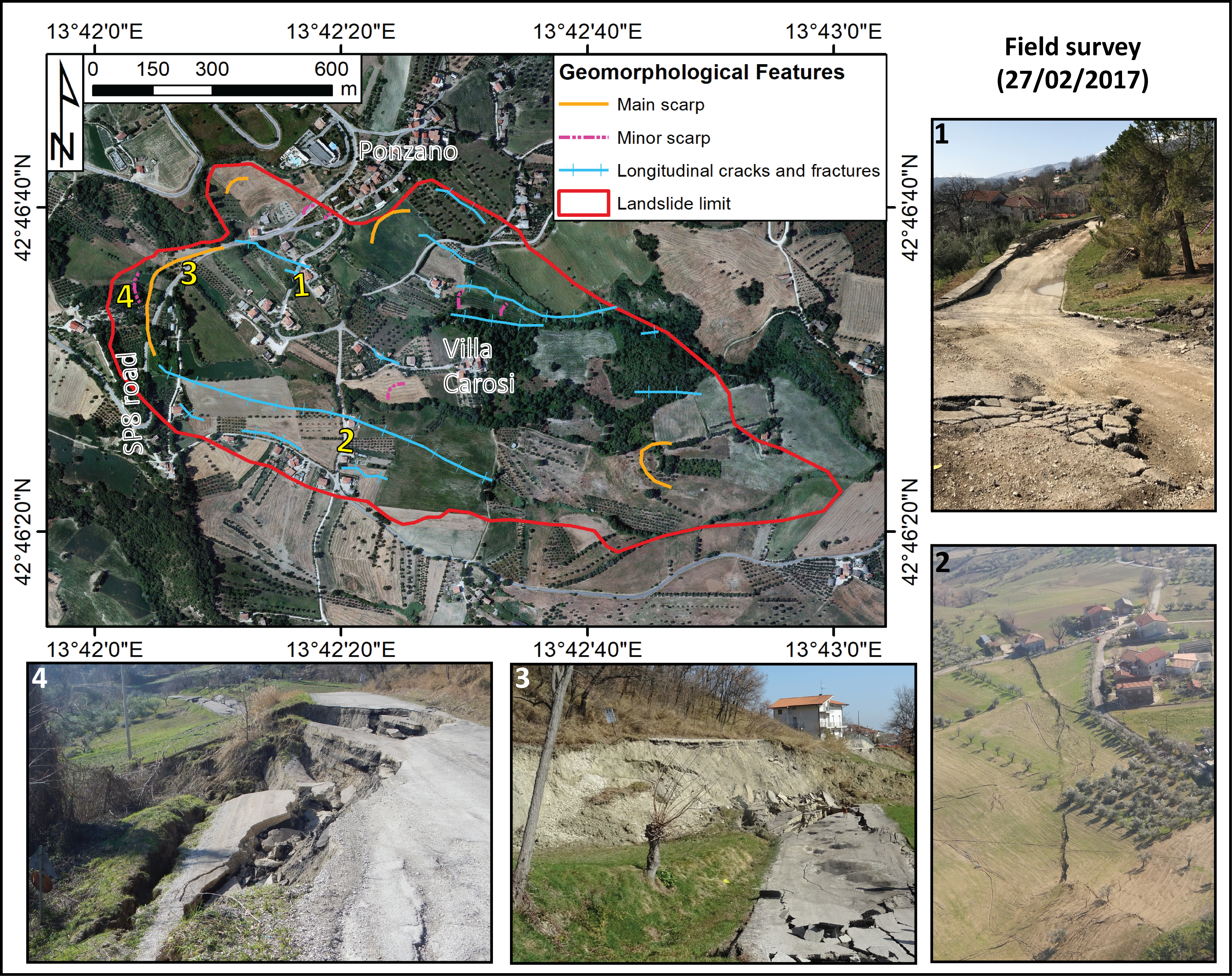
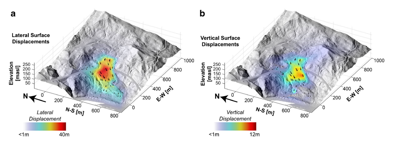
At 05:53 (UTC+08) on 20 September 2018, the extremely rapid Naga landslide devastated several villages of Naga City, Cebu Island, causing 134 casualties. The landslide destroyed 57 houses and led to the evacuation of 8252 people. Parts of the landslide dammed the nearby Pandan River, which was immediately excavated to prevent flooding of the city center downstream. Landslide deposits covered an area of about 9.46 × 10⁵ m2 with a maximum runout distance of 1.34 km, emplaced on built-up, industrial, and agricultural areas. The estimated total volume is at 27 million m3. The landslide slipped through a bedded limestone sequence of the Plio-Pleistocene Carcar Formation. A series of tension cracks at the source area were observed three (3) weeks before main failure, which probably indicated progressive deformation prior to failure. The event started as a translational slide which transformed in part to small grain flows and avalanches. Deposits exhibit a very irregular topography comprised of intact megablocks and smaller chaotic fragmented blocks that are spread across gently sloping terrain. The slope failure was possibly triggered by human activities that created steep slopes at the downslope portion of the failed mass. |
|


.png)