La Pergalla landslide
LCI : ITA1901211313| Main Information | |
| Landslide Name | : La Pergalla landslide |
| Latitude | : 44:45:59.09 N |
| Longitude | : 9:36:21.62 E |
| Location | |
| City / District | : Bettola |
| Province | : Piacenza |
| Country | : Italy |
| Reporter | |
| Reporter 1 | : Marco Mulas |
| Reporter 2 | : Alessandro Corsini |
| Landslide Type | |
| Material | : Earth |
| Movement | : Complex |
| Velocity (mm/sec) | : Moderate |
| Depth (m) | : Deep-Moderate |
| Slope (degree) | : Moderate |
| Volume (m³) | : Small |
| Date of Occurence | |
| Date of Occurence | : Mar 26, 2016 |
| Other Information | |
| Land Use |
Source area : Forest, Farming, Pasture, Human settlement, Road Run-out/deposition area : Forest, Farming, Pasture, Road, River |
| Other Activity | : Active in the past |
| Triggering Factor | : Rainfall |
| Death(s) & Missing | : - |
| Houses and other structural damage | : yes |
| Photo of landslide | : 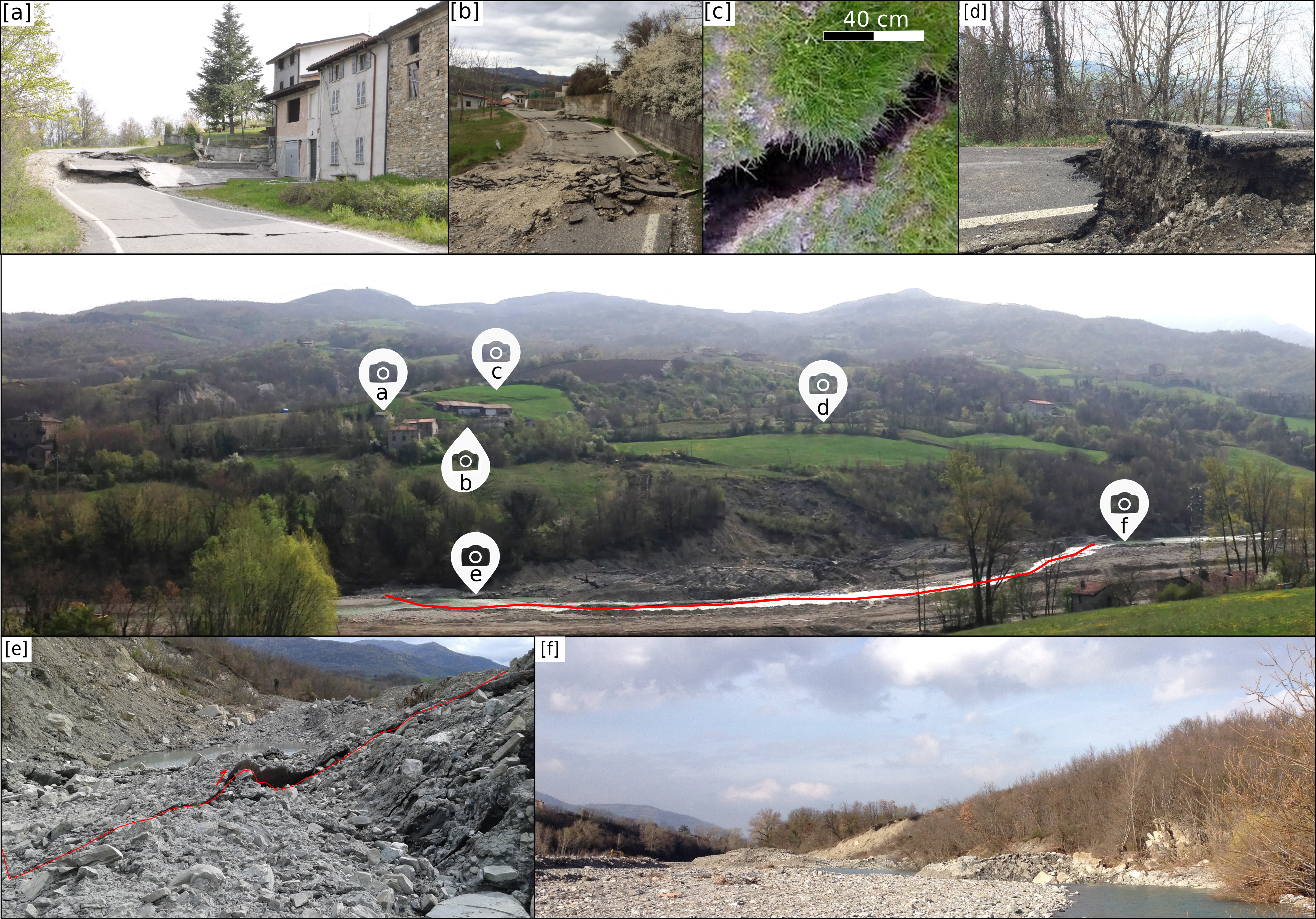 |
| Google earth kmz file | : Pergalla.kmz |
| Plan of landslide | : 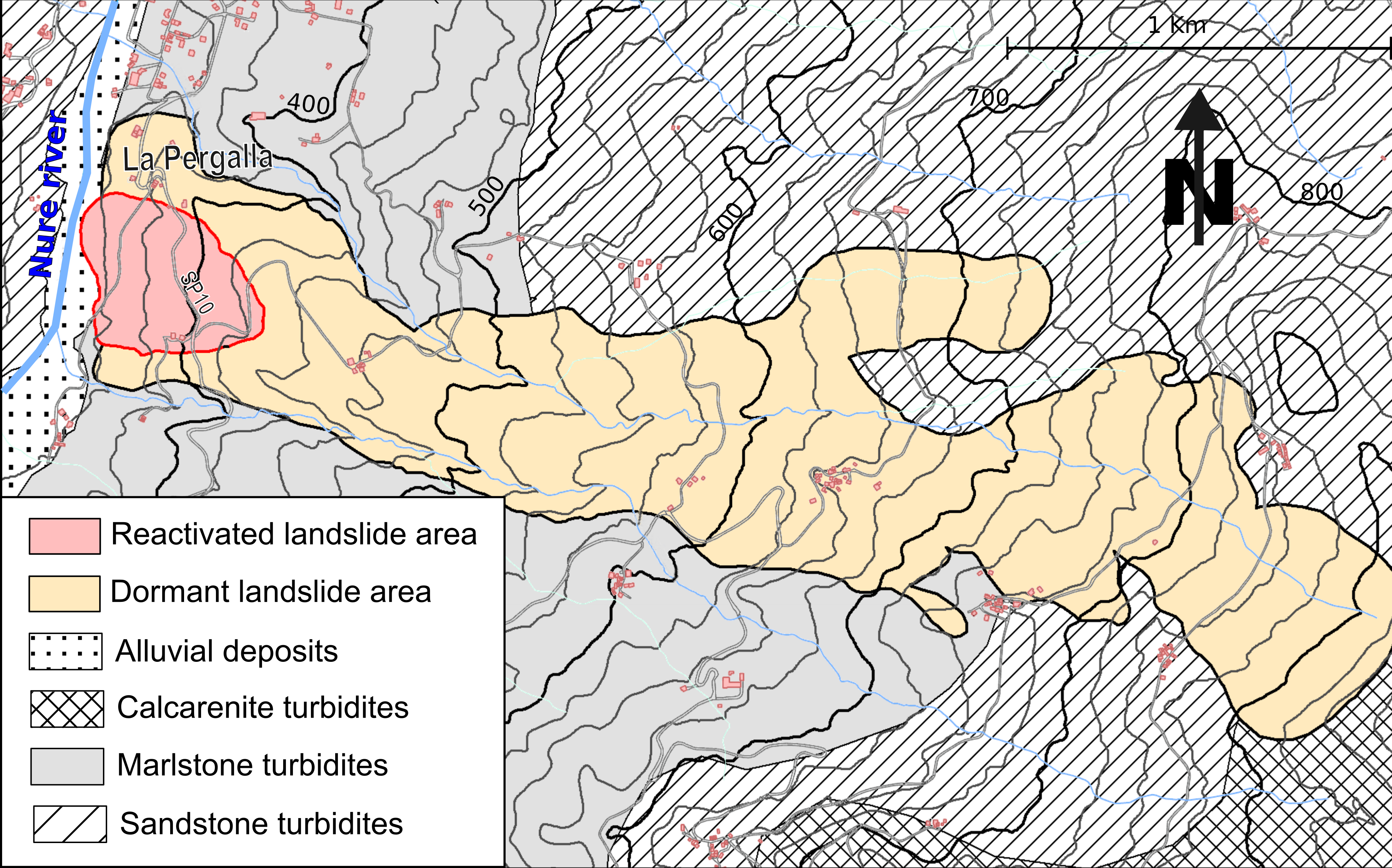 |
| Cross section of landslide | : 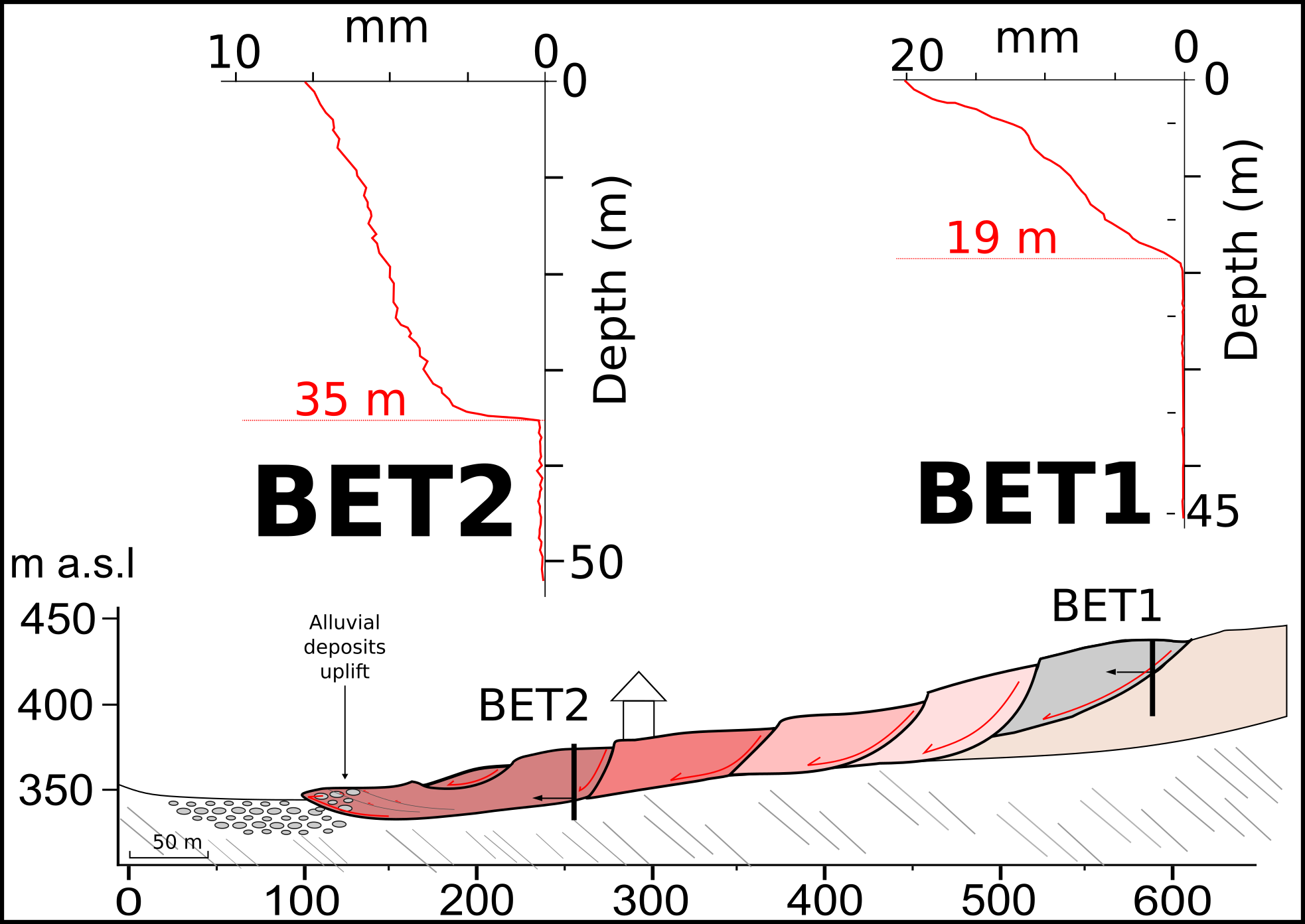 |
| Reference (paper/report) | : http://link.springer.com/10.1007/s10346-018-1039-4 |
| Testing graph | : 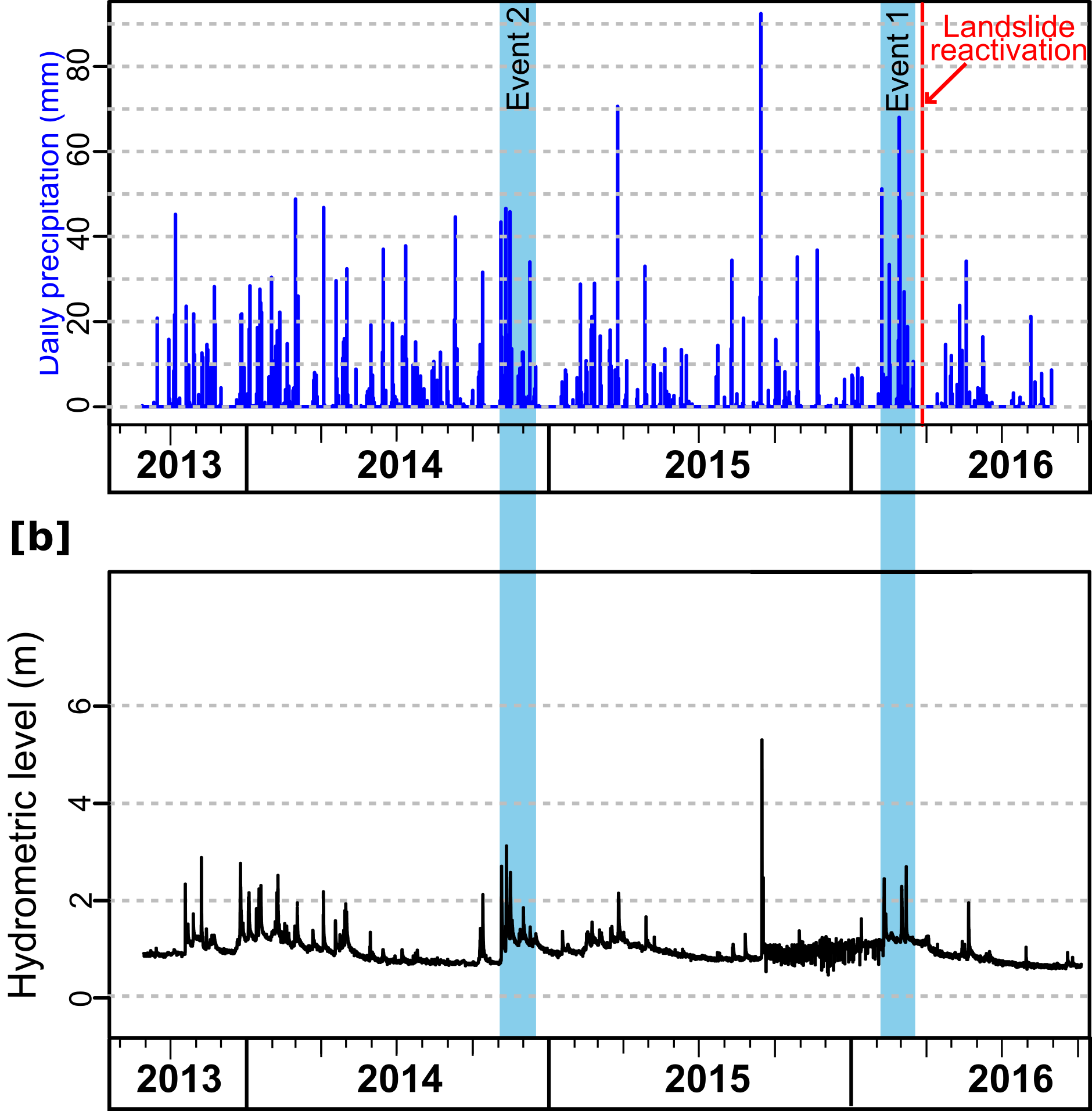 |
| Monitoring graph | : 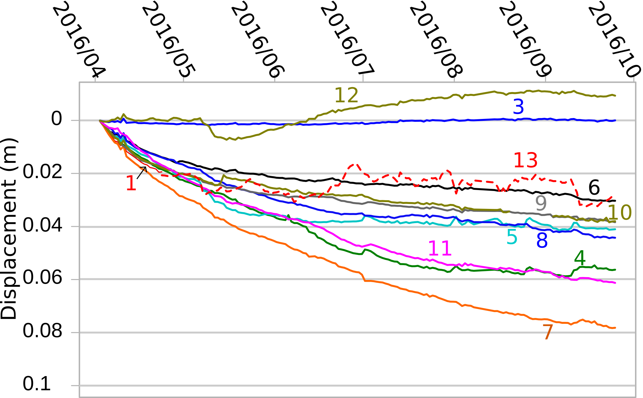 |
| Video of moving landslides including 3D simulation | : - |
| Description | : |
On March 28, 2016, the toe zone of the apparently dormant Pergalla earthslide-earthflow (Northern Apennines, Italy) had a paroxysmal reactivation. In the course of 2 days, displacements up to almost 8 m severely damaged several houses and roads. At the bottom of the slope, the emersion of rotational sliding surfaces determined the uplift of almost 3 m of the Nure river streambed that was consequently partially dammed. The landslide event was investigated by mean of field surveys and analysis of post-event aerial photos, as well as data from geophysical surveys and pre- to post-failure displacement monitoring. Antecedent rainfall, the migration of active streambed channels of Nure river toward the landslide toe in the previous year, and the existence of long-term pre-failure slow movements were identified as factors responsable for the landslide reactivation. It is concluded that these factors, together with the presence of sliding surfaces extending beneath the valley floor, should be primarily considered if a preventive assessment of river damming potential due to streambed uplift should be made for other similar landslides in the Apennines. |
|

