Karrat Fjord tsunamigenic landslide
LCI : GRL1810091655| Main Information | |
| Landslide Name | : Karrat Fjord tsunamigenic landslide |
| Latitude | : 71:38:33.51 N |
| Longitude | : 52:15:57.90 W |
| Location | |
| City / District | : Karrat Fjord |
| Province | : Nuugaatsiaq |
| Country | : Greenland |
| Reporter | |
| Reporter 1 | : Khang Dang |
| Reporter 2 | : Dave Gauthier |
| Landslide Type | |
| Material | : Rock |
| Movement | : Slide |
| Velocity (mm/sec) | : Extremely Rapid |
| Depth (m) | : Very Deep |
| Slope (degree) | : - |
| Volume (m³) | : Very Large |
| Date of Occurence | |
| Date of Occurence | : Jun 17, 2017 |
| Other Information | |
| Land Use |
Source area : Wildland Run-out/deposition area : Sea/lake |
| Other Activity | : Active in the past |
| Triggering Factor | : Unknown |
| Death(s) & Missing | : 4 |
| Houses and other structural damage | : - |
| Photo of landslide | : 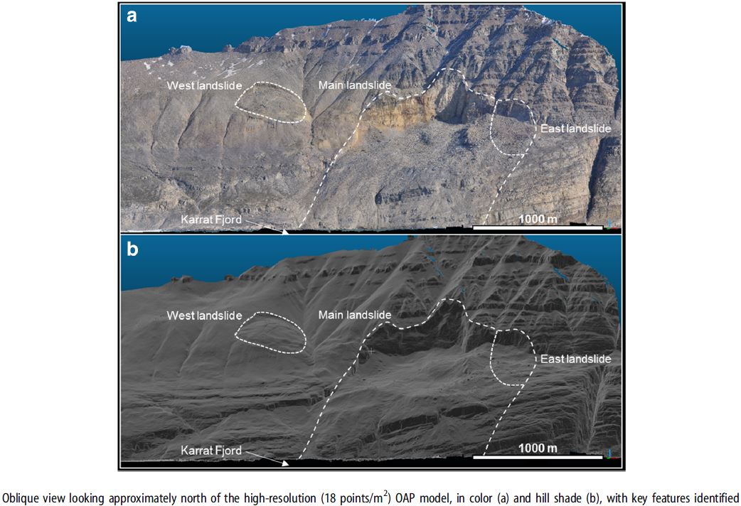 |
| Google earth kmz file | : Karrat Fjord tsunamigenic landslide.kmz |
| Plan of landslide | : 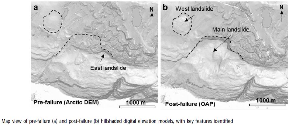 |
| Cross section of landslide | : 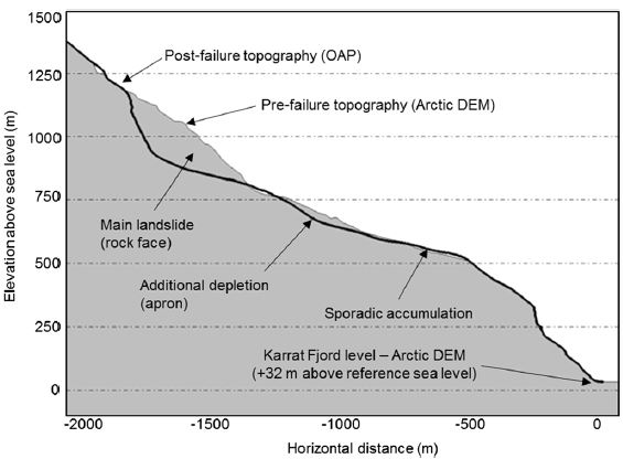 |
| Reference (paper/report) | : https://doi.org/10.1007/s10346-017-0926-4 |
| Testing graph | : 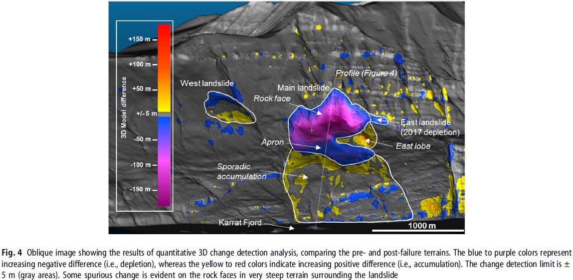 |
| Monitoring graph | : - |
| Video of moving landslides including 3D simulation | : - |
| Description | : |
On 17 June 2017, a landslide-generated tsunami reached the village of Nuugaatsiaq, Greenland, leaving four persons missing and presumed dead. Through a 3D quantitative comparison with pre-failure topography, it was estimated that approximately 58 million m3 of rock and colluvium (talus) was mobilized during the landslide, 45 million m3 of which reached the fjord, resulting in a destructive tsunami. This event was classified as a tsunamigenic extremely rapid rock avalanche which likely released along a pre-existing metamorphic fabric, bounded laterally by slope-scale faults. The Karrat Fjord landslide occurred on a steep, south-facing mountain slope with total vertical relief of greater than 2100 m from sea level to ridgetop, over a horizontal distance of approximately 3100 m. The source area of the landslide was approximately mid-slope, and the material involved both in situ bedrock and colluvium. The slope itself is not glaciated, although adjacent north-facing and sheltered slopes are. Permafrost conditions are unknown. Bedrock geology is high-grade Archean gneiss and overlying paleo-Proterozoic schist and quartzite of the Karrat Group (Mott et al. 2013; Grocott and McCaffrey 2017). These are recognized to have a strong planar metamorphic fabric, related to bedding in the protolithic sedimentary rocks (Mott et al. 2013; Grocott and McCaffrey 2017), and local and regional thrust and extensional faulting are common throughout the area. References: Gauthier, D., Anderson, S.A., Fritz, H.M. et al. Landslides (2018) 15: 327. https://doi.org/10.1007/s10346-017-0926-4 |
|

