K178 + 530 section landslide of Bei’an – Heihe Highway
LCI : CHN1612060810| Main Information | |
| Landslide Name | : K178 + 530 section landslide of Bei’an – Heihe Highway |
| Latitude | : 49:39:23 N |
| Longitude | : 127:21:57 E |
| Location | |
| City / District | : Sunwu |
| Province | : Heilongjiang |
| Country | : China |
| Reporter | |
| Reporter 1 | : Wei Shan |
| Reporter 2 | : |
| Landslide Type | |
| Material | : Earth |
| Movement | : Slide, Flow |
| Velocity (mm/sec) | : Extremely Slow |
| Depth (m) | : Shallow |
| Slope (degree) | : - |
| Volume (m³) | : Moderate-Small |
| Date of Occurence | |
| Date of Occurence | : Dec 06, 2003 |
| Other Information | |
| Land Use |
Source area : Wildland, Road Run-out/deposition area : Forest, Wildland |
| Other Activity | : Currently active |
| Triggering Factor | : Others |
| Death(s) & Missing | : - |
| Houses and other structural damage | : road bed |
| Photo of landslide | : 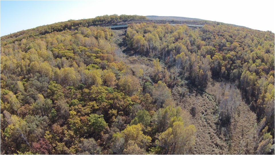 |
| Google earth kmz file | : Fig 5.jpg |
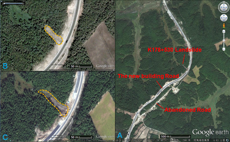
| Plan of landslide | : 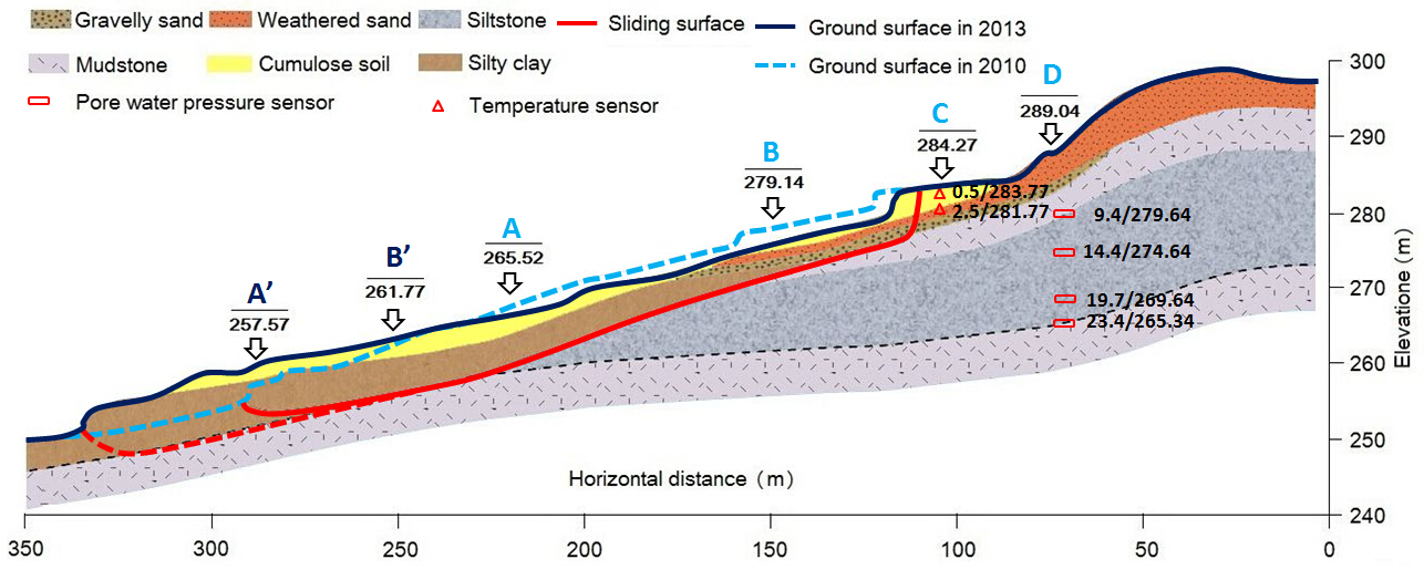 |
| Cross section of landslide | : 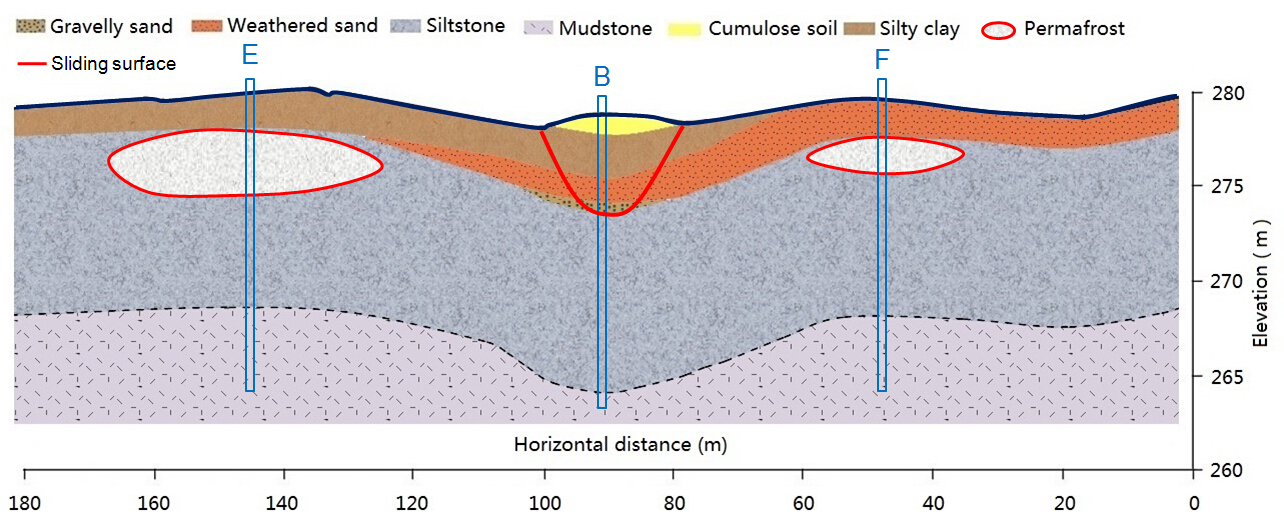 |
| Reference (paper/report) | : http://journal.frontiersin.org/article/10.3389/feart.2015.00007/full |
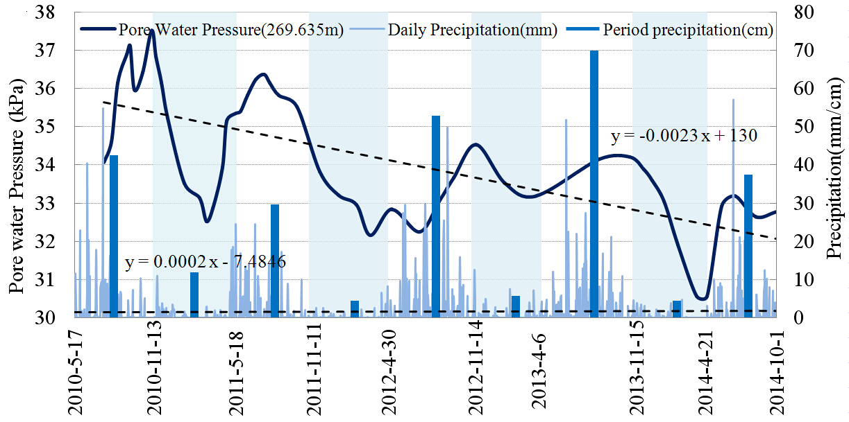
| Testing graph | : Fig.12.jpg |
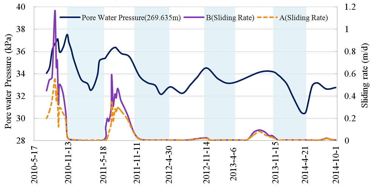
| Monitoring graph | : Fig.13.jpg |
| Video of moving landslides including 3D simulation | : - |
| Description | : |
Climate warming leads to permafrost degradation and permafrost melting phase transition, resulting in an increasing number of landslides. This study uses the road segments and road area at the intersection between Bei’an-Heihe Highway and the northwest section of the Lesser Khingan Range in north China as the study area. By means of geological survey combined with meteorological data, we analyzed the impact of climate change on landslide movement in the permafrost zone. Over a 60 year period, the average annual temperature of the study area has increased by 3.2 ◦ C, and permafrost degradation is severe. Loose soil on the hillside surface provides appropriate conditions for the infiltration of atmospheric precipitation and snowmelt, and seepage from thawing permafrost. As it infiltrates downwards, water is blocked by the underlying permafrost or dense soil, and infiltrates along this barrier layer toward lower positions, forming a potential sliding zone. The representative Landslide in the study area was examined in detail. Displacement monitoring points were set up on the surface of the landslide mass, and at the trailing edge of the landslide mass. The data collected were used to investigate the relationship between landslide movement and pore water pressure at the tailing edge as well as the ground temperature. The results show that the landslide movement process changes with the season, showing a notable annual cyclical characteristic and seasonal activity. Landslide movement is characterized by low angles and intermittence. The time of slide occurrence and the slip rate show a corresponding relationship with the pore water pressure at the tailing edge of the landslide mass. The seepage of water from thawing into the landslide mass will influence the pore water pressure at the tailing edge of the landslide mass, and is the main cause of landslide movement. |
|

