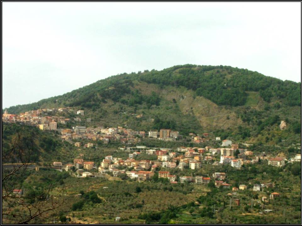
GIMIGLIANO LANDSLIDE
LCI : ITA1801111055| Main Information | |
| Landslide Name | : GIMIGLIANO LANDSLIDE |
| Latitude | : 38:58:23.69 N |
| Longitude | : 16:31:47.76 E |
| Location | |
| City / District | : GIMIGLIANO |
| Province | : CATANZARO |
| Country | : Italy |
| Reporter | |
| Reporter 1 | : GIOVANNA CAPPARELLI |
| Reporter 2 | : PASQUALE VERSACE |
| Landslide Type | |
| Material | : Complex |
| Movement | : Complex |
| Velocity (mm/sec) | : Slow |
| Depth (m) | : Deep-Moderate |
| Slope (degree) | : Gentle |
| Volume (m³) | : Very Large |
| Date of Occurence | |
| Date of Occurence | : Jan 12, 2018 |
| Other Information | |
| Land Use |
Source area : Forest, Farming, Road Run-out/deposition area : Forest, Farming, Urban area, Road |
| Other Activity | : Active in the past |
| Triggering Factor | : Rainfall |
| Death(s) & Missing | : NO |
| Houses and other structural damage | : YES |
| Photo of landslide | :  |
| Google earth kmz file | : FraneGimigliano.kmz |
| Plan of landslide | : |
| Cross section of landslide | : |
| Reference (paper/report) | : https://www.researchgate.net/publication/308792641_Esperienze_di_monitoraggio_topografico_di_grandi_frane_i_casi_di_Gimigliano_e_Maierato |
| Testing graph | : - |
| Monitoring graph | : - |
| Video of moving landslides including 3D simulation | : - |
| Description | : |
The area affected by instability is located in Gimigliano, in the “Sila Piccola’s” southern sector, located to 8,5 km from Catanzaro town, Calabria, Italy. The area’s geomorphological context is strongly influenced by the geological structure. Therefore, in the analysis is appropriate to consider the topographic, geologic-structural and hydrogeological influence due to the presence of fractured rocks and the underground water circulation. The stratigraphic reconstruction is very complex, regarding these units as have undergone multiple deformation phases. The presence of fault systems generates many areas covered by strongly fractured and altered rocks that often are the expression of real shear zone. Surveys and superficial and deep (inclinometers) monitoring data gave information on the deformation evolution. The phenomena occurred are characterized not only by different types of mechanisms but also by different states, distributions and activity styles (WP / WLI, 1995), as a consequence of an extremely complex geological context. In the area considered there are three main landslides, on which innumerable superficial phenomena develop. One of these is located at north-west of Gimigliano Superiore, one at South and other at East of the town (characterized by major cracks and fissures). Some of these landslides show translational sliding mechanisms and in some situations a rotational component. The multiplicity of landslides classifies the instability as a complex mechanism. Moreover, the results define the landslide of Gimigliano as a deep landslide with a well identified sliding surface around the depth of 50 meters in the central area of the landslide body. The landslide is active and the movements have a moderated speed, therefore the phenomenon is classified as a slow mechanism. Due to the presence of an active landslide body, of considerable size, joined with various degradation phenomena of the slope, this area is considered with a very high landslide risk. |
|


