Gallivaggio landslide
LCI : ITA2006221015| Main Information | |
| Landslide Name | : Gallivaggio landslide |
| Latitude | : 46:21:46.40 N |
| Longitude | : 9:22:7.75 E |
| Location | |
| City / District | : San Giacomo Filippo |
| Province | : Sondrio |
| Country | : Italy |
| Reporter | |
| Reporter 1 | : Tommaso Carlà |
| Reporter 2 | : Veronica Tofani |
| Landslide Type | |
| Material | : Rock |
| Movement | : Fall |
| Velocity (mm/sec) | : Extremely Rapid |
| Depth (m) | : Moderate-Shallow |
| Slope (degree) | : - |
| Volume (m³) | : Small |
| Date of Occurence | |
| Date of Occurence | : May 29, 2018 |
| Other Information | |
| Land Use |
Source area : Wildland Run-out/deposition area : Road, Cultural heritage site |
| Other Activity | : Active in the past |
| Triggering Factor | : Others |
| Death(s) & Missing | : None |
| Houses and other structural damage | : Serious damages to several buildings and a road |
| Photo of landslide | : 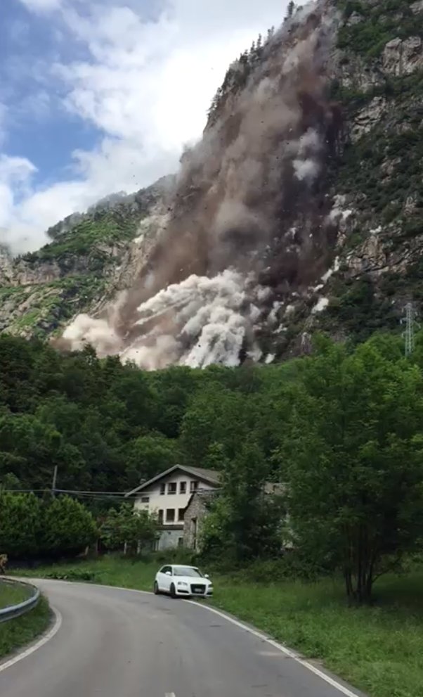 |
| Google earth kmz file | : Runout area.kmz |
| Plan of landslide | : 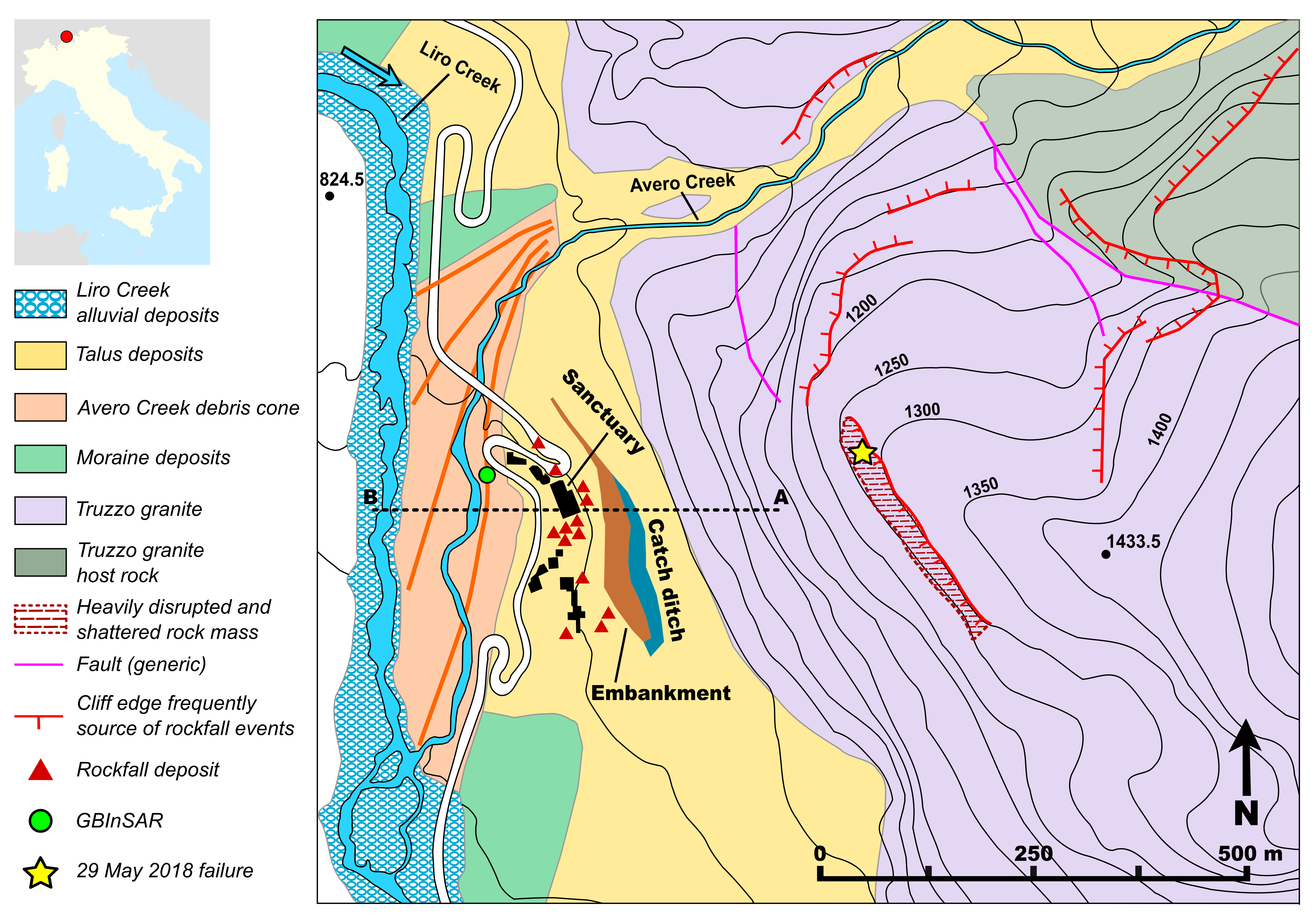 |
| Cross section of landslide | : 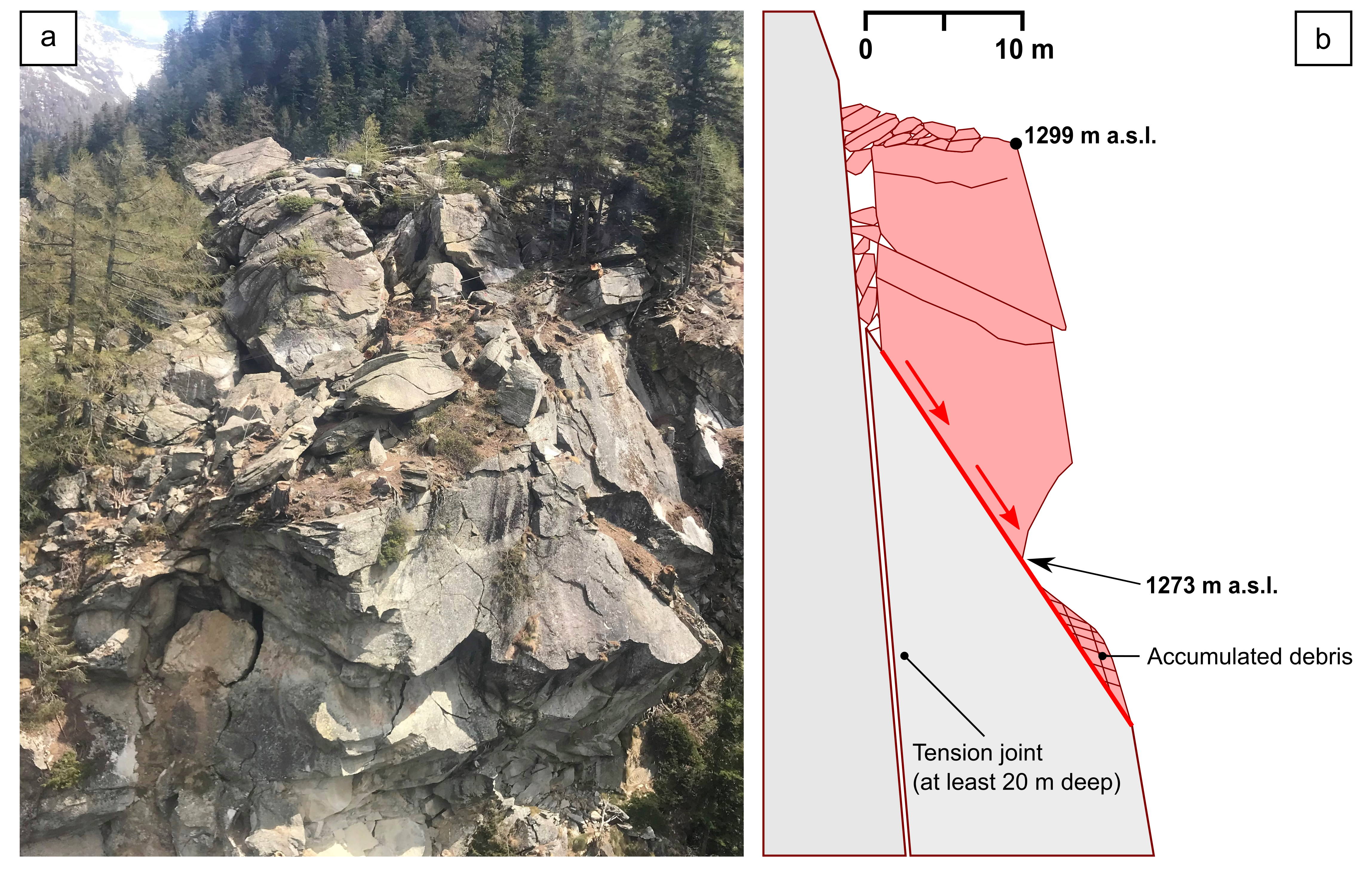 |
| Reference (paper/report) | : https://link.springer.com/article/10.1007/s10346-019-01190-y |
| Testing graph | : - |
| Monitoring graph | : Spostamento (b).png |
| Video of moving landslides including 3D simulation | : https://www.youtube.com/watch?v=orn-nhHDIkI |
| Description | : |
The failure originated at the top of the rock wall looming over the Gallivaggio sanctuary. Before the event, the instability appeared as a markedly disintegrated rock mass with very weak internal structure, lacking base support, and jutting out of the slope. Such an indentation could have derived from the previous detachment of other blocks, which left the overlying mass in precarious equilibrium. The size was 20–25 m in height, 21 m in width, and 8–11 m in thickness, yielding an estimated volume of ~ 5000 m^3. The geometry of the failure block was defined by a compound sliding plane. In particular, the main morphological features included the following: – a sub-vertical joint as rear release surface, penetrating at least 20 m into the slope and opening up to as much as 2 m in width; – a steeply dipping (55–60°) joint acting as basal release surface, over which the sliding movement predominantly occurred; – at the top of the mass, a chaotic pile of blocks and crushed debris indicating significant lowering of the ground surface. After final detachment and collapse, the falling mass crumbled in a myriad of smaller blocks and fragments, forming a huge cloud of dust and debris which ran over the valley floor. |
|


.png)