Atami Debris Flow
LCI : JPN2407051420| Main Information | |
| Landslide Name | : Atami Debris Flow |
| Latitude | : 35:7:19.03 N |
| Longitude | : 139:4:18.65 E |
| Location | |
| City / District | : Atami |
| Province | : Shizuoka |
| Country | : Japan |
| Reporter | |
| Reporter 1 | : Doan Loi |
| Reporter 2 | : |
| Landslide Type | |
| Material | : Debris |
| Movement | : Slide |
| Velocity (mm/sec) | : Extremely Rapid |
| Depth (m) | : Moderate-Shallow |
| Slope (degree) | : Steep |
| Volume (m³) | : Moderate-Small |
| Date of Occurence | |
| Date of Occurence | : Jul 03, 2021 |
| Other Information | |
| Land Use |
Source area : Urban area Run-out/deposition area : Urban area |
| Other Activity | : - |
| Triggering Factor | : Rainfall |
| Death(s) & Missing | : 28 |
| Houses and other structural damage | : 54 |
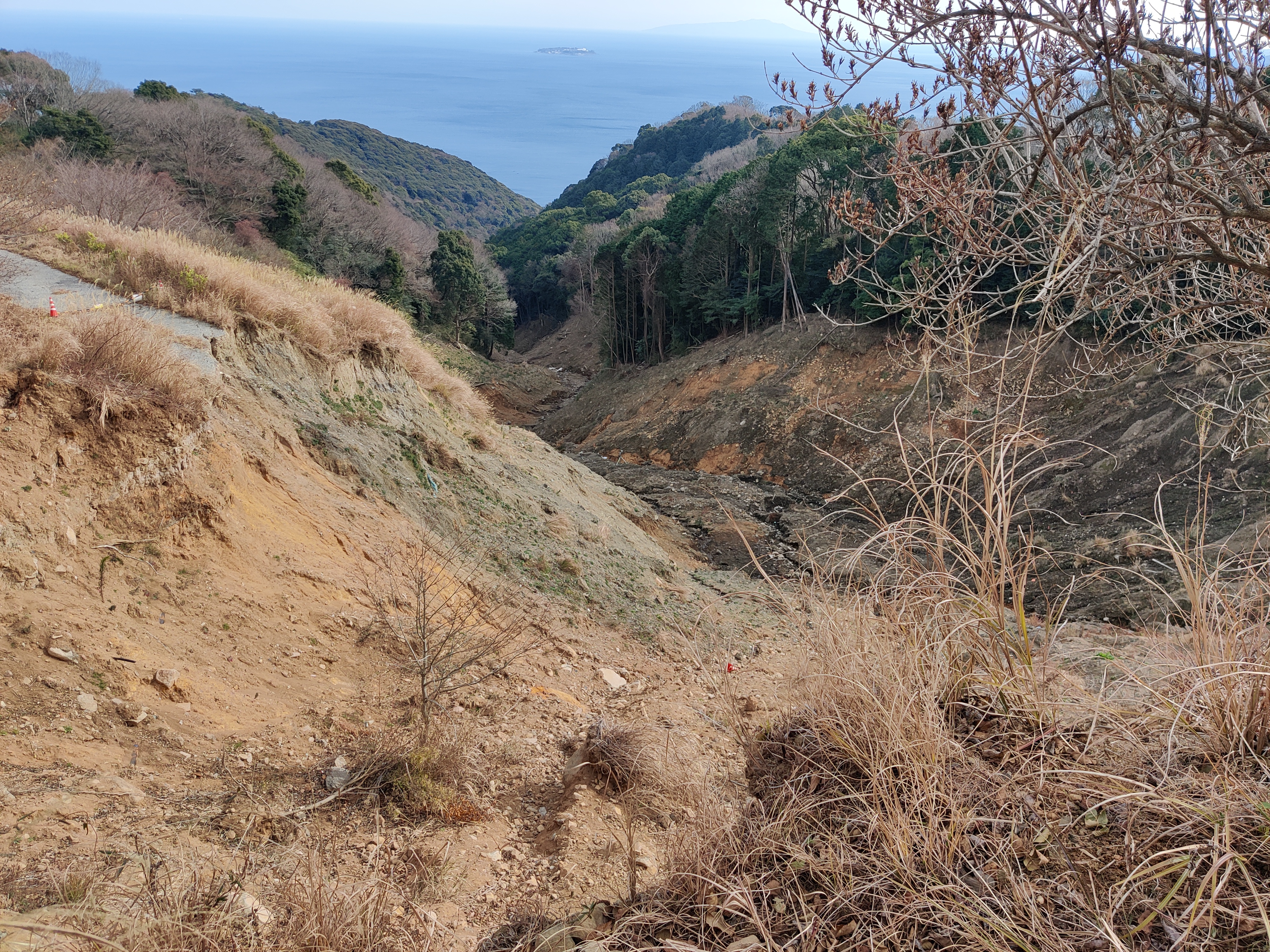
| Photo of landslide | :  |
| Google earth kmz file | : 2021 Atami debris flow.kmz |
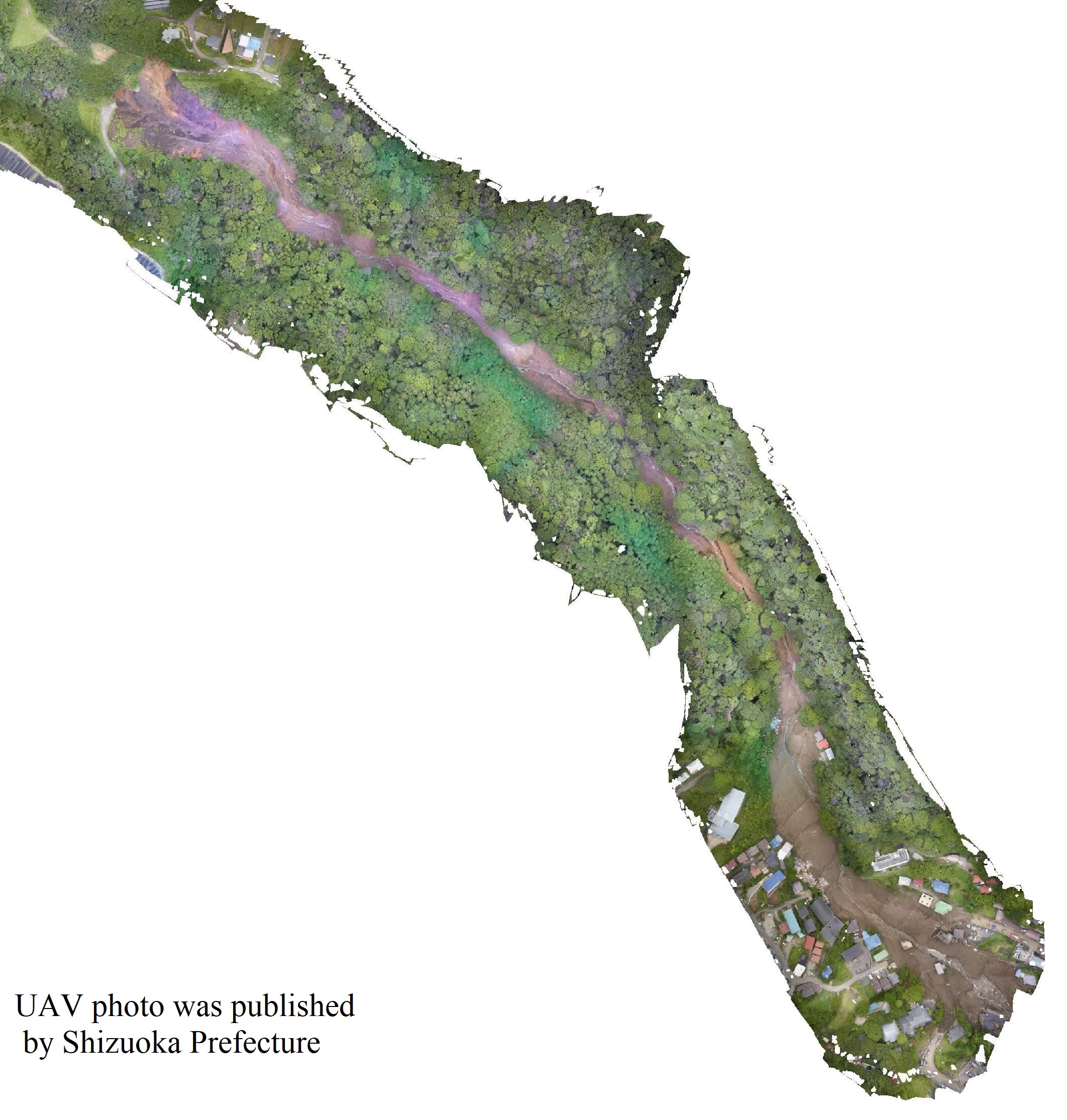
| Plan of landslide | :  |
| Cross section of landslide | : - |
| Reference (paper/report) | : https://link.springer.com/chapter/10.1007/978-3-031-16898-7_26 |
| Testing graph | : - |
| Monitoring graph | : - |
| Video of moving landslides including 3D simulation | : - |
| Description | : |
From 1 to 3 July 2021, extreme rainfall occurred in the Atami District, Shizuoka Prefecture, Japan causing a catastrophic debris flow on 3 July 2021. The Atami debris flow claimed 27 lives with one missing, three injuries and destroyed 54 houses, as of 10 February 2022 (Shizuoka Prefecture 2022). On 17 January 2022, International Consortium on Landslides (ICL) researchers investigated the landslide area. A sample was taken from immediately behind the exposed scar and sent to the Kyoto ICL-SATREPS office for ring shear tests. The underlying geology of the source area is andesite to basaltic andesite lava and pyroclastic deposits, which are products of Hakone Volcano. The ring shear test and computer simulation were conducted and published in the ICL open access book. Source LS-RAPID Manual with Video Tutorials Beena Ajmera, Hossein Emami Ahari, Doan Huy Loi, Hendy Setiawan, Khang Dang & Kyoji Sassa https://link.springer.com/chapter/10.1007/978-3-031-16898-7_26 |
|


