2012 Haida Gwaii landslides
LCI : CAN1911261446| Main Information | |
| Landslide Name | : 2012 Haida Gwaii landslides |
| Latitude | : 52:34:56.03 N |
| Longitude | : 131:47:36.67 W |
| Location | |
| City / District | : Haida Gwaii |
| Province | : British Columbia |
| Country | : Canada |
| Reporter | |
| Reporter 1 | : Khang Dang |
| Reporter 2 | : Marten Geertsema |
| Landslide Type | |
| Material | : Debris |
| Movement | : Slide, Flow |
| Velocity (mm/sec) | : Unknown |
| Depth (m) | : Unknown |
| Slope (degree) | : Unknown |
| Volume (m³) | : Unknown |
| Date of Occurence | |
| Date of Occurence | : Oct 27, 2012 |
| Other Information | |
| Land Use |
Source area : Forest, Wildland Run-out/deposition area : Forest, Wildland, Sea/lake |
| Other Activity | : Active in the past |
| Triggering Factor | : Earthquake |
| Death(s) & Missing | : - |
| Houses and other structural damage | : - |
| Photo of landslide | :  |
| Google earth kmz file | : 2012 Haida Gwaii landslides.kmz |
| Plan of landslide | :  |
| Cross section of landslide | : - |
| Reference (paper/report) | : https://link.springer.com/article/10.1007/s10346-019-01292-7 |
| Testing graph | : - |
| Monitoring graph | : - |
| Video of moving landslides including 3D simulation | : - |
| Description | : |
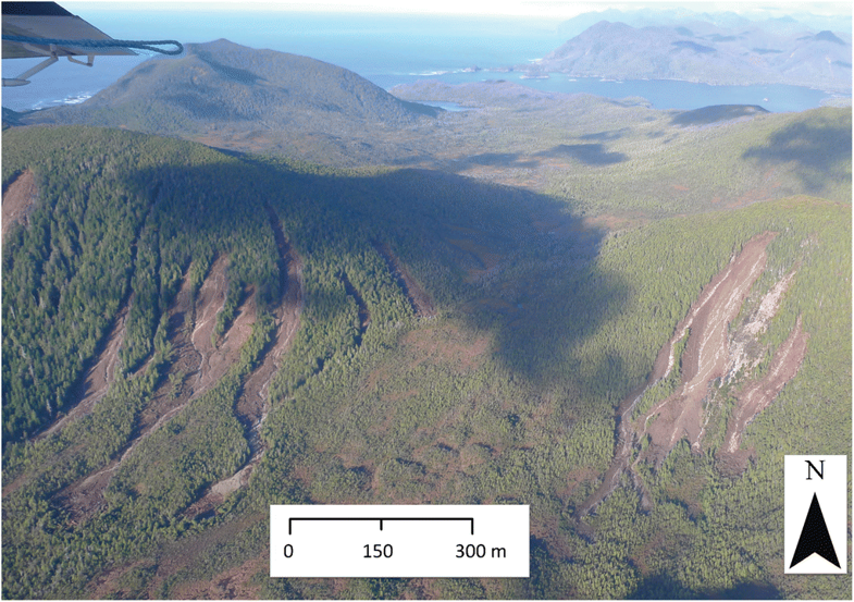
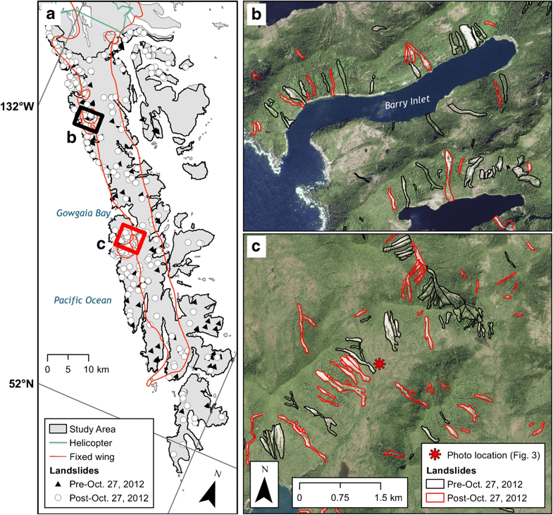
On 27 October 2012, an Mw 7.8 earthquake, the second largest instrumentally recorded earthquake in Canada, occurred approximately 20 km off the coast of Haida Gwaii at a depth of 23 km. 244 landslides were seismically induced and probably co-seismic. Barth S. et al. documented an order-of-magnitude increase in the number of debris slides and debris flows during and shortly after the Haida Gwaii earthquake of 27 October 2012. The number of landslides increased 12.9 times and the area of landslides increased 65.8 times immediately after the earthquake. Average landslide area increased from 0.07 km2 per year to 4.6 km2 per year, and the average size of landslides increased from 0.36 ha/y immediately before the earthquake to 1.88 ha/year afterwards. Landslide rates and sizes returned to near pre-2012 levels in the years after the earthquake, although they remained slightly elevated. Most non-seismically triggered landslides in study area occur on south- and southwest-facing slopes in the direction of the prevailing winds and storms. In contrast, some 32% of the seismically induced landslides occurred on north- and northwest-facing slopes, and 33% on south- and southeast facing in the direction of the earthquake epicentre. This contrasts with other studies that have shown a preference for landslides to face away from earthquake epicentres. This may relate to the earthquake’s rupture mechanism influencing directivity of ground motion. |
|


