1792 Unzen Landslide and Tsunami Disaster
LCI : JPN1611131539| Main Information | |
| Landslide Name | : 1792 Unzen Landslide and Tsunami Disaster |
| Latitude | : 32:46:13.24 N |
| Longitude | : 130:30:0.82 E |
| Location | |
| City / District | : Shimabara |
| Province | : Nagasaki |
| Country | : Japan |
| Reporter | |
| Reporter 1 | : Khang Dang |
| Reporter 2 | : Kyoji Sassa |
| Landslide Type | |
| Material | : Complex |
| Movement | : Slide |
| Velocity (mm/sec) | : Extremely Rapid |
| Depth (m) | : Very Deep |
| Slope (degree) | : Moderate |
| Volume (m³) | : Extremely Large |
| Date of Occurence | |
| Date of Occurence | : May 21, 1792 |
| Other Information | |
| Land Use |
Source area : Forest Run-out/deposition area : Urban area, Road, Railways, Sea/lake |
| Other Activity | : Active in the past |
| Triggering Factor | : Earthquake |
| Death(s) & Missing | : 15153 |
| Houses and other structural damage | : - |
| Photo of landslide | : 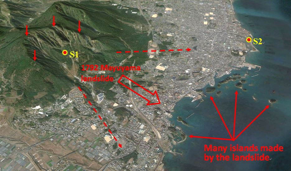 |
| Google earth kmz file | : 1792 Unzen Landslide and Tsunami Disaster.kmz |
| Plan of landslide | : 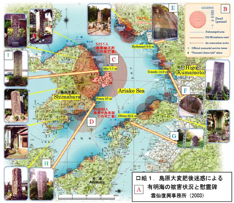 |
| Cross section of landslide | : 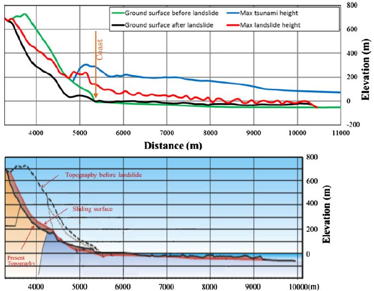 |
| Reference (paper/report) | : http://link.springer.com/article/10.1007/s10346-016-0691-9 |
| Testing graph | : 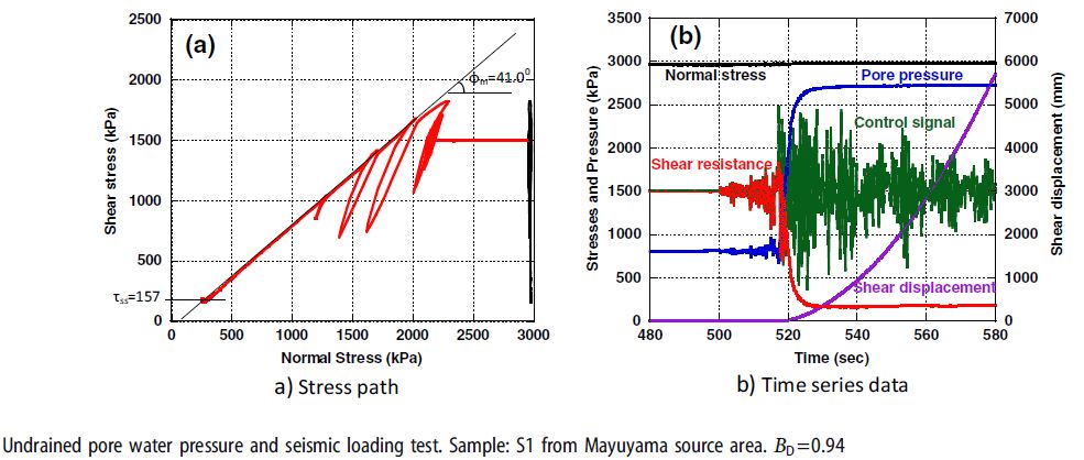 |
| Monitoring graph | :  |
| Video of moving landslides including 3D simulation | : https://youtu.be/QoQboDi7dQw |
| Description | : |
The 1792 Unzen-Mayuyama megaslide in Japan (volume, 3.4 x 10⁸ m3; maximum depth 400 m) killed 10,139 persons directly by the displaced landslide mass in the Shimabara area. The landslide mass also entering into the Ariake Sea where it triggered a tsunami wave. This landslide-induced tsunami wave killed 4,653 people in Kumamoto Prefecture, 343 people on Amakusa Island and 18 people in other areas (Usami, 1996). Simulations of this landslide and tsunami have already been made using LS-RAPID and LS-Tsunami in Sassa et al. (2014, 2016). Source: Sassa, K., Dang, K., Yanagisawa, H. et al. Landslides (2016). A new landslide-induced tsunami simulation model and its application to the 1792 Unzen-Mayuyama landslide-and-tsunami disaster. Landslides, First Online. doi:10.1007/s10346-016-0691-9 |
|

