Pernote Landslide, Ramban, J&K, India
LCI : PLRJKI25042024| Main Information | |
| Landslide Name | : Pernote Landslide, Ramban, J&K, India |
| Latitude | : 33:14:32.46 N |
| Longitude | : 75:12:28.76 E |
| Location | |
| City / District | : Ramban |
| Province | : Jammu and Kashmir |
| Country | : India |
| Reporter | |
| Reporter 1 | : Riyaz Mir |
| Reporter 2 | : Riyaz Mir |
| Landslide Type | |
| Material | : Debris, Earth |
| Movement | : Slide, Spread, Flow, Complex |
| Velocity (mm/sec) | : Moderate |
| Depth (m) | : Deep-Moderate |
| Slope (degree) | : Steep |
| Volume (m³) | : Large-Moderate |
| Date of Occurence | |
| Date of Occurence | : Apr 25, 2024 |
| Other Information | |
| Land Use |
Source area : Forest, Farming, Pasture, Human settlement, Road Run-out/deposition area : Farming, Human settlement, Road, River |
| Other Activity | : Currently active |
| Triggering Factor | : Rainfall |
| Death(s) & Missing | : 500 people evacuated |
| Houses and other structural damage | : 55 houses partially/fully damaged, 800 m stretch of Ramban–Gool road destroyed, 4 electricity towers collapsed, water supply pipeline damaged |
| Photo of landslide | : 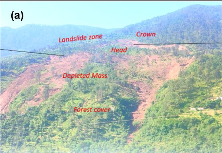 |
| Google earth kmz file | : Pernote_Landslide_J&K_India.shp.kmz |
| Plan of landslide | :  |
| Cross section of landslide | : 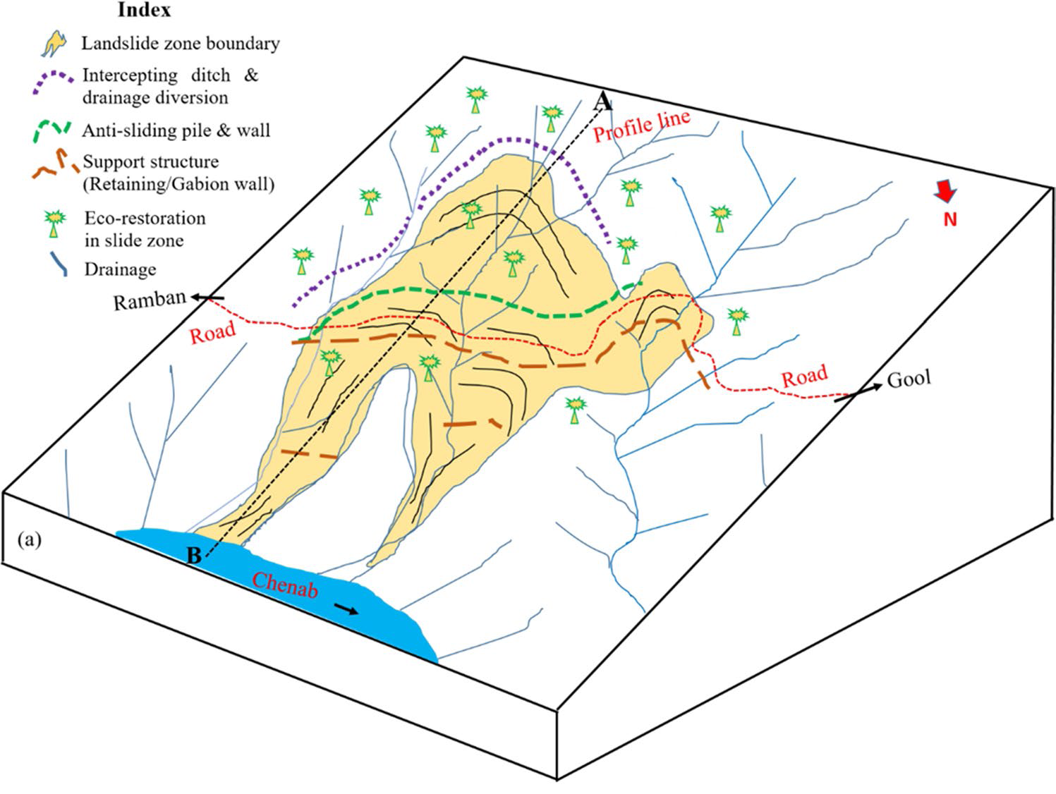 |
| Reference (paper/report) | : Landslides 22, 1577–1596 (2025). https://doi.org/10.1007/s10346-025-02469-z |
| Testing graph | : Testing_graph_Pernote.tiff |
| Monitoring graph | : Monitoring_Grapgh_Pernote1.jpg |
| Video of moving landslides including 3D simulation | : https://www.facebook.com/share/v/1NsZjHFAiG/ |
| Description | : |
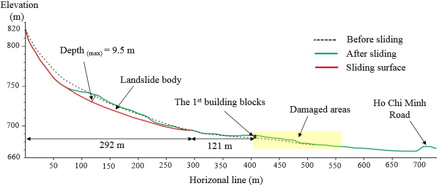
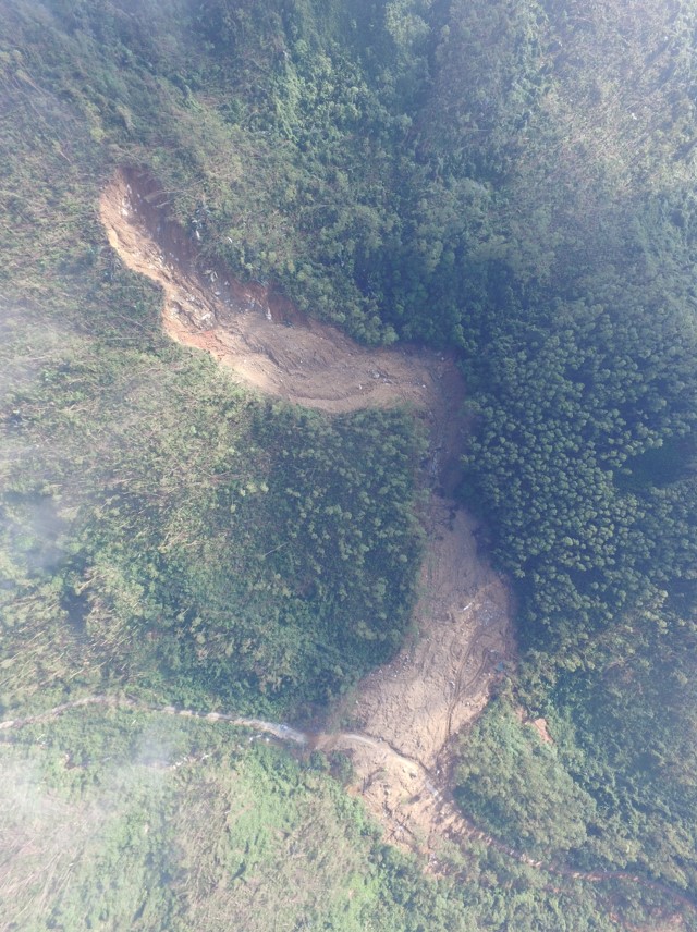
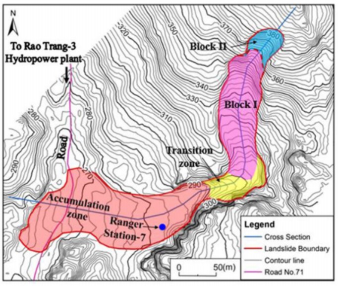
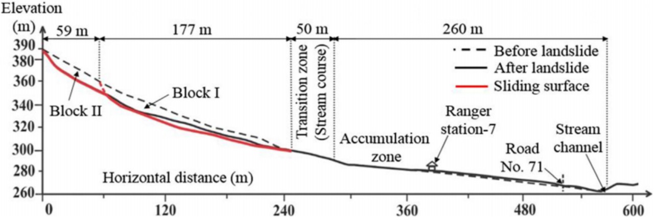
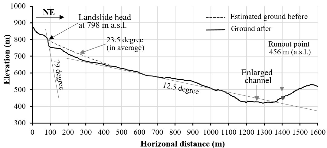
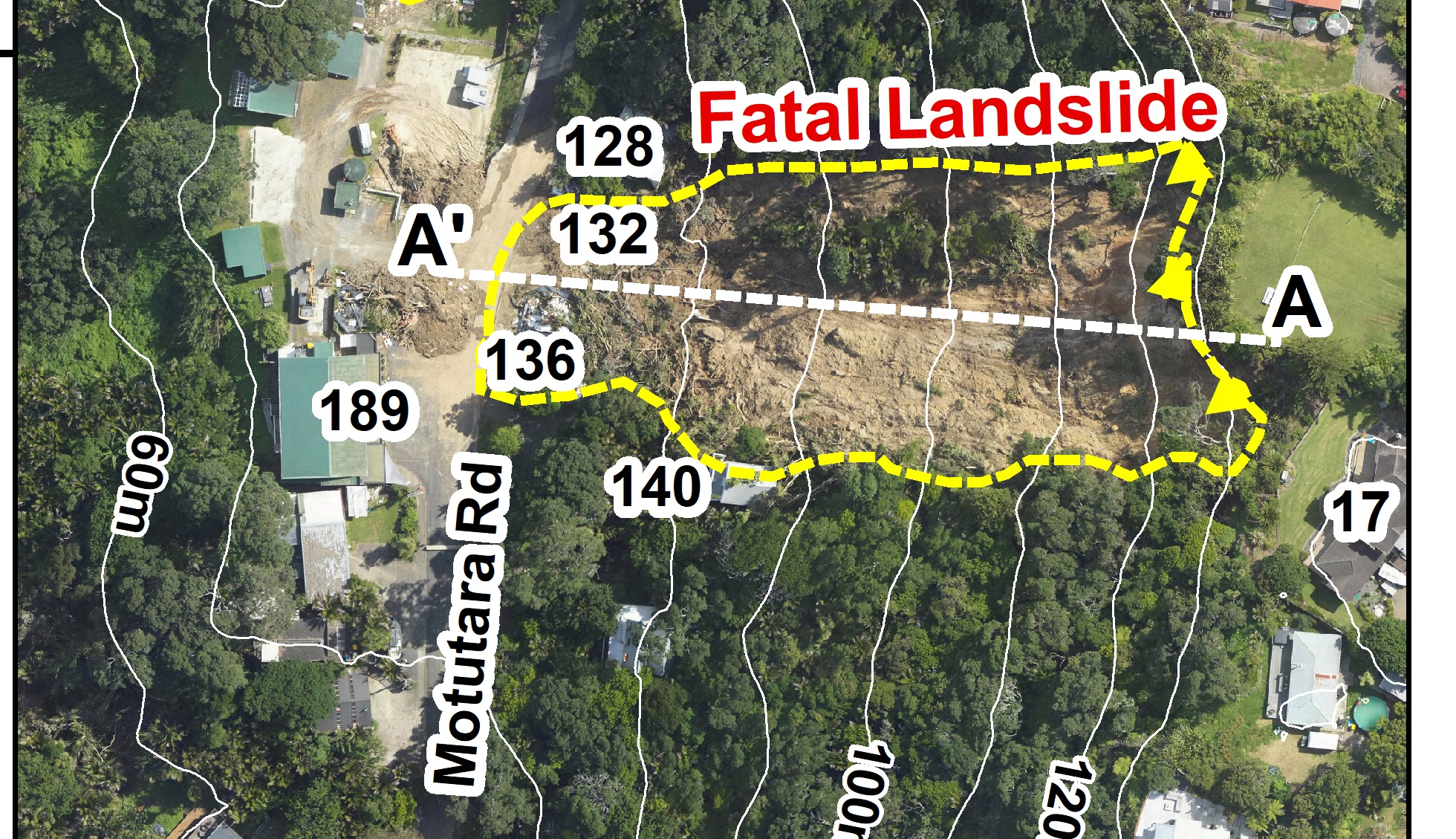
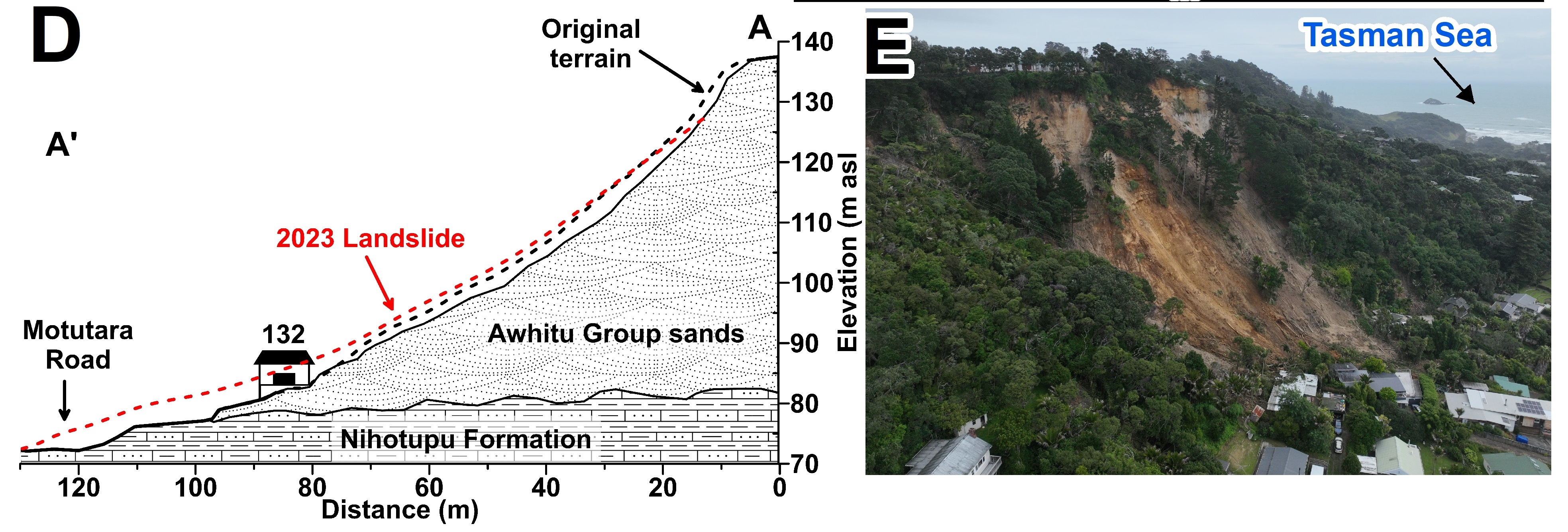
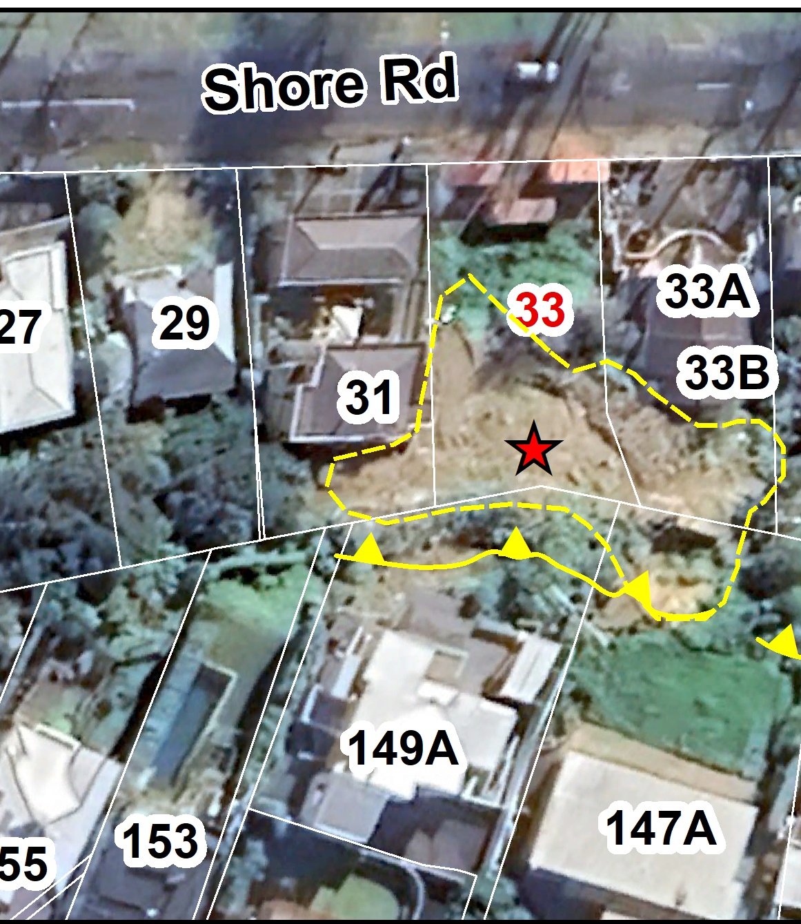
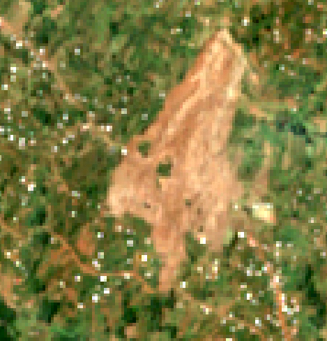
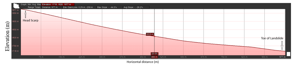
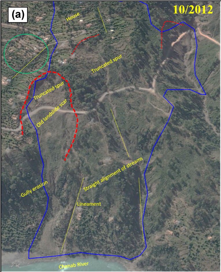
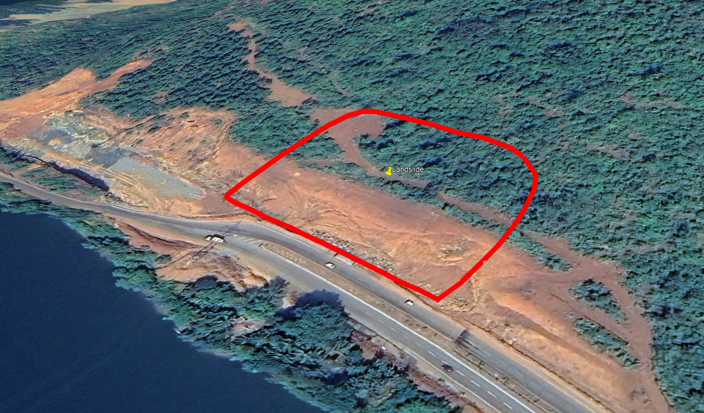
On 25 April 2024, a massive landslide struck the village of Pernote along the Ramban–Gool road in Ramban District, Jammu and Kashmir. The event began with ground cracks at ~4 pm, followed by major slope displacement by 11 pm. The failure was a rotational debris slide involving mud, silt, clay, and rock fragments, transitioning into debris flow. The landslide extended ~1250 m from crown (1140 m) to toe (650 m) into the Chenab River, with a total width ~800 m and depth ranging 10–30 m with average depth of ~ 12m. Approximately 0.60 km² of the area was affected. Antecedent rainfall of 100–175 mm over 5 days saturated the slope-forming debris, reducing shear strength and triggering failure along pre-existing thrust planes and fissures. Damage included destruction of ~55 houses, collapse of four electricity towers, heavy damage to Ramban–Gool road (~800 m), and disruption of water supply pipelines. About ~500 residents were evacuated during landslide activity by the authorities. Precursor features such as cracks, bulges, and fissures were detected in field surveys in 2021, providing early warning signs of slope instability. This event illustrates the combined role of geology, rainfall, and human activity in slope destabilization, highlighting the need for early warning systems, slope stabilization, and sustainable land use in the Ramban sector of the Himalayas. |
|

1.png)


