San Felice a Cancello post-fire debris flow
LCI : .| Main Information | |
| Landslide Name | : San Felice a Cancello post-fire debris flow |
| Latitude | : 41:0:9.69 N |
| Longitude | : 14:30:34.74 E |
| Location | |
| City / District | : San Felice a Cancello |
| Province | : Campania |
| Country | : Italy |
| Reporter | |
| Reporter 1 | : Stefano Luigi Gariano |
| Reporter 2 | : Giuseppe Esposito |
| Landslide Type | |
| Material | : Debris |
| Movement | : Flow |
| Velocity (mm/sec) | : Extremely Rapid |
| Depth (m) | : Surficial |
| Slope (degree) | : Steep |
| Volume (m³) | : Small |
| Date of Occurence | |
| Date of Occurence | : Aug 27, 2024 |
| Other Information | |
| Land Use |
Source area : Forest, Pasture Run-out/deposition area : Urban area, Road |
| Other Activity | : Active in the past |
| Triggering Factor | : Rainfall |
| Death(s) & Missing | : 2 |
| Houses and other structural damage | : extensive damage to the road network, and the ground and basement floors of many buildings |
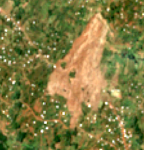
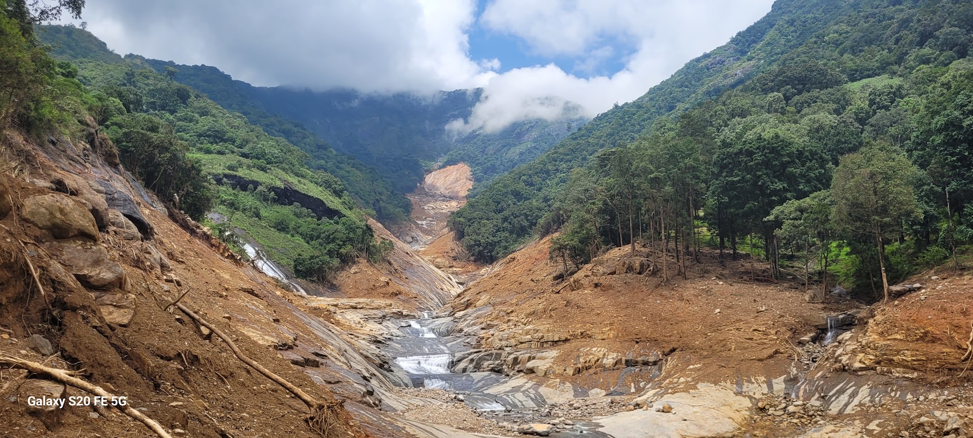
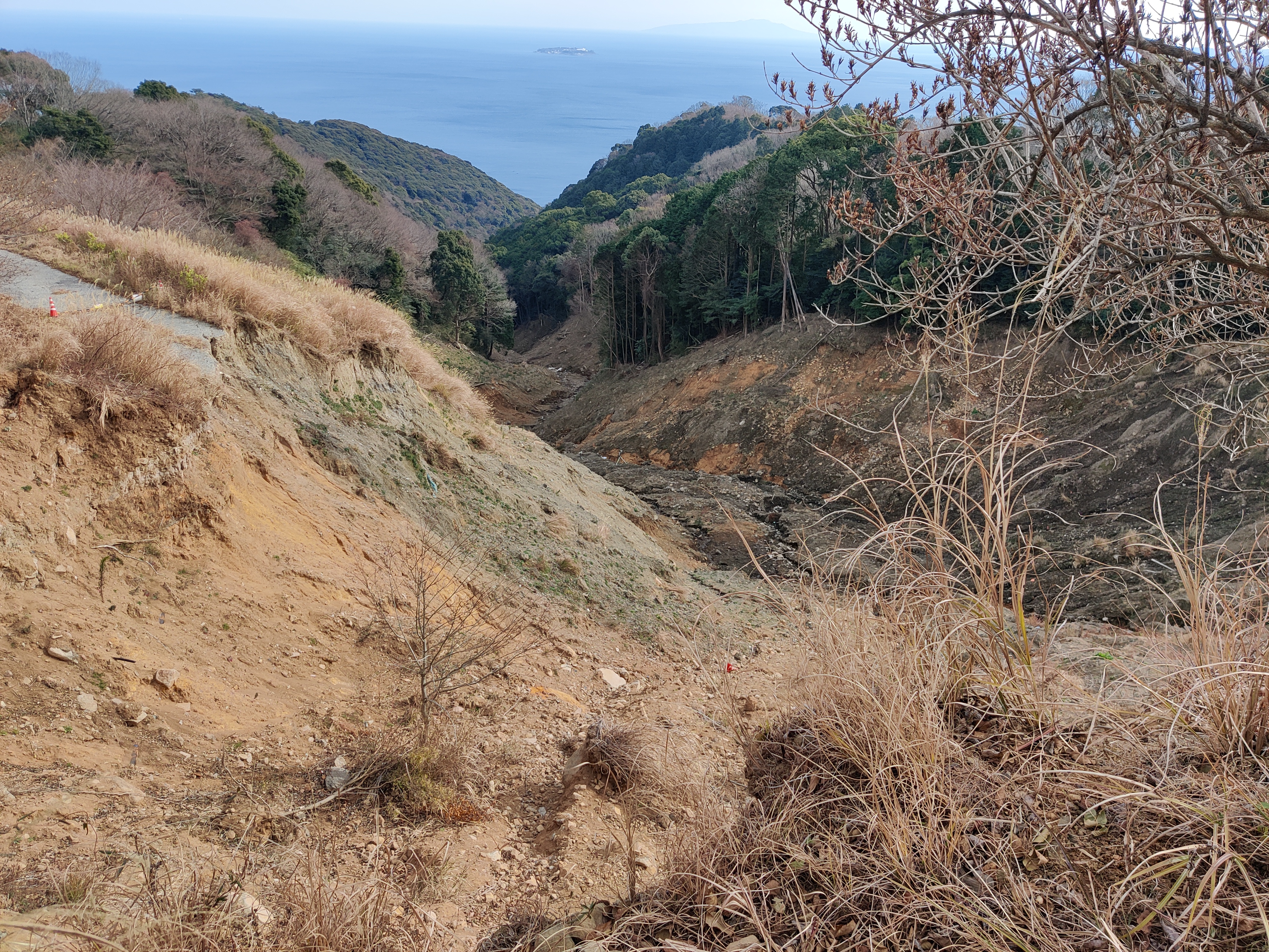
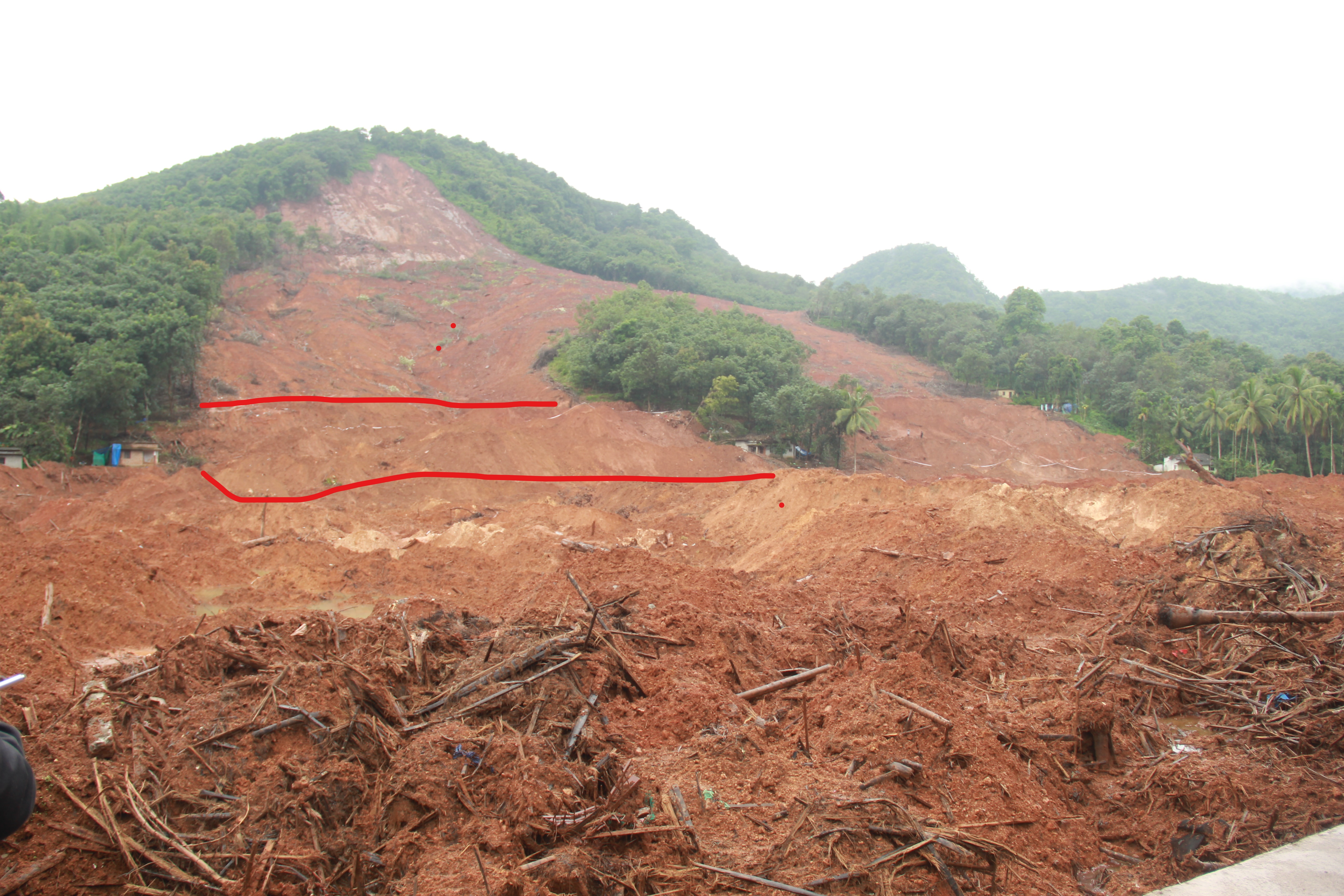
| Photo of landslide | : 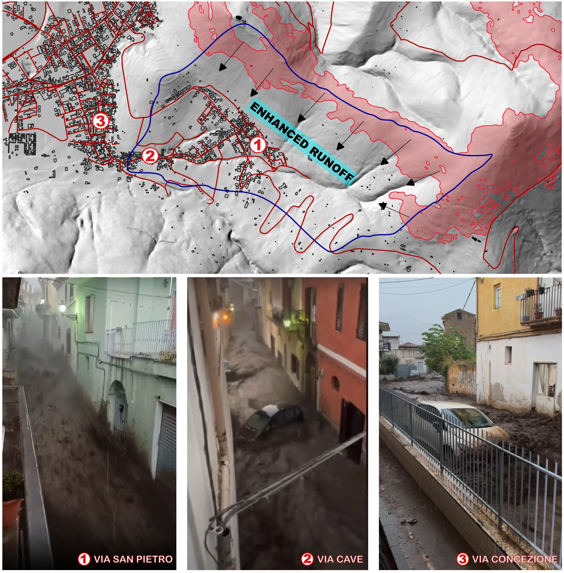 |
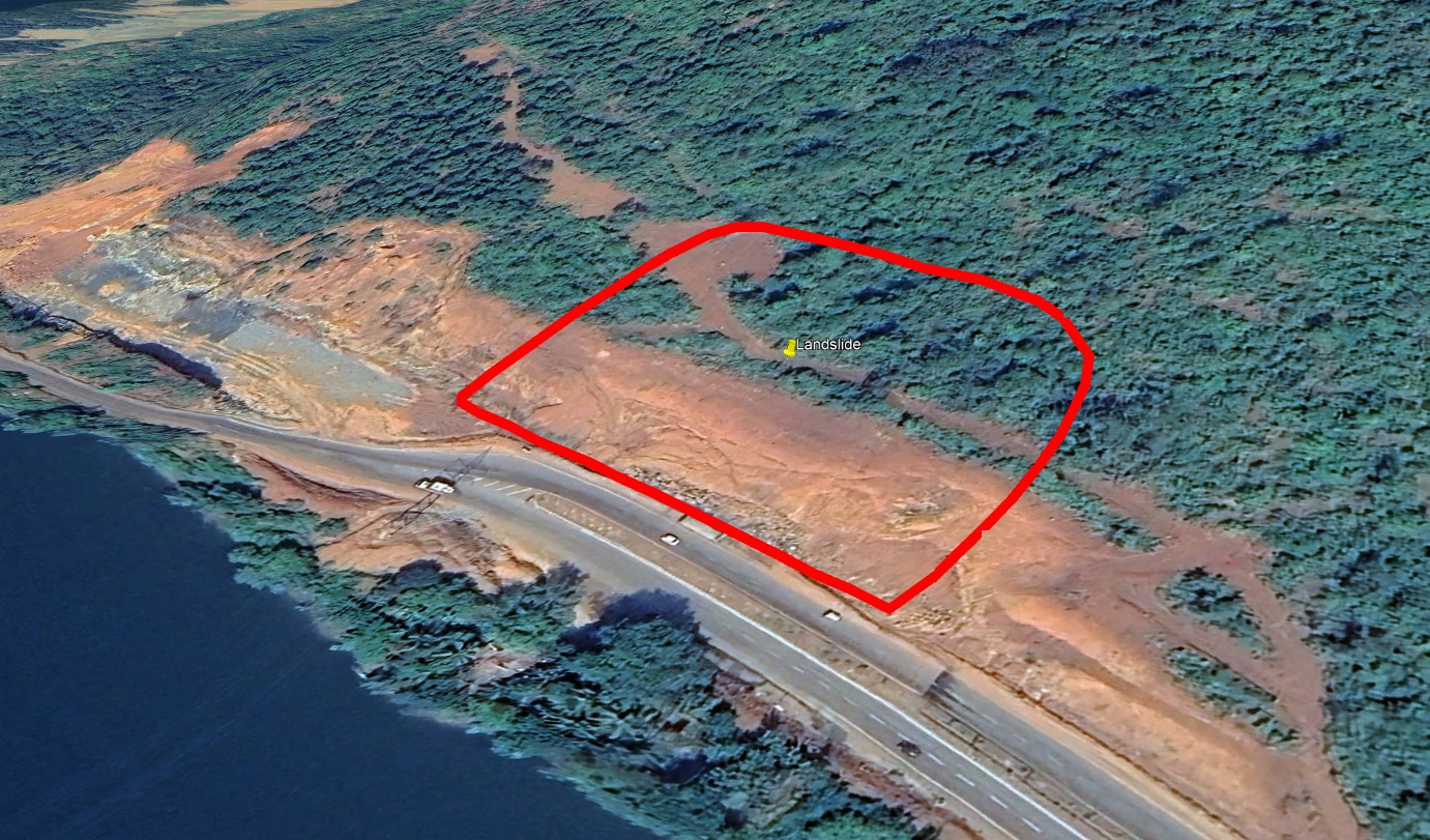
| Google earth kmz file | : watershed.kmz |
| Plan of landslide | : - |
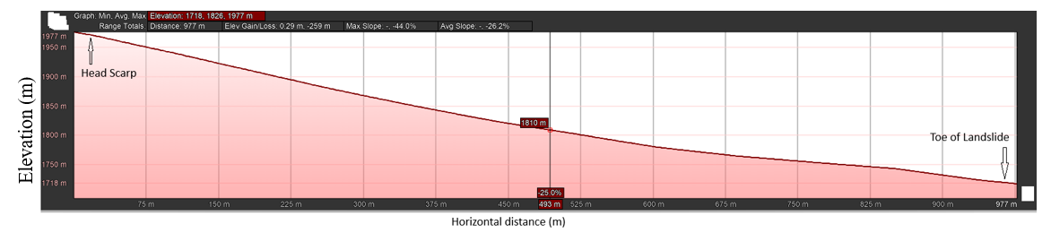
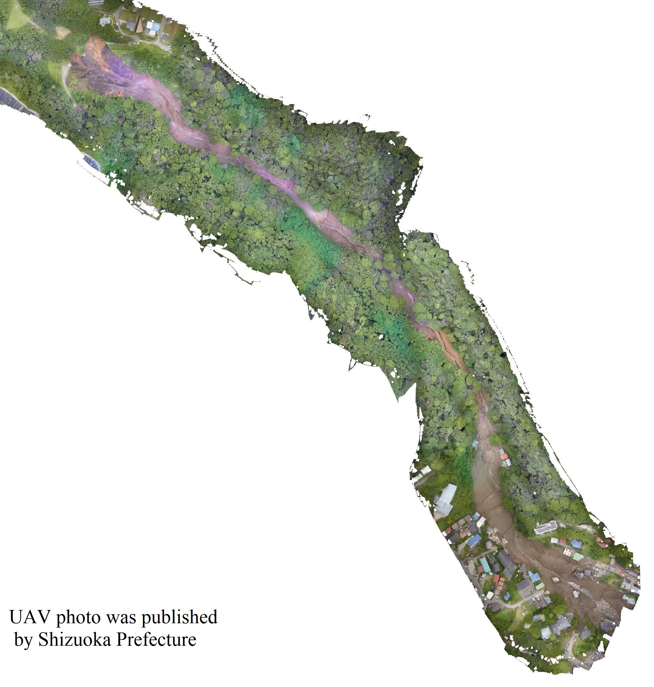
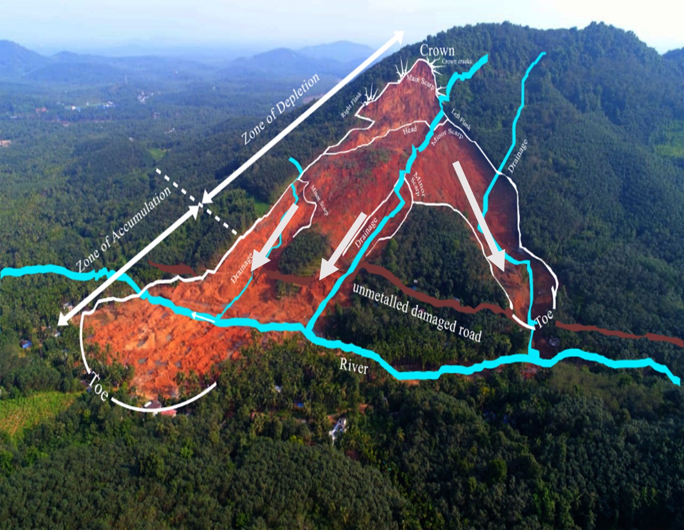
| Cross section of landslide | :  |
| Reference (paper/report) | : Esposito, G., Gariano, S. Overview of the first fatal post-fire debris flow event recorded in Italy. Landslides 22, 2131–2139 (2025). https://doi.org/10.1007/s10346-025-02516- |
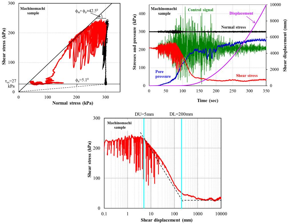
| Testing graph | : - |
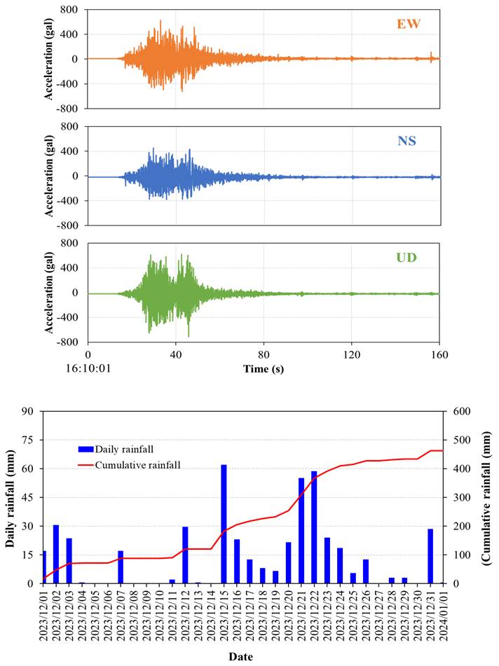
| Monitoring graph | : - |
| Video of moving landslides including 3D simulation | : https://www.youtube.com/watch?v=QW8_3lo03yI |
| Description | : |
On 27 August 2024, a large part of the Campania region, southern Italy, was affected by intense rainfall associated with forming local storm cells forced by orography. Three watersheds affected by wildfires some weeks before (3 and 14 August 2024) responded to rainfall with intense runoff and erosion processes supplying debris and hyperconcentrated flows downstream. In the town of San Felice a Cancello, a post-fire debris flow hit the urban fabric causing extensive damage to the road network, and the ground and basement floors of many buildings. The closest rain gauge recorded 29.2 mm in 20 min, as well as a peak intensity in 30 min of 83.6 mm/h. The highest peak intensity in 10 min was 106.8 mm/h. Landforms related to gully erosion generated by the runoff concentration were observed in the highest part of low-order channels, likely associated with rill and interrill erosion processes. A lot of sediments resulted from the incision of steep drainage channels and was carried out by turbulent flows. When hitting the urban fabric, flows poured down very fast along the roads and changed their rheology gradually along their paths downstream, transitioning from high-magnitude debris flows through to hyperconcentrated flows. Due to high sediment concentrations and human modifications of the drainage sections, the flows abandoned the natural drainage network to overwhelm roads and buildings. In the urban center of San Felice a Cancello, a vehicle with two people on board was dragged by flows for about 800 m. The vehicle was found a few hours after the accident. The two lifeless bodies were found only after long searches in a former quarry 2 km away from the impact point on 2 and 12 of September, respectively. This was the first known post-fire debris flow with fatal consequences in Italy. |
|
1.png)


