


The 9 April 2000 Yigong rockslide-debris avalanche
LCI : CHN2610120847| Main Information | |
| Landslide Name | : The 9 April 2000 Yigong rockslide-debris avalanche |
| Latitude | : 30:12:11 N |
| Longitude | : 94:58:03 E |
| Location | |
| City / District | : Nyingchi City / Bomi County |
| Province | : Tibet Autonomous Region |
| Country | : China |
| Reporter | |
| Reporter 1 | : Jie Liu |
| Reporter 2 | : Chengyong Fang |
| Landslide Type | |
| Material | : Rock, Debris, Complex |
| Movement | : Slide, Flow, Complex |
| Velocity (mm/sec) | : Extremely Rapid |
| Depth (m) | : Very Deep |
| Slope (degree) | : Extremely steep |
| Volume (m³) | : Extremely large |
| Date of Occurence | |
| Date of Occurence | : Apr 09, 2000 |
| Other Information | |
| Land Use |
Source area : Wildland Run-out/deposition area : Farming, Wildland, Human settlement, Road, River |
| Other Activity | : Active in the past |
| Triggering Factor | : Others |
| Death(s) & Missing | : 30 deaths; more than 100 missing |
| Houses and other structural damage | : Tongmai Bridge and other bridges were destroyed; the Sichuan-Tibet Highway was interrupted for months; more than 4,000 people were affected; direct economic loss exceeded RMB 140 million. |
| Photo of landslide | : 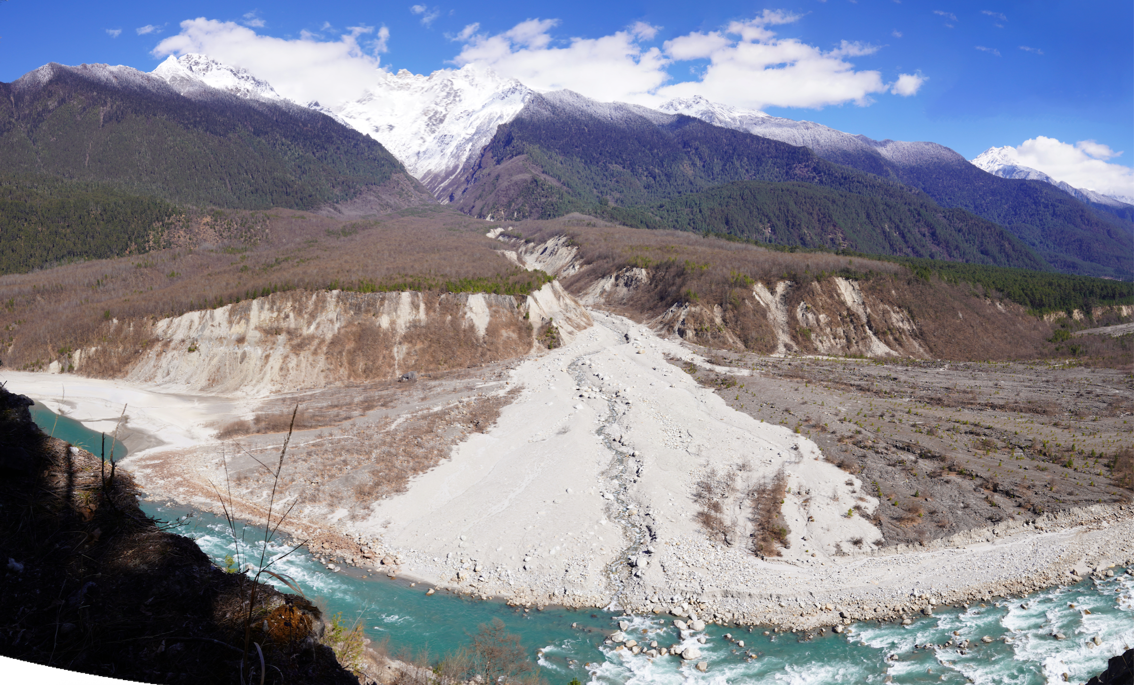 |
| Google earth kmz file | : Yigong_2000_landslide_site.zip |
| Plan of landslide | : 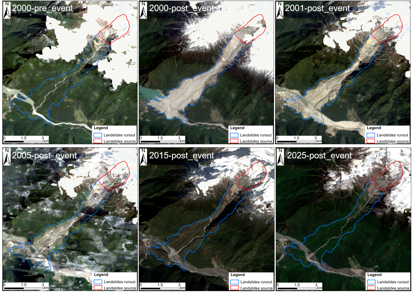 |
| Cross section of landslide | : 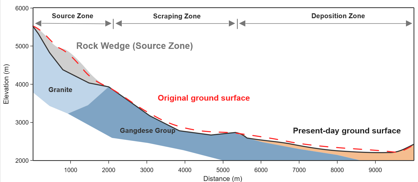 |
| Reference (paper/report) | : - |
| Testing graph | : - |
| Monitoring graph | : - |
| Video of moving landslides including 3D simulation | : - |
| Description | : |
On 9 April 2000, an extremely rapid rockslide-debris avalanche occurred in Zhamunong Gully, Bomi County, southeast Tibet, China (30°12’11” N, 94°58’03” E). Approximately 91 Mm³ of rock detached from a high-relief granite source controlled by persistent discontinuities. The mass fragmented, entrained loose gully deposits, and travelled about 10 km before spreading across the Yigong Tsangpo valley. Reconstructed mean velocity is 15-18 m/s, and a later coupled simulation estimated a maximum of about 90 m/s, placing the event in WRL Class 7 (extremely rapid). Published volume estimates differ by definition: about 115 Mm³ for the total dam-forming rockslide and up to 300 Mm³ for the final mobilized/deposited mass after entrainment. The deposit dammed the river, and the impoundment persisted for 62 days. On 10 June 2000, overtopping and erosion of an artificial diversion channel initiated dam breaching and a catastrophic outburst flood. The flood destroyed Tongmai Bridge about 17 km downstream and interrupted the Sichuan-Tibet Highway for months. Published consequence totals vary by geographic and temporal scope; one study reports 30 deaths and more than 100 missing for the landslide-dam-break chain, while the supplied local synthesis records more than 4,000 people affected and direct losses exceeding RMB 140 million. Long-term weathering, freeze-thaw damage, fracture-water effects, and discontinuity-controlled geometry likely promoted progressive failure. The event is an internationally important example of a rock-avalanche-landslide-dam-outburst-flood hazard chain. |
|