The 13 October 2020 Ranger Station-7 Landslide
LCI : VNM202509011810| Main Information | |
| Landslide Name | : The 13 October 2020 Ranger Station-7 Landslide |
| Latitude | : 16:25:59.65 N |
| Longitude | : 107:18:38.61 E |
| Location | |
| City / District | : Phong Xuan |
| Province | : Thua Thien Hue |
| Country | : Việt Nam |
| Reporter | |
| Reporter 1 | : Pham Tien |
| Reporter 2 | : Tien Van |
| Landslide Type | |
| Material | : Debris |
| Movement | : Slide |
| Velocity (mm/sec) | : Extremely Rapid |
| Depth (m) | : Moderate-Shallow |
| Slope (degree) | : Moderate |
| Volume (m³) | : Moderate-Small |
| Date of Occurence | |
| Date of Occurence | : Oct 13, 2020 |
| Other Information | |
| Land Use |
Source area : Forest Run-out/deposition area : Road |
| Other Activity | : Active in the past |
| Triggering Factor | : Rainfall |
| Death(s) & Missing | : 13 |
| Houses and other structural damage | : 1 |
| Photo of landslide | : 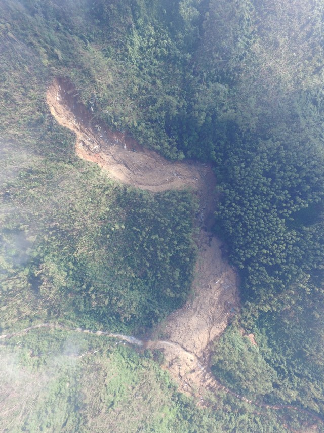 |
| Google earth kmz file | : Ranger Station-7 Landslide.kmz |
| Plan of landslide | : 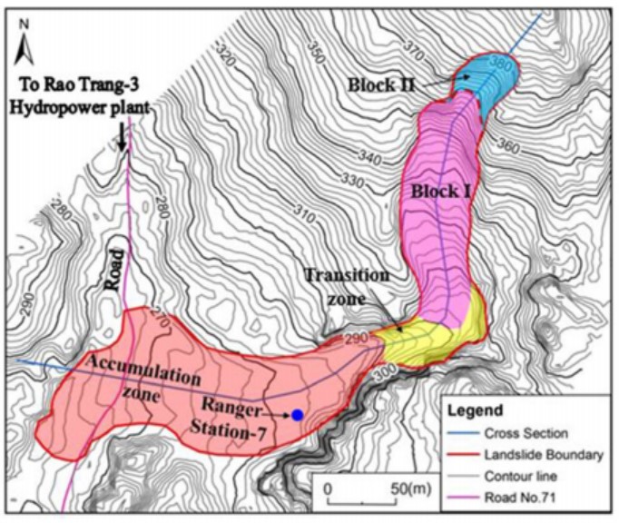 |
| Cross section of landslide | : 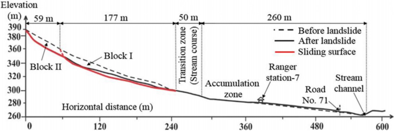 |
| Reference (paper/report) | : https://link.springer.com/article/10.1007/s10346-021-01663-z |
| Testing graph | : - |
| Monitoring graph | : - |
| Video of moving landslides including 3D simulation | : - |
| Description | : |
At approximately 0:00 AM on 13 October 2020, a rapid rainfall-induced landslide occurred in Phong Xuan commune, Phong Dien district, Thua Thien Hue province, sweeping over Ranger Station No. 7 and claiming the lives of 13 rescue team members, including 11 army officers and 2 district officials. Field evidence and topographic analysis indicate that the Ranger Station No. 7 landslide involved an estimated volume of about 81,550 m³, comprising two distinct blocks in the lower and upper slope parts. The failure initiated in the lower slope section, accompanied by a loud sound, which subsequently triggered the collapse of the upper part. The 13 October event was associated with extreme rainfall, with a cumulative amount of 2,190.2 mm recorded at the A Luoi rainfall station between 6 and 12 October. The landslide mass rapidly moved downslope, destroying the ranger station located 145 m from the landslide toe. The displaced materials not only accumulated on the rupture surface but also extended beyond the toe, spreading into the stream channel and covering a flat downslope area of approximately 2.25 ha. |
|

