Mundakkai Landslide, Wayanad
LCI : IND2516051200| Main Information | |
| Landslide Name | : Mundakkai Landslide, Wayanad |
| Latitude | : 11:27:52.5 N |
| Longitude | : 76:8:5.2 E |
| Location | |
| City / District | : Wayanad |
| Province | : Kerala |
| Country | : India |
| Reporter | |
| Reporter 1 | : Sreevalsa Kolathayar |
| Reporter 2 | : |
| Landslide Type | |
| Material | : Rock, Debris, Earth, Complex |
| Movement | : Flow |
| Velocity (mm/sec) | : Extremely Rapid |
| Depth (m) | : Deep-Moderate |
| Slope (degree) | : Very steep |
| Volume (m³) | : Large |
| Date of Occurence | |
| Date of Occurence | : Jul 30, 2024 |
| Other Information | |
| Land Use |
Source area : Forest Run-out/deposition area : Forest, Farming, Human settlement, Road |
| Other Activity | : Unknown |
| Triggering Factor | : Rainfall |
| Death(s) & Missing | : 251 death & 47 missing |
| Houses and other structural damage | : Over 200 buildings were washed away, and over 400 were damaged partially or fully |
| Photo of landslide | : 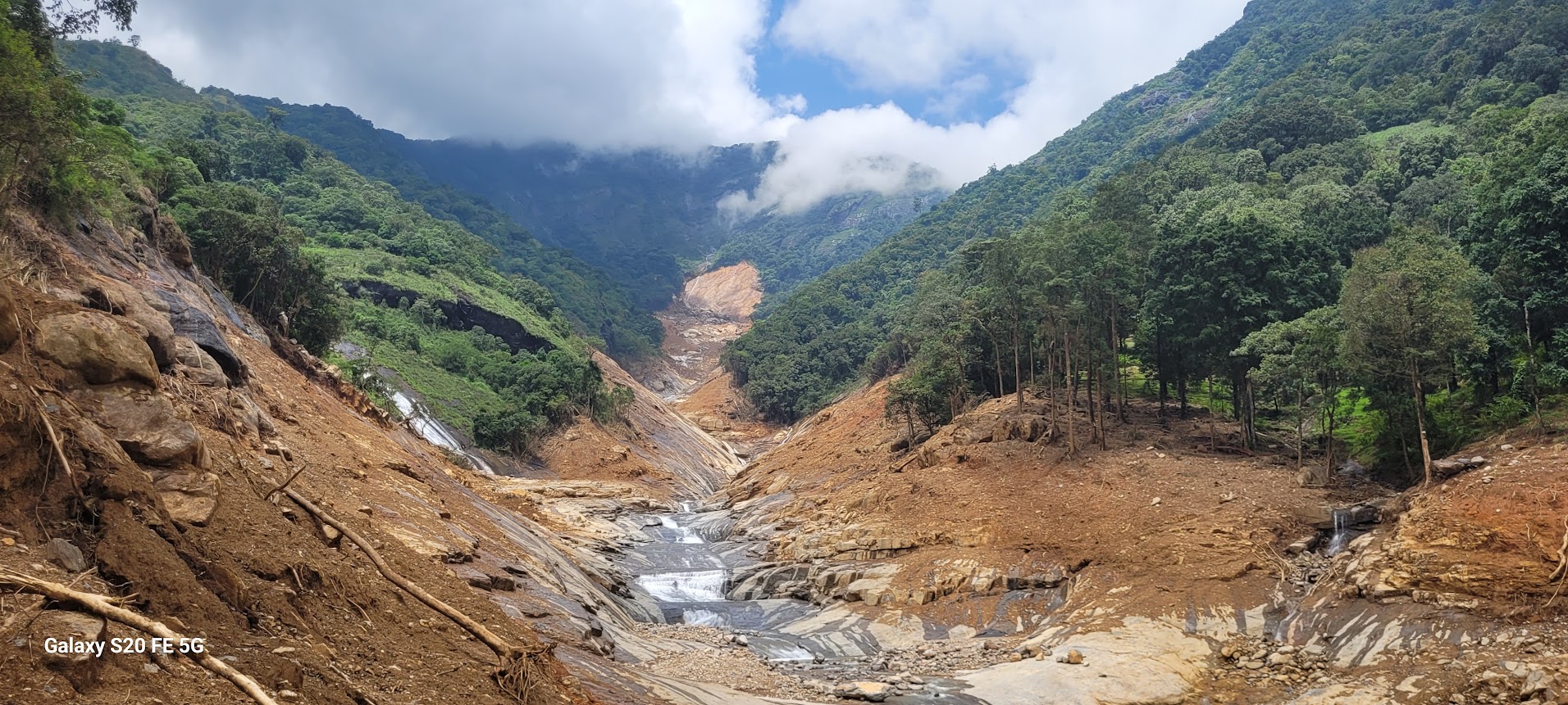 |
| Google earth kmz file | : Mundakkai Landslide 2024.kmz |
| Plan of landslide | : - |
| Cross section of landslide | : 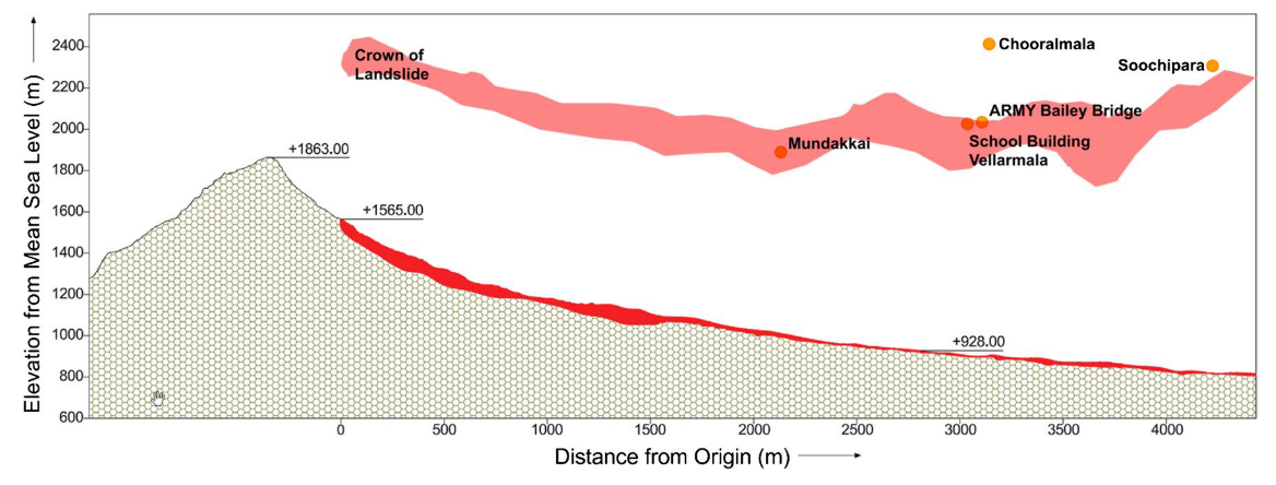 |
| Reference (paper/report) | : https://link.springer.com/10.1007/s10346-024-02443-1 |
| Testing graph | : - |
| Monitoring graph | : - |
| Video of moving landslides including 3D simulation | : - |
| Description | : |
In the last week of July 2024, the Punchirimattom region in Wayanad experienced exceptionally heavy and continuous rain- fall events, leading to two major landslides in the early hours of 30/07/2024 and a devastating debris flow that engulfed four places in the Meppadi Panchayath, namely, Punchirimattom, Mundakkai, Chooralmala, and Attamala. Over 200 buildings were washed away, and over 400 were damaged partially or fully, including two schools, one in Mundakkai and the other in Chooralmala. Three bridges were destroyed during the massive debris flow. This event has been described as one of the deadliest landslides of recent times. The loss of lives is currently reported as 251, and 47 individuals are still missing. Assessing the feasibility of continued habitation in the affected villages is crucial, given the significant debris deposited by the landslide. |
|

